
Mellor Glacier is a tributary glacier, flowing north-northeast between Mount Newton and Mount Maguire and coalescing with Collins Glacier just prior to its junction with Lambert Glacier at Patrick Point, in the Prince Charles Mountains of Antarctica. It was mapped from air photos taken by the Australian National Antarctic Research Expeditions in 1956, and was named by the Antarctic Names Committee of Australia after English-born glaciologist Malcolm Mellor (1933–91), who worked at Mawson Station in 1957, and as an engineer with the U.S. Army's Cold Regions Research and Engineering Laboratory from 1961 to 1991.
Denman Glacier is a glacier 7 to 10 nautical miles wide, descending north some 70 nautical miles, which debouches into the Shackleton Ice Shelf east of David Island, Queen Mary Land. It was discovered in November 1912 by the Western Base party of the Australasian Antarctic Expedition under Sir Douglas Mawson. Mawson named the glacier for Lord Denman, Governor-General of Australia in 1911, a patron of the expedition.

Knox Coast, part of Wilkes Land, is that portion of the coast of Antarctica lying between Cape Hordern, at 100°31′E, and the Hatch Islands, at 109°16′E.
Budd Coast, part of Wilkes Land, is that portion of the coast of Antarctica lying between the Hatch Islands, at 109°16'E, and Cape Waldron, at 115°33'E. It was discovered in February 1840 by the U.S. Exploring Expedition (1838–42) under the leadership of Lieutenant Charles Wilkes, and named by Wilkes for Thomas A. Budd, Acting Master of the sloop Peacock, one of the ships used on the expedition. A portion of the Puget Sound, Budd Inlet, is also named for Thomas Budd.
Cape Goodenough is an ice-covered cape marking the west side of the entrance to Porpoise Bay and forming the northernmost projection of Norths Highland in Antarctica. It was discovered by the British Australian New Zealand Antarctic Research Expedition under Douglas Mawson on an airplane flight in January 1931, and was named by Mawson for Admiral Sir William Goodenough, President of the Council of the Royal Geographical Society from 1930 to 1933.
The Walgreen Coast is a portion of the coast of Antarctica between Cape Herlacher and Cape Waite, or between Eights Coast on the east and Bakutis Coast in the west. It extends from 103°24'W to 114°12'Wto. It was discovered by Rear Admiral Richard E. Byrd and members of the US Antarctic Service (USAS) by flights from the USS Bear during February 1940.
Voyeykov Ice Shelf, is an ice shelf fringing the coast between Paulding Bay and Cape Goodenough, Antarctica. Mapped by the Soviet Antarctic Expedition (SovAE) (1958) and named after Aleksandr I. Voyeykov (1842–1916), a Russian climatologist.

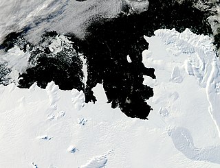
Posadowsky Glacier is a glacier about 9 nautical miles long, flowing north to Posadowsky Bay immediately east of Gaussberg. Posadowsky Bay is an open embayment, located just east of the West Ice Shelf and fronting on the Davis Sea in Kaiser Wilhelm II Land. Kaiser Wilhelm II Land is the part of East Antarctica lying between Cape Penck, at 87°43'E, and Cape Filchner, at 91°54'E, and is claimed by Australia as part of the Australian Antarctic Territory. Other notable geographic features in this area include Drygalski Island, located 45 mi NNE of Cape Filchner in the Davis Sea, and Mirny Station, a Russian scientific research station.
Anderton Glacier is a tributary glacier, 7 nautical miles (13 km) long, descending the south slopes of the Eisenhower Range to enter Reeves Glacier between Mount Matz and Andersson Ridge, in Victoria Land, Antarctica. The glacier is situated on the Pennell Coast, a portion of Antarctica lying between Cape Williams and Cape Adare. It was mapped by the United States Geological Survey from surveys and from U.S. Navy air photos, 1955–63, and was named by the Advisory Committee on Antarctic Names for Peter W. Anderton, a glaciologist at McMurdo Station, summer 1965–66.
Barnett Glacier is a large glacier in the Anare Mountains that flows east along the south side of Tapsell Foreland into Smith Inlet, northern Victoria Land, Antarctica. It was mapped by the United States Geological Survey (USGS) from surveys and from U.S. Navy air photos, 1960–63, and named by the Advisory Committee on Antarctic Names after Donald C. Barnett, USGS topographic engineer, a member of USGS Topo East and West, 1962–63, in which the expedition extended geodetic control from the area of Cape Hallett to the Wilson Hills and from the foot of Beardmore Glacier through the Horlick Mountains. The glacier lies on the Pennell Coast, a portion of Antarctica lying between Cape Williams and Cape Adare.
Cape Carr is a prominent, ice-covered cape, lying 15 nautical miles (30 km) northeast of Cape Morse.
Cape Charcot is a rocky headland at the northeast end of the Melba Peninsula, 3 nautical miles (6 km) west of David Island. It was discovered by the Australasian Antarctic Expedition under Mawson, 1911–14, who named it for Dr. Jean-Baptiste Charcot, French Antarctic explorer.

Darbel Bay is a bay 25 nautical miles (50 km) wide, indenting the west coast of Graham Land between Stresher Peninsula and Pernik Peninsula. Entered southwest of Cape Bellue and northeast of Cape Rey. The glaciers Widmark Ice Piedmont, Cardell, Erskine, Hopkins, Drummond, Widdowson, McCance, Solun and Škorpil feed the bay.

Gressitt Glacier is a broad glacier, about 45 nautical miles (80 km) long, draining the area between the Daniels Range and the Emlen Peaks in the Usarp Mountains of Victoria Land, Antarctica, and flowing northeast to enter the Rennick Glacier just north of the Morozumi Range. This geographical feature was first mapped by the United States Geological Survey from surveys and U.S. Navy air photos, 1960–63, and was so named by the Advisory Committee on Antarctic Names for biologist J. Linsley Gressitt, Program Director, who made biological studies, particularly in the Ross Sea area, during six austral summers, 1959–60 to 1965–66. The glacier lies situated on the Pennell Coast, a portion of Antarctica lying between Cape Williams and Cape Adare.
Fendorf Glacier is a broad glacier draining from the eastern slopes of the Gifford Peaks and flowing north to merge with Dobbratz Glacier, in the Heritage Range of the Ellsworth Mountains, Antarctica. It was mapped by the United States Geological Survey from ground surveys and U.S. Navy air photos, 1961–66, and was named by the Advisory Committee on Antarctic Names for Lieutenant Commander James E. Fendorf, U.S. Navy, a pilot with Squadron VX-6 during Operation Deep Freeze 1966.
Cape Gerlache is a cape which forms the northeast tip of Davis Peninsula, Antarctica, 4 nautical miles (7 km) southeast of David Island. It was discovered in November 1912 by the Australasian Antarctic Expedition, 1911–14, under Mawson, who named it for Lieutenant Adrien de Gerlache, leader of the Belgian Antarctic Expedition, 1897–99.

Liotard Glacier is a channel glacier in Antarctica. It is about 3 nautical miles (6 km) wide and 6 nautical miles (11 km) long, and flows north-northeast from the continental ice, terminating in a small ice tongue about 4 nautical miles (7 km) west of Hélène Island. The glacier was delineated from air photos taken by U.S. Navy Operation Highjump, 1946–47, and was named by the Advisory Committee on Antarctic Names for Andre-Frank Liotard, the leader of the French Antarctic Expedition, 1949–51, whose group completed the initial survey of the coastal features as far westward as this glacier.
Marret Glacier is a channel glacier about 4 nautical miles (7 km) wide and 4 nautical miles long, flowing northeast from the continental ice of Antarctica to the coast close east of Cape Robert. It was delineated from aerial photos taken by U.S. Navy Operation Highjump, 1946–47, and was named by the Advisory Committee on Antarctic Names for Mario Marret, the leader of the French Antarctic Expedition, 1952–53, whose party extended reconnaissance of the coastal features to the west side of Victor Bay.

May Glacier is a channel glacier about 5 nautical miles (9 km) wide and 6 nautical miles (11 km) long, flowing to the coast of Antarctica between Cape Morse and Cape Carr. It was delineated from air photos taken by U.S. Navy Operation Highjump (1946–47), and was named by the Advisory Committee on Antarctic Names for William May, passed midshipman on the Flying Fish of the United States Exploring Expedition (1838–42) under Charles Wilkes.


