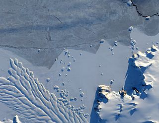
Thurston Island is a largely ice-covered, glacially dissected island, 135 nautical miles long and 55 nautical miles wide, lying between between Amundsen Sea and Bellingshausen Sea a short way off the northwest end of Ellsworth Land, Antarctica. The island is separated from the mainland by Peacock Sound, which is occupied by the west portion of Abbot Ice Shelf.
The Dennistoun Glacier is a glacier, 50 nautical miles long, draining the northern slopes of Mount Black Prince, Mount Royalist and Mount Adam in the Admiralty Mountains of Victoria Land, Antarctica. It flows northwest between the Lyttelton Range and Dunedin Range, turning east on rounding the latter range to enter the sea south of Cape Scott.

Frost Glacier is a channel glacier flowing to the head of Porpoise Bay, Antarctica. It was delineated from air photos taken by U.S. Navy Operation Highjump (1946–47), and named by the Advisory Committee on Antarctic Names for John Frost, boatswain on the brig Porpoise of the United States Exploring Expedition (1838–42) under Charles Wilkes.
Porpoise Bay is an ice-filled embayment about 90 miles (140 km) wide indenting the coast of Antarctica between Cape Goodenough and Cape Morse. The United States Exploring Expedition (1838–42) under Charles Wilkes applied the name "Porpoise Bay", after the USEE brig "Porpoise", to a large bay at about 66°S, 130°E. US-ACAN's identification of Porpoise Bay is based on the correlation of Wilkes' chart (1840) with G.D. Blodgett's reconnaissance map (1955) compiled from air photos taken by USN Operation Highjump (1946–47). The name has been applied to the large embayment lying close southwest in keeping with Wilkes' original naming.

Sulzberger Bay is a bay indenting the front of the Sulzberger Ice Shelf between Fisher Island and Vollmer Island, along the coast of Marie Byrd Land, Antarctica.
The Lazarev Mountains are a chain of mountains in Antarctica. They extend along the west side of Matusevich Glacier southward of Eld Peak, and are about 25 nautical miles long.

Clark Peninsula is a rocky peninsula, about 3 km (2 mi) long and wide, lying 5 km (3 mi) north-east of Australia's Casey Station at the north side of Newcomb Bay on the Budd Coast of Wilkes Land in Antarctica.

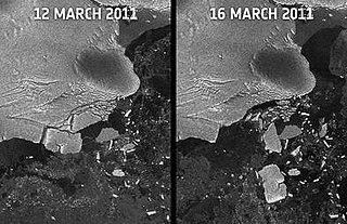
Blodgett Iceberg Tongue is a large iceberg tongue that extends seaward from the vicinity of Cape Morse and Cape Carr on the east side of Porpoise Bay. It was named by the Advisory Committee on Antarctic Names for Gardner D. Blodgett, Office of Geography, Department of Interior, who, in 1955, prepared a sketch map of the coastal features of Antarctica between 84°E and 144°E from U.S. Navy Operation Highjump (1946–47) aerial photographs. Since the iceberg tongue was partially delineated for the first time on the 1955 sketch map by Blodgett, use of his name for it is considered appropriate.
Cape Carr is a prominent, ice-covered cape, lying 15 nautical miles (30 km) northeast of Cape Morse.
Colvocoresses Bay is a bay formed by the right angle of the Budd Coast at Williamson Glacier. The bay is over 30 nautical miles (56 km) wide at the entrance and is occupied by glacier tongues and icebergs from Williamson Glacier and Whittle Glacier. It was delineated by G.D. Blodgett (1955) from aerial photographs taken by U.S. Navy Operation Highjump (1946–47), and named by the Advisory Committee on Antarctic Names for George Colvocoresses, midshipman on the sloop Vincennes during the United States Exploring Expedition (1838–42) under Charles Wilkes. Colvocoresses, later promoted to captain, U.S. Navy, published (1852–55) his own account of the voyage in Four Years in the Government Exploring Expedition Commanded by Captain Wilkes.
Norths Highland is an ice-covered upland close south of Cape Goodenough, surmounting the Banzare Coast between Maury and Porpoise Bays. The name "North's High Land" after James H. North, acting master on the brig Porpoise, was applied to an elevated coastal area by the United States Exploring Expedition (1838–42) under Wilkes. Subsequently, because of inadequate data regarding the nature of this feature, the name "Norths Coast" was applied to a coastal area in the vicinity of 12745E Advisory Committee on Antarctic Names (US-ACAN)'s identification of Norths Highland is based upon correlation of Wilkes' chart with G.D. Blodgett's reconnaissance map (1955) compiled from air photos taken by U.S. Navy Operation Highjump (1946–47). The name is adopted for this recently verified upland region in 12600E in keeping with Wilkes' original naming.

Waldron Glacier is a channel glacier flowing to the east side of Porpoise Bay, midway between Sandford and Morse Glaciers. Delineated from air photos taken by U.S. Navy Operation Highjump (1946–47). Named by Advisory Committee on Antarctic Names (US-ACAN) for Thomas W. Waldron, captain's clerk on the brig Porpoise of the United States Exploring Expedition (1838–42) under Wilkes.

Matusevich Glacier is a broad glacier about 50 nautical miles long, with a well developed glacier tongue, flowing to the coast of East Antarctica between the Lazarev Mountains and the northwestern extremity of the Wilson Hills.

Freeman Glacier is a channel glacier flowing to the west side of Perry Bay, Antarctica, immediately east of Freeman Point. It was delineated from air photos taken by U.S. Navy Operation Highjump (1946–47), and was named by the Advisory Committee on Antarctic Names for J.D. Freeman, sailmaker on the sloop Peacock of the United States Exploring Expedition (1838–42) under Charles Wilkes.
Maury Bay is an ice-filled bay indenting the coast of Antarctica just east of Cape Lewis. It was mapped by G.D. Blodgett in 1955 from aerial photographs taken by U.S. Navy Operation Highjump (1946–47), and named by the Advisory Committee on Antarctic Names for William Lewis Maury, lieutenant on the brig Porpoise during the United States Exploring Expedition (1838–42) under Lieutenant Charles Wilkes.

May Glacier is a channel glacier about 5 nautical miles (9 km) wide and 6 nautical miles (11 km) long, flowing to the coast of Antarctica between Cape Morse and Cape Carr. It was delineated from air photos taken by U.S. Navy Operation Highjump (1946–47), and was named by the Advisory Committee on Antarctic Names for William May, passed midshipman on the Flying Fish of the United States Exploring Expedition (1838–42) under Charles Wilkes.

Sandford Glacier is a channel glacier flowing to the east side of Porpoise Bay, about 25 nautical miles (46 km) south-southwest of Cape Morse. Delineated from air photos taken by U.S. Navy Operation Highjump (1946–47). Named by Advisory Committee on Antarctic Names (US-ACAN) for Joseph P. Sandford, Passed Midshipman on the brig Porpoise of the United States Exploring Expedition (1838–42) under Wilkes.
Cape Southard is an ice-covered cape separating the Banzare Coast and Sabrina Coast of Wilkes Land. Delineated from air photos taken by U.S. Navy Operation Highjump, 1946–47, and named by the Advisory Committee on Antarctic Names (US-ACAN) for Samuel Lewis Southard, Secretary of the Navy under President John Quincy Adams. While serving as Senator from New Jersey, Southard was instrumental in initiating interest in a government scientific expedition and gaining congressional authorization of the U.S. Exploring Expedition, 1838–1842, under Charles Wilkes.

Holmes Glacier is a broad glacier debouching into the western part of Porpoise Bay about 10 nautical miles (20 km) south of Cape Spieden. It was delineated from aerial photographs taken by U.S. Navy Operation Highjump (1946–47), and was named by the Advisory Committee on Antarctic Names after Dr. Silas Holmes, Assistant Surgeon on the brig Porpoise during the United States Exploring Expedition (1838–42) under Lieutenant Charles Wilkes.


