
Tasmania is an island state of Australia. It is located 240 kilometres to the south of the Australian mainland, and is separated from it by the Bass Strait. The state encompasses the main island of Tasmania, the 26th-largest island in the world, and the surrounding 1000 islands. It is Australia's smallest and least populous state, with 573,479 residents as of June 2023. The state capital and largest city is Hobart, with around 40% of the population living in the Greater Hobart area. Tasmania is the most decentralised state in Australia, with the lowest proportion of its residents living within its capital city.
The history of Victoria refers to the history of the Australian state of Victoria and the area's preceding Indigenous and British colonial societies.

Bass Strait is a strait separating the island state of Tasmania from the Australian mainland. The strait provides the most direct waterway between the Great Australian Bight and the Tasman Sea, and is also the only maritime route into the economically prominent Port Phillip Bay.
King Island is an island in Bass Strait, belonging to the Australian state of Tasmania. It is the largest of four islands known as the New Year Group and the second-largest island in Bass Strait. The island's population at the 2021 census was 1,617 people, up from 1,585 in 2016. The local government area of the island is the King Island Council.

Flinders Island, the largest island in the Furneaux Group, is a 1,367-square-kilometre (528 sq mi) island in the Bass Strait, northeast of the island of Tasmania. Today Flinders Island is part of the state of Tasmania, Australia. It is 54 kilometres (34 mi) from Cape Portland and is located on 40° south, a zone known as the Roaring Forties.

Western Port, commonly but unofficially known as Western Port Bay, is a large tidal bay in southern Victoria, Australia, opening into Bass Strait. It is the second largest bay in the state. Geographically, it is dominated by two large islands; French Island and Phillip Island. At the time it was renamed, its position was west of other known ports and bays, but Western Port has become something of a misnomer as it lies just to the east of the larger Port Phillip and the city of Melbourne. It is visited by Australian fur seals, whales and dolphins, as well as many migratory waders and seabirds. It is listed under the Ramsar Convention as a wetland of international significance.

Cape Barren Island, officially truwana / Cape Barren Island, is a 478-square-kilometre (185 sq mi) island in Bass Strait, off the north-east coast of Tasmania, Australia. It is the second-largest island of the Furneaux Group, with the larger Flinders Island to the north, and the smaller Clarke Island to the south. The highest point on the island is Mount Munro at 715 metres (2,346 ft). Mount Munro is named after James Munro, a former convict turned sealer who, from the 1820s, lived for more than 20 years with various indigenous women on nearby Preservation Island.
The Clarke Island, also known by its Indigenous name of lungtalanana, part of the Furneaux Group, is an 82-square-kilometre (32 sq mi) island in Bass Strait, south of Cape Barren Island, about 24 kilometres (15 mi) off the northeast coast of Tasmania, Australia. Banks Strait separates the island from Cape Portland on the mainland. Clarke Island is the third-largest island in the Furneaux Group, and Tasmania's eighth largest island.

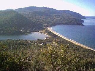
Hawley Beach is a rural and residential locality in the local government area (LGA) of Latrobe in the north-west and west region of Tasmania. The locality is about 22 kilometres (14 mi) north-east of the town of Latrobe. The 2016 census has a population of 484 for the state suburb of Hawley Beach. It is a locality and seaside resort town 22 kilometres (14 mi) from the nearest main town (Devonport). Nearby is the small town of Port Sorell and locality of Shearwater.

The Great Sandy Strait is a strait in the Australian state of Queensland of 70 kilometres (43 mi) length which separates mainland Queensland from K'gari. It is also a locality in the Fraser Coast Region local government area. To the north of the strait is Hervey Bay. In the 2021 census, Great Sandy Strait had "no people or a very low population".
Eaglehawk Neck, officially Teralina / Eaglehawk Neck, is a narrow isthmus that connects the Tasman Peninsula with the Forestier Peninsula and hence to the rest of Tasmania, Australia.
The Long Island, part of the Long Island Group within the Furneaux Group, is a 313-hectare (770-acre) unpopulated granite and dolerite island, located in Bass Strait, lying north-west of the Cape Barren Island in Tasmania, in south-eastern Australia. The island is part of the Franklin Sound Islands Important Bird Area, identified as such by BirdLife International because it holds over 1% of the world populations of six bird species.
Barnes Bay is a rural locality on Bruny Island in the local government area (LGA) of Kingborough in the Hobart LGA region of Tasmania. The locality is about 35 kilometres (22 mi) south of the town of Kingston. The 2016 census recorded a population of 22 for the state suburb of Barnes Bay.

Swan Island, part of the Waterhouse Island Group, is a 239-hectare (590-acre) granite island situated in Banks Strait, part of Bass Strait, lying close to the north-eastern coast of Tasmania, Australia.

Ringarooma is a small town in north-eastern Tasmania. It is located just east of the Ringarooma River and is about 12 km (7.5 mi) south-west from Derby and 55 km (34 mi) east-northeast from Launceston. The area around Ringarooma is known for dairy farming and timber harvesting. The locality is in the Dorset Council local government area, except for about 2.5% which is in the Break O'Day Council area.
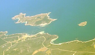
Robbins Island is a 9,900-hectare (24,000-acre) island located in Bass Strait, lying off the northwest coast of Tasmania, Australia. The island, separated from the Tasmanian mainland by a highly tidal area known as Robbins Passage, lies south to the adjacent Walker Island.

Logan Lagoon is a 2172 ha wetland Conservation Area on Flinders Island, the largest of the Furneaux Group at the eastern end of Bass Strait, which is part of the Australian state of Tasmania.
Rushy Lagoon is a rural locality in the local government area (LGA) of Dorset in the North-east LGA region of Tasmania. The locality is about 81 kilometres (50 mi) north-east of the town of Scottsdale. The 2016 census recorded a population of 30 for the state suburb of Rushy Lagoon.
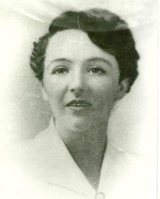
Dora Jeannette Turner was born at Cape Portland in Tasmania in 1888. She became an educationist associated with Tasmania's first special school that was later renamed to be the Dora Turner School.

