Caprington Loch

Last updated

Caprington Loch
East Ayrshire UK relief location map.jpg
Red pog.svg
Caprington Loch
Location Earlston, East Ayrshire, Scotland
Coordinates Coordinates: 55°35′04″N4°32′09″W / 55.58444°N 4.53583°W / 55.58444; -4.53583
Type Freshwater loch
Primary inflows Slough & Todrigs Burn, Rainwater & surface drainage
Primary outflows Todrigs Burn
Catchment area Coodham and Dankeith
Basin  countriesScotland
Surface area0.749 acre (1895)
Islands None
Settlements Kilmarnock

What now survives of the old Caprington Loch (NS402352) is situated near Earlston, Riccarton, East Ayrshire, Scotland. The loch was a natural feature, sitting in a hollow on the old Caprington Castle estate. The loch waters drain via the Todrigs Burn that flows into the River Irvine to the east of Gatehead village. It was partly drained, probably sometime after the 1820s, as were so many other lochs, as part of 18th and 19th centuries extensive agricultural improvements and the only area of open water that remains does so as it was once used as a curling pond for the Caprington Castle Estate owners and their employees or tenants.

Contents

History

Place names

John Kelso Hunter visited and described the loch in the 1820s. John Kelso Hunter.jpg
John Kelso Hunter visited and described the loch in the 1820s.

A habitation named 'Lochside' is recorded in 1775 [1] and again in 1821 to the east of the loch not far from the old Treesbank House and estate, but is no longer present or its old location known. [2] Tod-holes, tod-strips, tod-rigs were places frequented by foxes. [3]

The original 'Tothiricks' (sic) farm was located near Peatland, to the north of Caprington Loch. [4]

Caprington Loch

William Roy's map of 1747-55 does not show the loch however two mills are shown, one possibly a windmill. [4] In 1775 the loch is shown with a 'Tode' habitation marked near to Caprington Castle. West Todrigs Farm may well incorporate this place name element. [5] Todrigs Farm was the birthplace of Johnnie Walker of the Johnnie Walker whisky fame. It was sold to finance the purchase of the family's first grocer shop. [6]

In 1821 a sizeable loch is shown with the farm of Templeton to the south and a single burn running down from the Dankeith estate. [7] As stated the remnants of the loch are located near Earlston close to the old West Todrigs Farm that was used for many years as the Eglinton Hunt Kennels. The loch was mainly fed by the Todrigs Burn which arises on the old Coodham Estate and by the Slough Burn that arises in the Dankeith estate. [8]

In around 1820 the Dankeith born artist John Kelso Hunter (15 December 1802 – 3 February 1873) records a visit to Caprington Loch [9] in his biography, writing: "Passing Caprington Loch I made the first artistic halt, took my position on the margin of the lake with my face toward Kilbirnie Hills. Their azure purity was mirrored in the still water. Towards the front of the picture a stunted hedge and part of a dilapidated paling ran into the lake, out of which sprang up a bold old saugh tree. Its graceful form was massively mirrored in the crystalline liquid. There I stood, as much inspired as ever artist was." [10]

Scotland relief location map.jpg
Red pog.svg
Caprington Loch
Location of Caprington Loch, East Ayrshire

Caprington Castle and estate had been held by the Wallace's of Craigie Castle [11] however it passed into the hands of the Cunninghames who held the barony as baronets from 1669 to 1829 when the line became extinct and John Smith assumed the name Cunninghame on behalf of his wife who had inherited the estate. [12]

West Todrigs Farm or 'The Eglinton Kennels'. Todrigs Farm, Earlston, East Ayrshire.jpg
West Todrigs Farm or 'The Eglinton Kennels'.

Todrigs was a corn mill and later a thrashing mill [13] that stood on the Todrigs Burn to the north of the Earlston hamlet with a head of water supplied by a mill pod located close to West Todrigs Farm that has been infilled. The curling pond at West Todrigs Farm was a little unusual in being an irregular shape as it was the lowest lying part of the old loch and sits close to the farm house. It is shown in 1897 and 1908 was served by the Todrigs Burn that either fed the mill pond or ran past the mill via a separate lade. [14]

The old road from Ayr to Kilmarnock and Glasgow ran quite close by so the site was not as isolated as it is today. [15]

Mining

The 1908 OS map shows the location of two shafts close to a square raised water tank that represents the site of the 1770s Caprington Newcomen atmospheric pumping engine that helped drain the Caprington coalfield. The location of the site from which the 1770s Newcomen Atmospheric Beam engine originally came was the 'Caprington Colliery' with its numerous pits and the pumping engine itself located in Earlston. The engine is now displayed in the National Museum of Scotland. [16]

The engine worked more or less continuously for around ninety years and had its wooden beam replaced by a cast-iron one in 1837. It is not clear where the water was pumped to for disposal, however a square and embanked tank once stood near by and this may have been piped down to the old loch site to enter the burn. [17]

See also

Related Research Articles

East Ayrshire Council area of Scotland

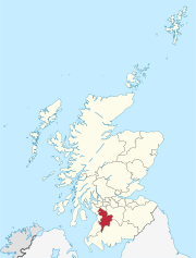
East Ayrshire is one of thirty-two council areas of Scotland. It shares borders with Dumfries and Galloway, East Renfrewshire, North Ayrshire, South Ayrshire and South Lanarkshire. The headquarters of the council are located on London Road, Kilmarnock. With South Ayrshire and the mainland areas of North Ayrshire, it formed the former county of Ayrshire.

Kilmarnock burgh in East Ayrshire, Scotland

Kilmarnock is a large burgh in East Ayrshire, Scotland and is the administrative centre of East Ayrshire Council. With a population of 46,770, Kilmarnock is the 15th most populated place in Scotland and the largest town in Ayrshire.

Lambroughton Human settlement in Scotland

Lambroughton is a village in the old Barony of Kilmaurs, Scotland. This is a rural area famous for its milk and cheese production and the Ayrshire or Dunlop breed of cattle.

Dundonald, South Ayrshire Human settlement in Scotland

Dundonald is a village in South Ayrshire, Scotland.

Trabboch

Trabboch is a hamlet in East Ayrshire, Scotland. Built as a miners village in the 1880s, it was owned and leased by Wm. Baird & Co., Ltd. and at one time had 94 dwellings. The miners rows stood, until demolition in 1969, on the Stair and Littlemill road, about two miles south of Stair, in that parish. The name is locally pronounced 'Traaboch'.

Gatehead, East Ayrshire Human settlement in Scotland

The village or hamlet of Gatehead is located in East Ayrshire, Parish of Kilmaurs, Scotland. It is one and a quarter miles from Crosshouse and one and a half miles from Kilmarnock. In the 18th and 19th centuries the locality was a busy coal mining district. The settlement runs down to the River Irvine where a ford and later a bridge was located.

River Irvine

The River Irvine is a river that flows through southwest Scotland. Its watershed is on the Lanarkshire border of Ayrshire at an altitude of 810 feet (250 m) above sea-level, near Loudoun Hill, Drumclog, and 7 miles SW by W of Strathaven. It flows 29 12 mi (47.5 km) westward, dividing the old district of Cunninghame from that of Kyle, until it reaches the sea via Irvine Harbour in the form of the Firth of Clyde, and flows into Irvine Bay by the town of Irvine. It has many tributaries, some of which form parish, district and other boundaries.

Riccarton, East Ayrshire Human settlement in Scotland

Riccarton is a village and parish in East Ayrshire, Scotland. It lies across the River Irvine from Kilmarnock, this river forming the boundary between Riccarton and Kilmarnock parishes, and also between the historical districts of Kyle and Cunningham. The name is a corruption of 'Richard's town', traditionally said to refer to Richard Wallace, the uncle of Sir William Wallace. The parish also contains the village of Hurlford.

John Kelso Hunter Scottish portrait painter (1802–1873)

John Kelso Hunter was a self-taught Scottish portrait painter and author of two books.

Busbie Castle

Busbie Castle was situated in what is now known as Knockentiber, a village in East Ayrshire, Parish of Kilmaurs, Scotland. Knockentiber is 2 miles (3.2 km) WNW of Kilmarnock and 1/2 mile NE of Crosshouse. The castle overlooked the Carmel Glen and its Burn, which runs into the River Irvine, a mile or so to the south, after passing through the old Busbie Mill.

Loch Brown

Loch Brown, also known in Scots as Loch Broun, Broon or Broom, was situated in a kettle hole in the mid-Ayrshire clayland near Crosshands. It is nowadays (2011) visible as a surface depression in pastureland, partially flooded, situated in a low-lying area close to farms and dwellings of Skeoch, Dalsangan, Ladebrae, Lochhill, and Crosshands, mainly in the Parish of Mauchline and partly in Craigie, East Ayrshire, Scotland. Duveloch is an old name for the loch and this may derive from the Gaelic Dubh, meaning black or dark loch.

Symington, South Ayrshire Human settlement in Scotland

Symington is a conservation village in South Ayrshire, Scotland. It is located in Symington Parish, covering 0.41 square kilometres (0.16 sq mi), and lies close to the A77 road from Ayr to Glasgow. Its church, built in 1160, remains one of the finest examples of a Norman church in Scotland.

Galrigs Loch (South Ayrshire)

The Galrigs Loch was a substantial freshwater loch situated in low lying area between Newfield and Dundonald in South Ayrshire, Scotland. It was drained in the early 18th century.

Old Rome, South Ayrshire Human settlement in Scotland

The old village or hamlet of Old Rome, Rome or Old Rome Ford is located in South Ayrshire, Parish of Dundonald, Scotland. It is one and a half miles from Crosshouse and one and less than a quarter of a mile from Gatehead. In the 18th and 19th centuries the locality was a busy coal mining district and many of the houses have been demolished. The settlement is situated near the River Irvine.

Newton Loch, South Ayrshire

Newton Loch was situated in a low-lying area near Newton-on-Ayr, South Ayrshire, just south of the old South and West Sanquhar Farms. It is now (2016) only visible as remnant heath land and surface darkening in pastureland, situated mainly in the Parish of Ayr and partly in St Quivox, South Ayrshire, Scotland.

Caprington Castle

Caprington Castle is a 15th century keep, incorporated in a castellated mansion, about 2 miles (3.2 km) south west of Kilmarnock, East Ayrshire, Scotland, south of the River Irvine.

Blacksyke Tower

The Blacksyke Tower, Blacksyke Engine House, Caprington Colliery Engine House or even Lusk's Folly is a Scheduled Monument associated with a double lime kiln complex in the Parish of Riccarton and is a building of national importance. The Blacksyke site is a significant survival of early coal and lime industries. The engine house's mock Gothic tower house style is very unusual and rare survival of its type. This late-18th-century engine house would be one of the oldest surviving examples of its kind in the United Kingdom. The track bed of the wagonway and several sidings that linked the complex with the Kilmarnock and Troon Railway can still be clearly made out.

Earlston, East Ayrshire Human settlement in Scotland

Earlston is a hamlet in Riccarton, East Ayrshire, Scotland. The habitation dates from at least the early 18th century and is near Caprington Castle and Todrigs Mill. It was for many years the site of a large sawmill and a mine pumping engine, and had sidings of the Glasgow and South-Western Railway's Fairlie Branch.

Bickering Bush

The Bickering bush (NS41863635) thorn grew near Caprington on the lands of Monksholm or Maxholm, Riccarton, East Ayrshire, Scotland. The old farm house at Maxholm sat in hollow on the old Caprington Castle estate and to the north and west its fields bordered the River Irvine. The thorn was located, as recorded on the OS map, near to the confluence of the Kilmarnock Water and the River Irvine, downstream of the Simon's Burn's confluence on the south bank of the river.

Lands of Dallars Human settlement in Scotland

The Lands of Dallars or Auchenskeith (NS463337) form a small estate in East Ayrshire, Hurlford, Kilmarnock, Parish of Riccarton, Scotland. The present mansion house is mainly late 18th-century, located within a bend of the Cessnock Water on the site of older building/s. "Dullers or Dillers" was changed to "Auchenskeith" or "Auchinskeigh" (sic) as well as other variants and then the name reverted back nearer to the original form as "Dollars" and then finally "Dallars". Dallars lies 3.25km south of Hurlford.

References

Notes

  1. "1775 - Andrew Armstrong - A new map of Ayrshire" . Retrieved 30 July 2018.CS1 maint: discouraged parameter (link)
  2. "Ainslie's Map of the Southern Part of Scotland" . Retrieved 30 July 2018.CS1 maint: discouraged parameter (link)
  3. "Dictionary of the Scots Language" . Retrieved 31 July 2018.CS1 maint: discouraged parameter (link)
  4. 1 2 "1747-55 - William ROY - Military Survey of Scotland" . Retrieved 31 July 2018.CS1 maint: discouraged parameter (link)
  5. "1775 - Andrew Armstrong - A new map of Ayrshire" . Retrieved 30 July 2018.CS1 maint: discouraged parameter (link)
  6. Johnnie Walker and Todrigs
  7. "Ayrshire Sheet XXIII.NW, Surveyed: 1908, Published: 1910" . Retrieved 30 July 2018.CS1 maint: discouraged parameter (link)
  8. "Ayrshire Sheet XXIII.NW, Surveyed: 1908, Published: 1910" . Retrieved 30 July 2018.CS1 maint: discouraged parameter (link)
  9. John Kelso Hunter (1912). Retrospect of An Artist's Life. The Standard Press, Kilmarnock. p. 119 & 120.
  10. John Kelso Hunter (1912). Retrospect of An Artist's Life. The Standard Press, Kilmarnock. p. 119 & 120.
  11. John Smith (1895). Prehistoric Man in Ayrshire. Elliot Stock. p. 131.
  12. James Paterson (2003). History of the Counties of Ayr and Wigton. James Stillie. p. 649.
  13. "Scotland's Place - OS Name Book" . Retrieved 31 July 2018.CS1 maint: discouraged parameter (link)
  14. "Historic Curling Ponds site" . Retrieved 30 July 2018.CS1 maint: discouraged parameter (link)
  15. "Roy Military Map 1747-55" . Retrieved 31 July 2018.CS1 maint: discouraged parameter (link)
  16. "Future Museum" . Retrieved 31 July 2018.CS1 maint: discouraged parameter (link)
  17. "Ayrshire XXII.4 (Dundonald; Kilmarnock; Kilmaurs; Riccarton) Publication date:1910. Revised:1908" . Retrieved 31 July 2018.CS1 maint: discouraged parameter (link)
Sources
  1. Hunter, John Kelso (1912). Retrospect of An Artist's Life. Kilmarnock : The Standard Press.
  2. Love, Dane (2003). Ayrshire : Discovering a County. Ayr : Fort Publishing. ISBN   0-9544461-1-9.
  3. Paterson, James (1863–66). History of the Counties of Ayr and Wigton. V. - II - Kyle. J. Stillie. Edinburgh.
  4. Robinson, Mairi (2000). The Concise Scots Dictionary. Aberdeen. ISBN   1-902930-00-2.
  5. Smith, John (1895). Prehistoric Man in Ayrshire. London : Elliot Stock.