This article needs additional citations for verification .(August 2017) |
Carlinghow | |
---|---|
Carlinghow Mills, Bradford Road, Carlinghow | |
Location within West Yorkshire | |
Metropolitan borough | |
Metropolitan county | |
Region | |
Country | England |
Sovereign state | United Kingdom |
Police | West Yorkshire |
Fire | West Yorkshire |
Ambulance | Yorkshire |
UK Parliament | |
Carlinghow is a district of Batley, West Yorkshire, England.
It is west of Batley town centre, and stretches up towards White Lee and Birstall, along Carlinghow Lane and Bradford Road.
The name means "the hill or burial mound of the "Witch", or "Hag"", as in an old woman, probably a soothsayer. A 'Carle' in Scots is a commoner, a husband or in a derogatory sense, a churl or male of low birth. The name 'Carline', 'Cairlin', Carlin, 'Cyarlin', 'Kerlin' or 'Kerl' was also used in Lowland Scots as a derogatory term for an old woman, meaning an 'old hag'. It is a corruption or equivalent of the Gaelic word "Cailleach", meaning a witch or the 'old Hag', the Goddess of Winter. [1] (A "how" means a mound, the same as a "low", often the last resting place of some ancient person of noble ranking.
It has been suggested in some quarters that the rocky outcrop, which is supposedly the place from where Carlinghow derives its name, known locally as "The Outies", was in ancient times a Druidic settlement, encompassing a sacred oak grove. Oak trees are still plentiful along the banks of the hillside, as are holly bushes, which were also sacred to the Drudic Bards of Iron Age Celtic Britain. It was in this area where the Druids once ruled which is why many of the field names have a reference to the sun and oaks. It is this area which catches the first rays of the sun on a morning. Nearby waterway the Batley Beck, a tributary of the River Calder runs through Carlinghow, winding parallel along the course Bradford Road.
Carlinghow used to have a station on a branch line that ran northwards from Batley to Birstall. The railway itself opened in 1852, with Carlinghow station being opened in 1872. Competition from Leeds New Line trains at Birstall and electric trams meant that the line closed to passengers as a wartime economy measure in December 1916, but the passenger trains were never restarted. The line remained open for freight until 1962. [2]
Batley General Hospital was located on Carlinghow Hill. The hospital was funded by the wealthy inhabitants of the area and was founded in 1878, and opening to practice in 1881. It lasted for just over 100 years after finally being closed in 1988. [3] [4]
In the area around Summerbridge Close was once Carlinghow Old Hall, an Elizabethan Manor House, a timber-framed building reputed to have been the home of the Eland family in the later Middle Ages. According to Sheard's book, Records of Batley, it was built by Robert Eland, who died in 1521. The style of the timbering also suggests a 16th-century date, and there was, in 1968, a loose date-stone on site inscribed with the year 1505.
All that survived in the late 1960s, when the Hall was recorded in detail before its demolition, was a two-storey, two-bay timber-framed range with stone walling to the ground floor, and diagonal timber ‘stud’ walling with a stone slate infill (partly replaced by bricks) at first-floor level.
The ground floor stone walling was an original feature of the building (there were no peg holes or mortices to show that it replaced earlier timbering), though the windows in it were timber-mullioned. The first-floor windows projected from the walls.
A drawing of the Hall, published in Sheard's book in 1894, shows that the building was no more extensive at that date than it was in the 1960s, but what survived then was presumably only the 'solar' wing of a once much bigger 'gentry house'.
Carlinghow Lane is a gradual hill.
Batley Community Fire Station was at Carlinghow, but this and Dewsbury Fire Station were closed in August 2015 when a combined fire station was opened up on Carlton Road in Dewsbury. [5] The Wilton council estate and Wilton Park, locally known as Batley Park, are both in the area.
Batley is a market town in the Kirklees district, in West Yorkshire, England, south-west of Leeds, north-west of Wakefield and Dewsbury, south-east of Bradford and north-east of Huddersfield, in the Heavy Woollen District. In 2011, the population was 48,730.
Dewsbury is a market town in the Metropolitan Borough of Kirklees in West Yorkshire, England. It lies on the River Calder and on an arm of the Calder and Hebble Navigation waterway. It is to the west of Wakefield, east of Huddersfield and south of Leeds. Historically a part of the West Riding of Yorkshire, after undergoing a period of major growth in the 19th century as a mill town, Dewsbury went through a period of decline. Dewsbury forms part of the Heavy Woollen District of which it is the largest town. The population of the built-up area was 63,722 at the 2021 Census.
Ossett is a market town in the Wakefield district, in the county of West Yorkshire, England. Historically part of the West Riding of Yorkshire, it is situated between Dewsbury, Horbury and Wakefield. At the 2021 census, the town had a population of 21,861. Ossett forms part of the Heavy Woollen District.
Cleckheaton is a town in the metropolitan borough of Kirklees, West Yorkshire, England. Historically part of the West Riding of Yorkshire, it is situated south of Bradford, east of Brighouse, west of Batley and south-west of Leeds. It is at the centre of the Spen Valley and was the major town in the former borough of Spenborough. Cleckheaton has a history as a mill town and forms part of the Heavy Woollen District.
Kirklees is a metropolitan borough of West Yorkshire, England. The borough comprises the ten towns of Batley, Birstall, Cleckheaton, Dewsbury, Heckmondwike, Holmfirth, Huddersfield, Meltham, Mirfield and Slaithwaite. It is governed by Kirklees Council. Kirklees had a population of 422,500 in 2011; it is the third-largest metropolitan district in England by area, behind Doncaster and Leeds.
Heckmondwike is a town in the Kirklees district, West Yorkshire, England, 9 miles (14 km) south west of Leeds. Historically part of the West Riding of Yorkshire, it is close to Cleckheaton and Liversedge. It is mostly in the Batley and Spen parliamentary constituency, and had an estimated population of 16,986 at the 2011 Census increasing to 18,149 at the 2021 Census. Heckmondwike forms part of the Heavy Woollen District.
Tingley is a suburban village in the City of Leeds in West Yorkshire, Northern England, forming part of the parish of West Ardsley. Tingley forms part of the Heavy Woollen District. It is situated between the cities of Leeds and Wakefield.
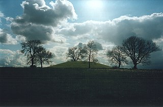
Navan Fort is an ancient ceremonial monument near Armagh, Northern Ireland. According to tradition it was one of the great royal sites of pre-Christian Gaelic Ireland and the capital of the Ulaidh. It is a large circular hilltop enclosure—marked by a bank and ditch—inside which is a circular mound and the remains of a ring barrow. Archeological investigations show that there were once buildings on the site, including a huge roundhouse-like structure that has been likened to a temple. In a ritual act, this timber structure was filled with stones, deliberately burnt down and then covered with earth to create the mound which stands today. It is believed that Navan was a pagan ceremonial site and was regarded as a sacred space. It features prominently in Irish mythology, especially in the tales of the Ulster Cycle. According to the Oxford Dictionary of Celtic Mythology, "the [Eamhain Mhacha] of myth and legend is a far grander and mysterious place than archeological excavation supports".
Batley and Spen was a constituency in the House of Commons of the UK Parliament. The most recent MP was Kim Leadbeater, a Labour politician, elected in a 2021 by-election by a 323-vote margin. The seat had returned Labour MPs since the 1997 general election.
Birstall is a market and mill town in the metropolitan borough of Kirklees, West Yorkshire, England. It is part of the Birstall and Birkenshaw ward, which had a population of 16,298 at the 2011 census. Historically in the West Riding of Yorkshire, and part of the Heavy Woollen District, Birstall is approximately 6 miles (10 km) south-west of Leeds and situated close to the M62 motorway. The town is situated between Leeds, Bradford, Huddersfield and Wakefield.
Dewsbury railway station serves the town of Dewsbury in West Yorkshire, England. Situated 9.25 miles (15 km) south west of Leeds on the main line to Huddersfield and Manchester, the station was opened by the London and North Western Railway in 1848.
Batley railway station serves the market town of Batley in West Yorkshire, England. Situated 8 miles (13 km) south-west of Leeds on the main line to Huddersfield and Manchester, the station was opened by the London and North Western Railway in 1848.
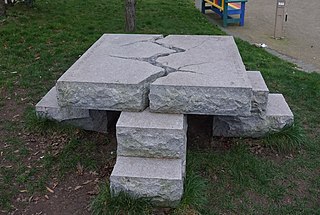
In C. S. Lewis's fantasy novel series the Chronicles of Narnia, the hill of the Stone Table, or Aslan's How, is a high mound or cairn, located south of the Great River in Narnia next to the Great Woods. The How was built over the hill of the Stone Table. The word how derives from the Old Norse haugr, meaning hill or mound. In parts of England, it is a synonym for barrow.
Oakwell Hall is an Elizabethan manor house in Birstall, West Yorkshire, England. The Grade I listed hall is set in period gardens surrounded by 110 acres (0.45 km2) of country park.
Lithgow railway station is a heritage-listed former station master's residence and railway station located on the Main Western line at Railway Parade, Lithgow, City of Lithgow, New South Wales, Australia. It was designed and built by New South Wales Government Railways and built from 1924 to 1925. It is also known as Lithgow Railway Station Group and Residence and Eskbank East. The property was added to the New South Wales State Heritage Register on 30 August 2013. The station has frequent NSW TrainLink services running to and from Sydney Central.
Birkenshaw is a village in the borough of Kirklees in the county of West Yorkshire, England. It lies at the crossroads between the A58 Leeds to Halifax road and the A651 Bradford to Heckmondwike road. At the 2011 census, the village was located in the ward of Birstall and Birkenshaw, which had a population 16,298. Birkenshaw forms part of the Heavy Woollen District.
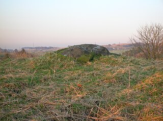
Carlin Stone or Carline Stane is the name given to a number of prehistoric standing stones and natural stone or landscape features in Scotland. The significance of the name is unclear, other than its association with old hags, witches, and the legends of the Cailleach.
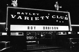
Batley Variety Club was a variety club in Batley, West Yorkshire, England. During its existence, the club staged concerts by performers including Louis Armstrong, Shirley Bassey, Tom Jones, Roy Orbison, Eartha Kitt, Morecambe and Wise, Gene Pitney, Neil Sedaka, Ken Dodd and Helen Shapiro. At the peak of its success, the club had 300,000 members. It closed about 1978 and reopened as "Crumpets" night club. It closed again shortly afterwards and its contents were auctioned off. It reopened as the "Frontier" in the early 1980s and this eventually closed in 2016.
The Bradford, Wakefield and Leeds Railway was an independent railway company that built a line between Wakefield and a junction close to Leeds, in Yorkshire, England. It opened its main line in 1857, and was worked by the Great Northern Railway. The line shortened the GNR route to Leeds.
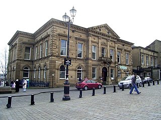
Batley Town Hall is a municipal facility in the Market Place in Batley, West Yorkshire, England. It is a Grade II listed building.