Carn Euny

Last updated

Carn Euny
Cornish: Chapeluni [1]
CarnEuny1.jpg
Carn Euny ancient village
Southwest Cornwall UK location map.svg
Archaeological site icon (red).svg
Shown within Southwest Cornwall
Location Brane, Cornwall
grid reference SW402288
Coordinates 50°06′08″N5°38′04″W / 50.10234°N 5.63448°W / 50.10234; -5.63448
TypeAncient village
History
Foundedc. 200 BC
Abandonedc. 400 AD
Periods Iron Age/Roman
Cultures Romano-British
Site notes
ConditionRuins
OwnershipCornwall Heritage Trust
Public accessYes

Carn Euny (from Cornish : Karn Uni) [1] is an archaeological site near Sancreed, on the Penwith peninsula in Cornwall, United Kingdom. It consists of evidence of both Iron Age and post-Iron Age settlement, [2] with excavation on the site showning activity at Carn Euny as early as the Neolithic period. The first timber huts there were built about 500 BC, and 400-500 years later were replaced by stone huts; the remains of which are still visible.

Contents

Carn Euny is best known for the well-preserved state of the large fogou, an underground passageway, which is more than 65 feet (20 metres) long. This fogou runs just below the surface of the ground and is roofed with massive stone slabs.

The site was abandoned late in the Roman period.

Location

View from the Fogou Carn Euny ancient village - geograph.org.uk - 649875.jpg
View from the Fogou

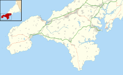
Carn Euny lies in southwest Cornwall in the Penwith District, near the village of Sancreed. The archaeological site can be accessed at any time and the admission is free. Parking can be found in the nearby hamlet of Brane. [3] The site is overlooked by the Iron Age hill fort of Caer Bran. Another similar Romano-British settlement is Chysauster about 10 km to the northeast. Carn Euny is managed by the Cornwall Heritage Trust.

Construction

Traces of human activity in Carn Euny have been detected from the early Neolithic period. Iron Age round houses of wattle and daub, mud and wood were built around 500-400 BC, [4] and replaced by stone houses starting in the 1st century BC. Some of these stone houses were "replaced with larger, stone ‘courtyard’ houses" between 200-400 AD, [4] the remains of which are the ruins still visible above ground as the older roundhouses are only left as sub-surface ruins. [5] Seven single-room stone houses, of both a round and oval form, and three courtyard houses are in evidence; courtyard houses only being found in Cornwall. [5]

The most important structure of the site is the fogou (Ogo being Cornish for cave), [5] a man-made underground passage which is covered with massive stone slabs. Fogous can be found in other places in the UK and Ireland, and are known more generally as souterrains. Their purpose is unclear. The fogou at Carn Euny is in particularly good condition and consists of a 20 m long corridor, with a side passage that leads to a round stone chamber with a collapsed roof, and a small tunnel which may be a second entrance. [6]

At this time the people of Carn Euny lived from agriculture, livestock, trade, and perhaps tin mining. Evidence of farming here includes 40 acres enclosed within a field boundary, which is most likely the area farmed by this settlement. [4] The inhabitants likely grew oats, barley and rye, and kept sheep, goats and cattle. [4] The courtyard houses "may have been used for stabling livestock, crop processing and outdoor cooking." [5]

Excavations

Drawing by John Thomas Blight, 1868 Carneuny.jpg
Drawing by John Thomas Blight, 1868

The site was discovered in the early 19th Century by prospectors searching for tin deposits. Between 1863 and 1868, the antiquarian William Copeland Borlase examined the archaeological site and exposed the fogou. The graphic artist John Thomas Blight made corresponding engravings for the excavation report. During the 1920s, Dr. Favell and Canon Taylor discovered the foundation walls of the houses with courtyards. Between 1964 and 1972, extensive excavations were carried out, in which nine hut foundations were discovered. The fogou and the circular chamber were investigated and restored. Four main occupation phases between the 5th century BC and the 4th century AD were found. [7]

Chapel Euny Well

Chapel Euny well Chapel Euny holy well - geograph.org.uk - 658601.jpg
Chapel Euny well

West of the settlement are a pair of ancient wells. One is mentioned in The Legendary Lore of the Holy Wells of England [8] of 1893 where William Borlase [9] states (writing in the 1750s):

"I happened luckily to be at this well upon the last day of the year, on which, according to vulgar opinion, it exerts its principal and most salutary powers. Two women were here, who came from a neighbouring parish, and were busily employed in bathing a child. They both assured me that people who had a mind to receive any benefit from St. Euny's Well must come and wash upon the three first Wednesdays in May. Children suffering from mesenteric disease [10] should be dipped three times in Chapel Uny widderschynnes, and widderschynnes dragged three times round the well."

It is also referred to as St. Eurinus' or Uny's Well (i.e. well of St Euny) and may be confused with Saint Euny's Well at Carn Brea.

See also

Related Research Articles

<span class="mw-page-title-main">Chysauster Ancient Village</span>

Chysauster Ancient Village is a late Iron Age and Romano-British village of courtyard houses in Cornwall, England, United Kingdom, which is currently in the care of English Heritage. The village included eight to ten houses, each with its own internal courtyard. To the south east is the remains of a fogou, an underground structure of uncertain function.

<span class="mw-page-title-main">Fogou</span> Ancient dry-stone underground structures in Cornwall

A fogou or fougou is an underground, dry-stone structure found on Iron Age or Romano-British-defended settlement sites in Cornwall. The original purpose of a fogou is uncertain today. Colloquially called vugs, vows, foggos, giant holts, or fuggy holes in various dialects, fogous have similarities with souterrains or earth-houses of northern Europe and particularly Scotland, including Orkney. Fewer than 15 confirmed fogous have been found.

<span class="mw-page-title-main">Carn Brea, Redruth</span> Civil parish and site in Cornwall, England

Carn Brea is a civil parish and hilltop site in Cornwall, England, United Kingdom. The population of Carn Brea including Bosleake and Church Coombe was 8,013 at the 2011 census. The hilltop site is situated approximately one mile (1.6 km) southwest of Redruth. The settlements of Bosleake, Brea, Broad Lane, Carn Arthen, Carn Brea Village, Carnkie, Four Lanes, Grillis, Illogan Highway, Pencoys, Penhallick, Piece, Pool, Tolskithy, Tregajorran, Treskillard, Tuckingmill and West Tolgus are in the parish.

<span class="mw-page-title-main">Bant's Carn</span> Scillonian entrance grave

Bant's Carn is a Bronze Age entrance grave located on a steep slope on the island of St Mary's in the Isles of Scilly, England. The tomb is one of the best examples of a Scillonian entrance grave. Below Bant's Carn, lies the remains of the Iron Age village of Halangy Down.

<span class="mw-page-title-main">Pendeen</span> Village and parish in Cornwall, England

Pendeen is a village and ecclesiastical parish on the Penwith peninsula in Cornwall, England. It is 3 miles north-northeast of St Just and 7 mi (11 km) west of Penzance. It lies along the B3306 road which connects St Ives to Land's End and the A30 road.

<span class="mw-page-title-main">Sancreed</span> Human settlement in England

Sancreed is a village and civil parish in Cornwall, England, United Kingdom, approximately three miles (5 km) west of Penzance.

<span class="mw-page-title-main">The Hurlers (stone circles)</span> Group of three stone circles in Cornwall, England

The Hurlers is a group of three stone circles in the civil parish of St Cleer, Cornwall, England, UK. The site is half-a-mile (0.8 km) west of the village of Minions on the eastern flank of Bodmin Moor, and approximately four miles (6 km) north of Liskeard.

<span class="mw-page-title-main">Tregiffian Burial Chamber</span> Archaeological site in Cornwall County, England

The Tregiffian Burial Chamber is a Neolithic or early Bronze Age chambered tomb. It is near Lamorna in west Cornwall, United Kingdom. It is a rare form of a passage grave, known as an Entrance grave. It has an entrance passage, lined with stone slabs, which leads into a central chamber. This type of tomb is also found in the neighbouring Isles of Scilly.

<span class="mw-page-title-main">William Copeland Borlase</span> British antiquarian and liberal politician

William Copeland Borlase was a British antiquarian and Liberal politician who sat in the House of Commons from 1880 until 1887 when he was ruined by bankruptcy and scandal.

Bosporthennis is a hamlet south of Treen in the civil parish of Zennor on the Penwith peninsula in west Cornwall, England, United Kingdom.

<span class="mw-page-title-main">Caer Bran</span>

Caer Bran Hill Fort is an archaeological site near Sancreed and Carn Euny Iron Age village, on the Penwith peninsula in Cornwall.

<span class="mw-page-title-main">Sancreed Beacon</span>

Sancreed Beacon is a Bronze Age archaeological site near the village of Sancreed in the Penwith peninsula of Cornwall maintained by the Cornwall Heritage Trust. On top of the hill are several stone cists and Bronze Age archaeological remains comprising burial mounds and the remains of a Bronze Age hut on the Western slope.

<span class="mw-page-title-main">Bartinney Castle</span> Iron Age enclosure in Cornwall, England

Bartinney Castle is an Iron Age enclosure located in the Penwith Peninsula of Southwest Cornwall, England, it is surrounded by a circular earthwork standing on a hill surrounded by various archaeological prehistoric remains, including ancient settlements, field systems, tumuli and cairns.

<span class="mw-page-title-main">Grumbla</span> Hamlet in Cornwall, England

Grumbla is a hamlet in the parish of Sancreed, Cornwall, England, UK.

<span class="mw-page-title-main">Promontory forts of Cornwall</span> Cliff castles in north-west Europe

Cornish promontory forts, commonly known in Cornwall as cliff castles, are coastal equivalents of the hill forts and Cornish "rounds" found on Cornish hilltops and slopes. Similar coastal forts are found on the north–west European seaboard, in Normandy, Brittany and around the coastlines of the British Isles, especially in Wales, Scotland and Ireland. Many are known in southwest England, particularly in Cornwall and its neighbouring county, Devon. Two have been identified immediately west of Cornwall, in the Isles of Scilly.

<span class="mw-page-title-main">Brane Barrow</span> Neolithic entrance grave in Cornwall

Brane Barrow, or Chapel Euny Barrow, is a Neolithic entrance grave located near the hamlet of Brane, Cornwall, England, UK. It is considered to be one of the smallest and best preserved burial monuments in Britain.

Saint Euny or Uny is the patron saint of the churches of Lelant and Redruth in west Cornwall, England, UK.

Presented below is an alphabetical index of articles related to Cornwall:

This is a list of scheduled monuments in Cornwall, United Kingdom. Monuments are listed by Historic England as part of the National Heritage List for England. For the scope of this list, the Isles of Sicily are included and the ceremonial county boundaries are used.

<span class="mw-page-title-main">Prehistoric Cornwall</span> Period of Cornish history from c. 225,000 yeats ago until c. 43 CE

The prehistory of Cornwall spans an extensive timeframe from the earliest evidence of archaic human presence in Cornwall, perhaps c. 225,000 years ago, to the Roman conquest of Britain c. 43 CE, encompassing the Palaeolithic, Mesolithic, Neolithic, Bronze Age, and Iron Age periods. Throughout this era Cornwall underwent significant cultural and environmental changes, evolving from a sparsely-populated hunter-gatherer society reliant on rudimentary stone tools to an agricultural society characterized by developed metallurgical practices, expansive trade networks, and emerging social complexity.

References

  1. 1 2 Place-names in the Standard Written Form (SWF) Archived 15 May 2013 at the Wayback Machine  : List of place-names agreed by the MAGA Signage Panel Archived 15 May 2013 at the Wayback Machine . Cornish Language Partnership.
  2. Craig Weatherhill Cornovia: Ancient Sites of Cornwall & Scilly (Alison Hodge 1985; Halsgrove 1997, 2000)
  3. Carn Euny Ancient Village – English Heritage
  4. 1 2 3 4 "History of Carn Euny". English Heritage. Retrieved 7 March 2024.
  5. 1 2 3 4 "Description of Carn Euny". English Heritage. Retrieved 7 March 2024.
  6. Carn Euny at Stone Pages
  7. Carn Euny, Cornwall's Archaeological Heritage – Access to Monuments
  8. Hope, Robert (1893). The Legendary Lore of the Holy Wells of England including Rivers, Lakes, Fountains and Springs. Elliot Stock.
  9. Dr. Borlase was the author of "The Natural History and Antiquities of Cornwall, and Observations of the Scilly Islands" and the vicar of Ludgvan. He died 31 August 1772 aged 77
  10. Mesenteric disease is tuberculosis of lymph glands inside the abdomen. An illness of children caused by drinking milk from cows infected with tuberculosis. Now uncommon as milk is pasteurised

50°06′08″N5°38′04″W / 50.10234°N 5.63448°W / 50.10234; -5.63448