List of managed sites
The Trust owns or manages the following sites: [3]
- Caer Bran
- Carn Euny
- Castle an Dinas
- Duloe stone circle
- Dupath Well
- East Pentire Headland
- Hurlers Stone Circles
- Lammana Chapel
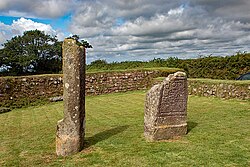
- King Doniert's Stone
- Sancreed Beacon
- St Breock Downs Monolith
- St Cleer Holy Well and Cross
- Tregiffian Burial Chamber
- Trethevy Quoit
- Trevanion Culverhouse
- Treffry Viaduct
- Tregonning Hill
- Warbstow Bury [4]