St Breock Downs Monolith

Last updated
St Breock Downs Monolith
Men Gurta
SaintBreockDownsLongstone ancientAndModern.jpg
St Breock Downs Monolith
Alternative nameSt Breock Longstone
Locationnear St Breock
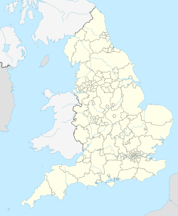
Region Cornwall, England
Coordinates 50°28′45.54″N4°51′56.28″W / 50.4793167°N 4.8656333°W / 50.4793167; -4.8656333 Coordinates: 50°28′45.54″N4°51′56.28″W / 50.4793167°N 4.8656333°W / 50.4793167; -4.8656333
Type Standing stone (megalith)
History
MaterialShale
PeriodsLate Neolithic / Early Bronze Age
Site notes
Public accessYes

St Breock Downs Monolith (or St Breock Longstone; Cornish: Men Gurta [1] ) is the largest and heaviest prehistoric standing stone in Cornwall, England. [2] It stands on the summit of St Breock Downs.

Contents

Description

The stone is made from the local Devonian shale which has extensive feldspar veining, [3] and it is estimated to weigh around 16.5 tonnes. [1] It is 4.92 metres long [1] and stands to a height of just over 3 metres above ground level. [3] It stands on a low stone mound or cairn with a diameter of around 10 metres. [3] It is believed to be Late Neolithic or Early Bronze Age (around 2500-1500 BC). [1]

It fell over in 1945, and was re-erected in 1956 after a small excavation had been carried out. [3] The excavation showed that the stone stood in a setting of quartz pebbles below which were two small hollows. [1] Similar hollows at other sites have been found to contain human bone or ashes. [1]

The stone may have been associated with other Bronze Age ritual monuments in the area, including one other standing stone, [4] and a series of barrows that extend up to 4 miles (7 km) to the west. [3]

The stone is mentioned in antiquarian records as early as 1613, and was later adopted as a St Breock parish boundary marker. [3] The site is now in the care of the Cornwall Heritage Trust on behalf of English Heritage. [5]

Notes

  1. 1 2 3 4 5 6 Historic England. "St Breock Downs Monolith (430282)". PastScape. Retrieved 12 April 2012.
  2. St Breock Downs Monolith, English Heritage, retrieved 12 April 2012
  3. 1 2 3 4 5 6 History and Research: St Breock Downs Monolith, English Heritage, retrieved 12 April 2012
  4. Historic England. "St Breock Downs Standing Stone (430297)". PastScape. Retrieved 12 April 2012.
  5. Sites Managed and Cared for by Cornwall Heritage Trust for English Heritage Archived 2012-06-13 at the Wayback Machine , retrieved 12 April 2012

Commons-logo.svg Media related to St Breock Downs Monolith at Wikimedia Commons

Related Research Articles

Arbor Low Neolithic henge monument in Derbyshire, England

Arbor Low is a well-preserved Neolithic henge in the Derbyshire Peak District, England. It lies on a carboniferous limestone plateau known as the White Peak area. The monument consists of a stone circle surrounded by massive earthworks and a ditch.

Rudston Village and civil parish in the East Riding of Yorkshire, England

Rudston is a small village and civil parish in the East Riding of Yorkshire, England. It is situated between Driffield and Bridlington approximately 6 miles west of Bridlington, and lies on the B1253 road. The Gypsey Race runs through the village, which lies in the Great Wold Valley. There are a number of Neolithic sites associated with the stream and its valley. It is the current Seat of the Clan Macdonald of Sleat.

Cadbury Camp hillfort in North Somerset

Cadbury Camp is an Iron Age hill fort in Somerset, England, near the village of Tickenham. It is a scheduled monument. Although primarily known as a fort during the Iron Age it is likely, from artefacts, including a bronze spear or axe head, discovered at the site, that it was first used in the Bronze Age and still occupied through the Roman era into the sub-Roman period when the area became part of a Celtic kingdom. The name may mean "Fort of Cador" - Cado(r) being possibly the regional king or warlord controlling Somerset, Bristol, and South Gloucestershire, in the middle to late 5th century. Cador has been associated with Arthurian England, though the only evidence for this is the reference in the Life of St. Carantoc to Arthur and Cador ruling from Dindraithou and having the power over western Somerset to grant Carantoc's plea to build a church at Carhampton. Geoffrey of Monmouth invented the title 'Duke of Cornwall' for Cador in his misleading History of the Kings of Britain.

The Hurlers (stone circles) The Hurlers is a group of three stone circles on Bodmin Moor in Cornwall, UK

The Hurlers is a group of three stone circles in the civil parish of St Cleer, Cornwall, England, UK. The site is half-a-mile (0.8 km) west of the village of Minions on the eastern flank of Bodmin Moor, and approximately four miles (6 km) north of Liskeard at grid reference SX 258 714.

St Agnes, Cornwall Human settlement in England

St Agnes is a civil parish and a large village on the north coast of Cornwall, England, UK. The village is about five miles (8 km) north of Redruth and ten miles (16 km) southwest of Newquay. An electoral ward exists stretching as far south as Blackwater. The population at the 2011 census was 7,565.

Rudston Monolith Standing stone in Rudston, East Riding of Yorkshire, England

The Rudston Monolith at over 25 feet (7.6 m) is the tallest megalith in the United Kingdom. It is situated in the churchyard in the village of Rudston in the East Riding of Yorkshire.

Mayburgh Henge Neolithic henge in Cumbria, England

Mayburgh Henge is a large prehistoric monument in the county of Cumbria in northern England. The henge is in the care of English Heritage and is a Scheduled Ancient Monument. It is 400 metres from King Arthur's Round Table Henge.

Stoney Littleton Long Barrow Neolithic chambered tomb in England

The Stoney Littleton Long Barrow is a Neolithic chambered tomb with multiple burial chambers, located near the village of Wellow in the English county of Somerset. It is an example of the Cotswold-Severn Group and was scheduled as an ancient monument in 1882. It was one of the initial monuments included when the Ancient Monuments Protection Act 1882 became law.

King Donierts Stone

King Doniert's Stone consists of two pieces of a decorated 9th century cross, located near St Cleer, Bodmin Moor, Cornwall. The inscription is believed to commemorate Dungarth, King of Cornwall who died around 875.

King Arthurs Hall Megalithic enclosure on Bodmin Moor, Cornwall, England

King Arthur's Hall is a megalithic enclosure on Bodmin Moor in Cornwall, England. It is thought to be a late Neolithic or early Bronze Age ceremonial site.

St Breock Human settlement in England

St Breock is a village and a civil parish in north Cornwall, England, United Kingdom. The spelling St Breoke was also formerly in use.

Milecastle 79 human settlement in United Kingdom

Milecastle 79 was one of a series of Milecastles or small fortlets built at intervals of approximately one Roman mile along Hadrian's Wall.

Cursus Barrows Barrow cemetery in England

The Cursus Barrows is the name given to a Neolithic and Bronze Age round barrow cemetery located mostly south of the western end of the Stonehenge Cursus. The cemetery contains around 18 round barrows scattered along an east-to-west ridge, although some of the mounds are no longer visible. The Cursus Barrows can be seen just north of the route between the Stonehenge Visitor Centre and Stonehenge.

Leaze stone circle Stone circle on Bodmin Moor, Cornwall, England

Leaze stone circle is a stone circle located in the parish of St. Breward on Bodmin Moor in Cornwall, UK.

Catchall, Cornwall Human settlement in England

Catchall is a hamlet in west Cornwall, England, UK. Catchall is 1 mile (1.6 km) south-east of Sancreed at around 310 feet (94 m) above sea level at the junction of the B3283 with the A30 main road.

Sperris Quoit Dolmen in the Cornwall region, England

Sperris Quoit is a ruined megalithic burial chamber or dolmen, and one of a type of tomb unique to West Penwith, located on a moor around 365 metres northeast of Zennor Quoit, being roughly halfway between Zennor and Amalveor, Cornwall. It is the northernmost quoit in the Penwith peninsula and a Scheduled Monument.

Turret (Hadrians Wall) watch tower incorporated into Hadrians Wall

A turret was a small watch tower, incorporated into the curtain wall of Hadrian's Wall. The turrets were normally spaced at intervals of one third of a Roman mile between Milecastles, giving two Turrets between each Milecastle.

Promontory forts of Cornwall

Cornish promontory forts, commonly known in Cornwall as cliff castles, are coastal equivalents of the hill forts and Cornish "rounds" found on Cornish hilltops and slopes. Similar coastal forts are found on the north–west European seaboard, in Normandy, Brittany and around the coastlines of the British Isles, especially in Wales, Scotland and Ireland. Many are known in southwest England, particularly in Cornwall and its neighbouring county, Devon. Two have been identified immediately west of Cornwall, in the Isles of Scilly.

The Cornwall Heritage Trust (CHT) is an organisation which owns and manages historic sites in Cornwall, UK. It was founded in 1985.

Cuckoo Stone Neolithic standing stone in Wiltshire, England

The Cuckoo Stone is a Neolithic or Bronze Age standing stone. The stone, which is now fallen, is in a field near to Woodhenge and Durrington Walls in Wiltshire, England. It is part of the wider Stonehenge Landscape.