Related Research Articles
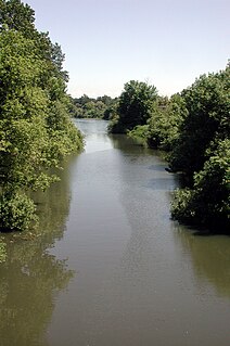
Marys River is a 40-mile (64 km) tributary of the Willamette River in the U.S. state of Oregon. From its source at the confluence of its east and west forks near Summit, it flows generally southeast from the Central Oregon Coast Range to Corvallis.

Kings Valley is an unincorporated community and census-designated place in Benton County, Oregon, United States. It is located on the Luckiamute River and Oregon Route 223, the Kings Valley Highway. As of the 2010 census it had a population of 65.

Wren is an unincorporated community in Benton County, Oregon, United States. It is located at the junction of U.S. Route 20 and Oregon Route 223 on the Marys River.
Azalea is an unincorporated community in Douglas County, Oregon, United States, about 10 miles Northeast of Glendale on Interstate 5, at an elevation of 1,657 feet.
Alder is an unincorporated community in Benton County, Oregon, United States. Alder lies near U.S. Route 20 southeast of Blodgett on the Marys River in the Central Oregon Coast Range. The post office serving Alder was named Hipp.

Kelley Point Park is a city park in north Portland in the U.S. state of Oregon. Bounded by the Columbia Slough on the south, the Willamette River on the west, and the Columbia River on the north, the park forms the tip of the peninsula at the confluence of the rivers. Marine Terminal 6 of the Port of Portland lies immediately east of the park along the Columbia, while Terminal 5 is along the Willamette slightly south of the Columbia Slough. The park is at 45.6498384°N 122.7637106°W and rises to an elevation of 39 feet (12 m) above sea level. Sauvie Island is west of the park across the Willamette River. Hayden Island is slightly upstream of the park on the Columbia River opposite Marine Terminal 6.
Camas Valley is an unincorporated community in Douglas County, Oregon, United States, in the valley of the same name. It is on Oregon Route 42, near the Middle Fork Coquille River.

Curtin is an unincorporated community in Douglas County, Oregon, United States. It is on Interstate 5 and the former Southern Pacific railroad line about 7 miles (11 km) northeast of Drain along Pass Creek. It stands at an elevation of 404 feet.
Tenmile is an unincorporated community in Douglas County, Oregon, United States. It is located on Oregon Route 42 southwest of Roseburg.

Rickreall Creek is a stream in Polk County, Oregon, United States rising on Laurel Mountain in the Central Oregon Coast Range and draining into the Willamette River west of Salem at Eola. The creek passes through the city of Dallas and the unincorporated community of Rickreall. The origin of the name is under some dispute, but one theory says that "Rickreall" is a corruption of "La Creole", La Creole River being another name for the stream.
Hugo is an unincorporated community in Josephine County north of Grants Pass, Oregon, United States.

Milo is an unincorporated community in Douglas County, Oregon, United States, about 17 miles (27 km) east of Canyonville on the South Umpqua River.
Wonder is an unincorporated community in Josephine County, Oregon, United States, on U.S. Route 199 about 13 miles west of Grants Pass and 8 miles east of Selma. It is within the Rogue River – Siskiyou National Forest.
Woodson is an unincorporated community in Columbia County, Oregon, United States. It is located on U.S. Route 30 seven miles west of Clatskanie and three miles east of Westport, on Westport Slough, a tributary of the Columbia River. In December 2007, the debris overflow from the flooding of Eilersten Creek caused evacuations and mud cover on Woodson Road north of the highway.
Necanicum is an unincorporated community in Clatsop County, Oregon, United States. It is located approximately 13 miles southeast of Seaside on U.S. Route 26 in the Northern Oregon Coast Range, next to the Necanicum River. Necanicum Junction is about a mile east of the site of the former post office, at the intersection of U.S. 26 and Oregon Route 53. It is served by the Seaside post office.
Holland is an unincorporated community in Josephine County, Oregon, United States. It is about eight miles southeast of Cave Junction, in the Illinois Valley south of Oregon Route 46.
Dixie is an unincorporated historic community in Washington County, Oregon, United States. Dixie post office was established five or six miles southwest of Scappoose in 1887, with John Dix as the first postmaster. The office was named for the Dix family and not for the U.S. South. The office closed in 1924, but when real estate was being sold in the area in 1933, a name for the locality was needed for marketing reasons. When a vote was held at a community picnic circa 1936 or 1937, 80 of the attendees chose the name "Dixie" to commemorate the former post office and its postmaster.
Pleasant Valley is an unincorporated community in Tillamook County, Oregon, United States. It is located about seven miles south of Tillamook, on U.S. Route 101.
Crowley is an unincorporated community in Polk County, Oregon, United States. It is located east of Oregon Route 99W, about four miles north of Rickreall.
Dryden is an unincorporated community in Josephine County, Oregon, United States. It is located in the Deer Creek Valley about five miles east of Selma. As of 1990 only one house remained; the 1920 structure formerly served as the Dryden Store and post office.
References
- 1 2 "Carpenters Island". Geographic Names Information System . United States Geological Survey, United States Department of the Interior. November 28, 1980. Retrieved August 1, 2011.
- 1 2 McArthur, Lewis A.; McArthur, Lewis L. (2003) [1928]. Oregon Geographic Names (7th ed.). Portland, Oregon: Oregon Historical Society Press. p. 169. ISBN 978-0875952772.
Coordinates: 42°33′30″N123°35′44″W / 42.558447°N 123.595625°W
| | This Josephine County, Oregon state location article is a stub. You can help Wikipedia by expanding it. |