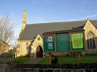
Dinnington is a town in the civil parish of Dinnington St John's, in the Metropolitan Borough of Rotherham, in South Yorkshire, England. It is near to the towns of Worksop and Rotherham and cities of Sheffield and Doncaster.

The Metropolitan Borough of Rotherham is a metropolitan borough of South Yorkshire, England. It is named after its main settlement of Rotherham. The wider borough spans a larger area and covers the outlying towns of Maltby, Swinton, Wath-upon-Dearne, Dinnington. As well as the villages of Rawmarsh and Laughton. A large valley spans the entire borough and is referred to as the "Rother Valley".

Woodsetts is a village and civil parish in the Metropolitan Borough of Rotherham in South Yorkshire, England, on the border with Nottinghamshire. It lies between the towns of Dinnington and Worksop at an elevation of around 60 metres above sea level, and has a population of 1,746 at the 2011 Census. The village originated as a medieval farming hamlet of the manor of Anston, nestled amongst the ancient woodland of which a few patches remain. The village grew rapidly in the late 19th century when a colliery was sunk at Dinnington. The village now serves as a commuter base for travellers between nearby towns.

Thorpe Salvin is a village and a civil parish in the Metropolitan Borough of Rotherham in South Yorkshire, England, on the border with Nottinghamshire. It lies between Worksop and Harthill, and is located at an elevation of around 110 metres above sea level. At the 2011 Census, it had a population of 476, down from 502 in 2001.

Appleton Wiske is a small village and civil parish that sits between Northallerton and Yarm in the Vale of York, a flat tract of land that runs between the North Yorkshire Moors to the east, the Yorkshire Dales to the west and the River Tees to the north.

Strafforth and Tickhill, originally known as Strafforth, was the southernmost wapentake in the West Riding of Yorkshire, England. The west of the district, plus a detached area in the east, constituted the Upper Division, while the central area and a detached part in the extreme east constituted the Lower Division.

Cawood is a village and civil parish in North Yorkshire, England that is notable as the location of the Cawood sword. It was historically part of the West Riding of Yorkshire until 1974.
Chapel-le-Dale is a hamlet in the civil parish of Ingleton, North Yorkshire, England. It is in the Yorkshire Dales National Park in a valley of the same name, and was previously in the West Riding of Yorkshire.

Dinnington and Laughton railway station was situated on the South Yorkshire Joint Railway line between the town of Dinnington and village of Laughton-en-le-Morthen, near Rotherham, South Yorkshire, England.
Laughton en le Morthen is a village and civil parish in the Metropolitan Borough of Rotherham lying to the south of Rotherham, South Yorkshire, England, and its main attraction is the All Saints Church with its tower and spire of 185 feet. The village had a population of 1,241 at the 2011 Census. The parish also includes the hamlets of Carr, Slade Hooton and Brookhouse.

Halton West is a village and civil parish in the Craven district of North Yorkshire, England. North Yorkshire County Council estimated the population in 2015 at 70. It is situated on the River Ribble and is 7 miles (11 km) north of Barnoldswick, 7 miles (11 km) south of Settle and 12 miles (19 km) west of Skipton.

Plompton is a hamlet and civil parish south of Harrogate in North Yorkshire, England. It is close to the A661.
Thurcroft is a village and civil parish situated south-east of Rotherham in the Metropolitan Borough of Rotherham in South Yorkshire, England. From 1902 to 1991, it was a mining community. It has a population of 5,296, increasing to 6,900 at the 2011 Census.

Flixton is a village in North Yorkshire, England. Until 1974 the village lay in the historic county boundaries of the East Riding of Yorkshire and from 1974 to 2023 it was part of the Borough of Scarborough. There is a public house, the Foxhound Inn.
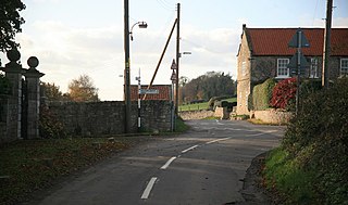
Morthen is a hamlet in South Yorkshire in England, lying between Brampton-en-le-Morthen and Laughton-en-le-Morthen. The population of the hamlet as taken at the 2011 Census was less than 100. Details are included in the civil parish of Thurcroft.

Brampton-en-le-Morthen is a small dormitory village and former civil parish, now in the parish of Thurcroft, in the Rotherham district lying to the south of Rotherham, South Yorkshire, England. In 1911, the parish had a population of 148.

Stackhouse, is a hamlet in the civil parish of Giggleswick on the western bank of the River Ribble in North Yorkshire, England.
Laughton en le Morthen is a civil parish in the Metropolitan Borough of Rotherham, South Yorkshire, England. The parish contains 27 listed buildings that are recorded in the National Heritage List for England. Of these, one is listed at Grade I, the highest of the three grades, two are at Grade II*, the middle grade, and the others are at Grade II, the lowest grade. The parish contains the village of Laughton en le Morthen, the smaller settlements of Brookhouse, Carr, and Slade Hooton, and the surrounding countryside. Most of the listed buildings are houses, cottages and associated structures, farmhouses and farm buildings. The other listed buildings include a church and its vicarage, a school, a cascade, and a telephone kiosk.
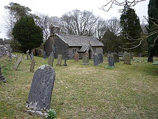
Slade Hooton is a hamlet in the Metropolitan Borough of Rotherham, in South Yorkshire, England. Historically in the West Riding of Yorkshire, the hamlet was moved into South Yorkshire in April 1974.

