Geography
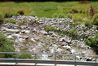
The waterfalls are located in the rugged and step valley of torrente Masone, a left-hand tributary of the Stura di Ovada. The waterfall is not formed by a discontinuity in the stream bedrock, but by a diverse grade of breaking of the same type of rock, the greenschists prevailing in the small valley. This different grade of fracturation produced the step from which the water jumps in the underlying lake, leaping over a less fractured (and thus less erodible) rock layer.
The site is considered one sito di interesse geomorfolgico (site of geomorphological interest) of the Parco naturale regionale del Beigua. The Park administration created close to the waterfalls a Percorso botanico (botanical itinerary) in co-operation with a local secondary school. [3]
In summer the small lake underlying the main drop is a popular bathing place. [4]
History
In the past the waterfall was named Cascata delle Cheucie, and only the small lake was referred as del Serpente (of the snake).
... stands Cheucie waterfall, an horrid and pictoresque cascade falling in a small lake named "Lago del Serpente".
The abundant waters of torrente Masone were used for many purposes and is still possible to recognize ruins of a big mill located near the junction of torrente Masone and the Stura. Closer to the waterfalls are located remains of Cartiera Savoi, an ancient paper mill moved by freshwater. [1]
Cuneo is a city and comune in Piedmont, Italy, the capital of the province of Cuneo, the fourth largest of Italy’s provinces by area.
The Cerusa is a 10.7-kilometre (6.6 mi) stream of Liguria (Italy).

Cocullo is a comune and town in the Province of L'Aquila, located in the Abruzzo region of Italy. As of 2013 its population was of 246.

Campo Ligure is a comune (municipality) in the Metropolitan City of Genoa in the Italian region Liguria, located about 37 kilometres (23 mi) northwest of Genoa.
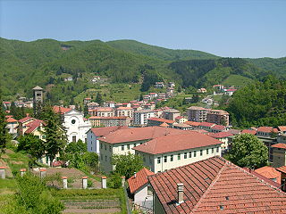
Masone is a comune (municipality) in the Metropolitan City of Genoa in the Italian region Liguria, located about 32 kilometres (20 mi) northwest of Genoa.

Tiglieto is a comune (municipality) in the Metropolitan City of Genoa in the Italian region Liguria, located about 52 kilometres (32 mi) northwest of Genoa.
Bivongi is a comune (municipality) in the Province of Reggio Calabria in the Italian region Calabria, located about 50 kilometres (31 mi) southwest of Catanzaro and about 80 kilometres (50 mi) northeast of Reggio Calabria in the Stilaro Valley, at the feet of the Monte Consolino.

Bric delle Camere is a mountain in northern Italy, part of the Ligurian Apennines. It is located in the provinces of Genoa and Alessandria. It lies at an altitude of 1016 metres.
Monte Buio is a mountain in Liguria, northern Italy, part of the Ligurian Apennines. It is located between the provinces of Genoa and Alessandria. It lies at an altitude of 1400 metres.

The Pora is a 15-kilometre (9.3 mi) stream of Liguria (Italy).

Bric Gettina is a 1025 metres high mountain in the Ligurian Prealps in Italy.
The Beigua Natural Regional Park is a natural park located in province of Savona and the Metropolitan City of Genoa, both in Liguria (Italy). It's the largest protected area of the region. It gets the name from the highest mountain of the area, Monte Beigua.

Bric del Dente is a 1107 metres high mountain of the Apennines located in the Italian region of Liguria.
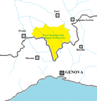
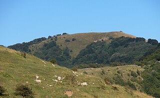
The Capanne di Marcarolo Natural Regional Park is a natural park in the province of Alessandria. It gets the name from a small village in the protected area, Capanne di Marcarolo.

The Stura di Ovada is a 32.9-kilometre (20.4 mi) stream of Liguria and Piedmont (Italy); it is the main tributary of the Orba.

The Colle del Quazzo (1090 m) is a mountain pass in the Ligurian Alps (Italy). It connects Garessio (Piedmont) with Calizzano (Liguria).

The Monte Antoroto is a mountain of the Ligurian Alps located in Piedmont.
The Vermenagna is a 27.1-kilometre (16.8 mi) long river in northwestern Italy (Piedmont).

The Punta Mirauda is a mountain of the Ligurian Alps located in Piedmont.
The Monte Alpe is a mountain of the Ligurian Prealps, the eastern section of the Ligurian Alps.
This page is based on this
Wikipedia article Text is available under the
CC BY-SA 4.0 license; additional terms may apply.
Images, videos and audio are available under their respective licenses.


