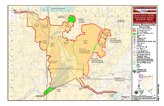
The Black Rock Desert is a semi-arid region of lava beds and playa, or alkali flats, situated in the Black Rock Desert–High Rock Canyon Emigrant Trails National Conservation Area, a silt playa 100 miles (160 km) north of Reno, Nevada, that encompasses more than 300,000 acres (120,000 ha) of land and contains more than 120 miles (200 km) of historic trails. It is in the northern Nevada section of the Great Basin with a lakebed that is a dry remnant of Pleistocene Lake Lahontan.

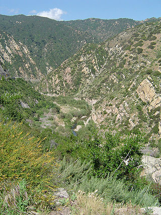
The Santa Monica Mountains are a coastal mountain range in Southern California, next to the Pacific Ocean. It is part of the Transverse Ranges. The Santa Monica Mountains National Recreation Area encompasses this mountain range. Because of its proximity to densely populated regions, it is one of the most visited natural areas in California.
The Support Force Glacier is a major glacier in the Pensacola Mountains, draining northward between the Forrestal Range and Argentina Range to the Filchner-Ronne Ice Shelf.

The Usarp Mountains are a major mountain range in North Victoria Land, Antarctica. They are west of the Rennick Glacier and trend north to south for about 190 kilometres (118 mi). The mountains are bounded to the north by Pryor Glacier and the Wilson Hills. They are west of the Bowers Mountains.
The Aviator Glacier is a major valley glacier in Antarctica that is over 60 nautical miles long and 5 nautical miles wide, descending generally southward from the plateau of Victoria Land along the west side of Mountaineer Range, and entering Lady Newnes Bay between Cape Sibbald and Hayes Head where it forms a floating tongue.

The Diablo Range is a mountain range in the California Coast Ranges subdivision of the Pacific Coast Ranges in northern California, United States. It stretches from the eastern San Francisco Bay Area at its northern end to the Salinas Valley area at its southern end.
Foundation Ice Stream is a major ice stream in the Pensacola Mountains of Antarctica. The ice stream drains northward for 150 nautical miles along the west side of the Patuxent Range and the Neptune Range to enter the Ronne Ice Shelf westward of Dufek Massif.
The Sør Rondane Mountains are a group of mountains about 100 miles (160 km) long with main peaks rising to 3400 m, between the Queen Fabiola Mountains and Wohlthat Mountains in Queen Maud Land. They were discovered and photographed from the air by members of the Lars Christensen Expedition (LCE) on February 6, 1937, and named after Rondane, a mountain massif in southern Norway. The mountains and their constituent features were mapped in greater detail and named in 1957 by Norwegian cartographers working with air photos taken by U.S. Navy Operation Highjump, 1946–47.

Casmalia is a census-designated place (CDP) in Santa Barbara County, California located just outside the borders of Vandenberg Air Force Base about 5 miles (8.0 km) southwest of Santa Maria. The ZIP Code is 93429, and the community is inside area code 805. The population was 138 at the 2010 census.

The Black Hills is an isolated mountain range rising from the Great Plains of North America in western South Dakota and extending into Wyoming, United States. Black Elk Peak, which rises to 7,242 feet (2,207 m), is the range's highest summit. The name of the range in Lakota is Pahá Sápa. It encompasses the Black Hills National Forest. It formed as a result of an upwarping of ancient rock, after which the removal of the higher portions of the mountain mass by stream erosion produced the present-day topography. The hills are so called because of their dark appearance from a distance, as they are covered in evergreen trees.

Point Sal State Beach is a beach on the Pacific coast of California, located near the city of Guadalupe, in the northwestern part of Santa Barbara County. There are approximately 80 acres (320,000 m2) of property with 1.5 miles (2.4 km) of ocean frontage. The rocks around the headland constitute part of the Coast Range Ophiolite, one of the largest ophiolite terranes in the world. This beach is at risk of landslides as there are rocky shorelines and extremely steep slopes.

The Orcutt Oil Field is a large oil field in the Solomon Hills south of Orcutt, in Santa Barbara County, California, United States. Discovered in 1901 by William Warren Orcutt, it was the first giant field to be found in Santa Barbara County, and its development led to the boom town of Orcutt, now the major unincorporated southern suburb of Santa Maria. With a cumulative production in 2008 of 870,000 barrels (138,000 m3) of oil, it is the largest onshore producing field in Santa Barbara County.
Rancho Casmalia was a 8,841-acre (35.78 km2) Mexican land grant in present-day Santa Barbara County, California given in 1840 by Governor Juan Alvarado to Jose Maria del Carmen Domínguez and Antonio Olivera. The grant extended along the Pacific coast from Point Sal and Rancho Guadalupe on the north, through the Casmalia Hills to Shuman Canyon and Rancho Jesús María on the south, and encompasses present-day Casmalia.

The Sisquoc Formation is a sedimentary geologic unit widespread in Southern California, both on the coast and in mountains near the coast. Overlying the Monterey Formation, it is of upper Miocene and lower Pliocene age. The formation consists of claystone, mudstone, siltstone, shale, diatomite, and conglomerates, with considerable regional variation, and was deposited in a moderately deep marine environment at a depth of approximately 500–5,000 feet (150–1,520 m). Since some of its diatomites, along with those of the underlying Monterey Formation, are of unusual purity and extent, they can be mined as diatomaceous earth. France-based Imerys operates a mine in the Sisquoc and Monterey Formations in the hills south of Lompoc, California, the largest such operation in the world.
The Casmalia Resources Hazardous Waste Landfill was a 252–acre disposal facility located in the hills near Casmalia, California. During its operation, 4.5 billion pounds of hazardous waste from up to 10,000 individuals, businesses and government agencies were dumped on site. The facility was closed in 1989, and is now a listed as a Superfund site by the Environmental Protection Agency.

The Bear Lodge Mountains are a small mountain range in Crook County, Wyoming. These mountains are protected in the Black Hills National Forest as part of its Bearlodge District. Devils Tower National Monument was the first U.S. National Monument and draws about 400,000 visitors per year to the area. The Bear Lodge Mountains are one of three mountain ranges which compose the Black Hills region and national forest, including the Black Hills itself and South Dakota's Elk Mountains.

The San Luis Hills are a group of small mountain ranges in Conejos and Costilla counties in the San Luis Valley in southern Colorado. The individual mountain ranges that make up the San Luis Hills include the Fairy Hills, the Brownie Hills, the Piñon Hills, and the South Piñon Hills. The San Luis Hills' highest point is Flat Top, elevation 9,206 feet


