Castiglione Messer Raimondo | ||
---|---|---|
Comune | ||
Comune di Castiglione Messer Raimondo | ||
| ||
Coordinates: 42°32′N13°53′E / 42.533°N 13.883°E | ||
Country | Italy | |
Region | Abruzzo | |
Province | Teramo (TE) | |
Frazioni | Appignano, Borea Santa Maria, Bozzano, Cesi, Colletrimarino, Piane, San Giorgio, Vorghe | |
Government | ||
• Mayor | Danilo Crescia | |
Area | ||
• Total | 30 km2 (10 sq mi) | |
Elevation | 306 m (1,004 ft) | |
Population (1 January 2009) [1] | ||
• Total | 2,398 | |
• Density | 80/km2 (210/sq mi) | |
Demonym(s) | Castiglionesi | |
Time zone | CET (UTC+1) | |
• Summer (DST) | CEST (UTC+2) | |
Postal code | 64034 | |
Dialing code | 0861 | |
Patron saint | San Donato Martire | |
Saint day | 7 August | |
Website | Official website |
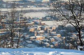
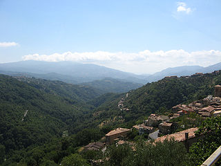
Castiglione Messer Raimondo (locally Castiùne) is a town and comune in the province of Teramo, Abruzzo, central Italy.
The comune is a basic administrative division in Italy, roughly equivalent to a township or municipality.
The Province of Teramo is a province in the Abruzzo region of Italy. Its capital is the city of Teramo. The province has an area of 1,948 square kilometres (752 sq mi), a population of 313,029 (2012), and is subdivided into 47 comunes, see Comunes of the Province of Teramo. The Province of Teramo shares its northern border with the Province of Ascoli Piceno in the Marche Region, southern and southwestern borders with the Province of L'Aquila in the Abruzzo Region, and a western border with the Province of Rieti in the Region of Lazio. To the south is the Abruzzo Province of Pescara and to the east is the Adriatic Sea.
Abruzzo is a region of Southern Italy with an area of 10,763 square km and a population of 1.2 million. It is divided into four provinces: L'Aquila, Teramo, Pescara, and Chieti. Its western border lies 80 km (50 mi) east of Rome. Abruzzo borders the region of Marche to the north, Lazio to the west and south-west, Molise to the south-east, and the Adriatic Sea to the east. Geographically, Abruzzo is divided into a mountainous area in the west, which includes the Gran Sasso d'Italia, and a coastal area in the east with beaches on the Adriatic Sea.
It is a medieval borough near the Gran Sasso d'Italia massif. Economy is mostly based on agriculture.
Gran Sasso d'Italia (Italian: [ɡran ˈsasso diˈtaːlja] is an Apennine secondary mountain massif. Its highest peak, Corno Grande, is the highest mountain in the Apennines and outside the Alps. Included in Gran Sasso e Monti della Laga National Park, is a popular touristic attraction and ski resort, used several times as filming locations.
Collebeato is a town and comune in the province of Brescia, in Lombardy, Italy. It is located on the right bank of the river Mella, 5 kilometres (3.1 mi) north of Brescia.
Pompiano is a comune in the province of Brescia, Lombardy, northern Italy.
Averara is a comune in the province of Bergamo, in Lombardy, Italy. It is one of the smallest and least populated comunes in the province of Bergamo.
Cisano Bergamasco is a town and comune in the province of Bergamo, Lombardy, northern Italy.
San Mauro la Bruca is a town and comune in the province of Salerno in the Campania region of south-west Italy.
San Lorenzo del Vallo is a town and comune in the province of Cosenza in the Calabria region of southern Italy.
Campana is a town and comune in the province of Cosenza in the Calabria region of southern Italy.
Cervicati is a town and comune in the province of Cosenza in the Calabria region of southern Italy.
Scigliano is a small town and comune located in the hills in the province of Cosenza in the Calabria region of southern Italy. It is the birthplace of Italian humanist Giovanni Valentino Gentile.
Frascineto is a town and comune in the province of Cosenza in the Calabria region of southern Italy. It is home to an Arbëresh minority.
Rivarossa is a comune (municipality) in the Metropolitan City of Turin in the Italian region Piedmont, located about 20 km north of Turin. Rivarossa borders the following municipalities: Rivarolo Canavese, Oglianico, Front, San Francesco al Campo, and Lombardore.
San Francesco al Campo is a comune (municipality) in the Metropolitan City of Turin in the Italian region Piedmont, located about 21 km (13 mi) northwest of Turin.
Casalgrasso is a comune (municipality) in the Province of Cuneo in the Italian region Piedmont, located about 30 km (19 mi) south of Turin and about 50 km (31 mi) north of Cuneo.
Marsaglia is a comune (municipality) in the Province of Cuneo in the Italian region Piedmont, located about 70 kilometres (43 mi) southeast of Turin and about 35 kilometres (22 mi) east of Cuneo.
Mombasiglio is a comune (municipality) in the Province of Cuneo in the Italian region Piedmont, located about 80 kilometres (50 mi) southeast of Turin and about 35 kilometres (22 mi) east of Cuneo.
Rocchetta Belbo is a comune (municipality) in the Province of Cuneo in the Italian region Piedmont, located about 60 kilometres (37 mi) southeast of Turin and about 60 kilometres northeast of Cuneo.
Trinità is a comune (municipality) in the Province of Cuneo in the Italian region Piedmont, located about 60 kilometres (37 mi) south of Turin and about 20 kilometres (12 mi) northeast of Cuneo.
Fiorano al Serio is a comune (municipality) in the Province of Bergamo in the Italian region of Lombardy, located about 60 kilometres (37 mi) northeast of Milan and about 15 kilometres (9 mi) northeast of Bergamo.
Ranzanico is a comune (municipality) in the Province of Bergamo in the Italian region of Lombardy, located about 70 kilometres (43 mi) northeast of Milan and about 25 kilometres (16 mi) northeast of Bergamo.
Nulvi is a comune (municipality) in the Province of Sassari in the Italian region Sardinia, located about 180 kilometres (110 mi) north of Cagliari and about 20 kilometres (12 mi) northeast of Sassari. It is one of the main centers of the Anglona historical regione.
This Abruzzo location article is a stub. You can help Wikipedia by expanding it. |