Villavallelonga is a village and comune in the Abruzzo region in central Italy. A part of Marsica traditional area, it is included in the Abruzzo, Lazio and Molise National Park.

Scanno is a town and district in the province of L'Aquila, in the Abruzzo region of central Italy. It is one of I Borghi più belli d'Italia.

Palmoli is a comune and town in the province of Chieti, Abruzzo, south-eastern Italy.

Montazzoli is a comune and town in the Province of Chieti in the Abruzzo region of Italy
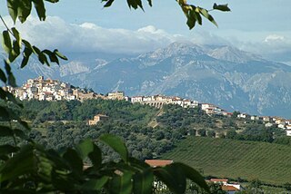
Torino di Sangro is a comune and town in the province of Chieti in the Abruzzo region of central Italy.

Balsorano is a comune (municipality) and town in the province of L'Aquila in the Abruzzo region of Italy.

Barisciano, is a comune and town in the province of L'Aquila in the Abruzzo region of central Italy. It is located in the Gran Sasso e Monti della Laga National Park.

Bisegna is a comune and town in the Province of L'Aquila in the Abruzzo region of Italy.
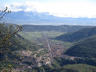
Capistrello is a comune and town in the province of L'Aquila in the Abruzzo region of central-southern Italy. It is located at the border between the upper Liri River valley and the Marsica. Capistrello borders the following municipalities: Avezzano, Canistro, Castellafiume, Filettino (Frosinone), Luco dei Marsi, Scurcola Marsicana and Tagliacozzo.

Cerchio is a comune and town in the province of L'Aquila in the Abruzzo region of southern Italy.

Goriano Sicoli is a comune and town in the Province of L'Aquila in the Abruzzo region of Italy.
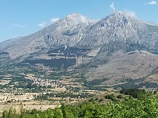
Massa d'Albe is a comune and town in the province of L'Aquila in the Abruzzo region of central Italy. It is part of the Marsica.

Montereale is a comune and town in the province of L'Aquila, in the Abruzzo, region of Italy. It is located in the Gran Sasso e Monti della Laga National Park.

Ovindoli is a village and comune of the province of L'Aquila in the Abruzzo region of central Italy. Close to Rome, it is a resort for both summer and winter sports, including hiking, biking, equestrian activities and downhill and cross-country skiing.
Pescocostanzo is a comune and town of 1038 inhabitants in the Province of L'Aquila in the Abruzzo region of Italy. It is a tourist destination, attracting people from all over Italy due to its landscape and environment. It is part of the Maiella National Park and is one of I Borghi più belli d'Italia. In winter, Pescocostanzo is a destination for skiers and snowboarders, and has its own ski resort. The towns of Roccaraso and Rivisondoli are close by.

Rocca di Mezzo is a comune and town in the Province of L'Aquila, in the Abruzzo region of central Italy.

Sante Marie is a comune and town in the province of L'Aquila, in the Abruzzo region of central Italy
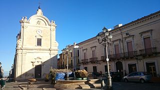
Catignano is a comune and town in the Province of Pescara in the Abruzzo region of Italy
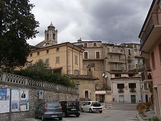
Isola del Gran Sasso d'Italia is a town and comune in province of Teramo in the Abruzzo region of southern Italy. It is located in the Gran Sasso e Monti della Laga National Park. The Gran Sasso mountain is the highest mountain in the Apennine chain in Italy.

Bellante is a town and comune in the province of Teramo, in the Abruzzo region of eastern Italy.


