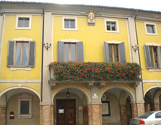
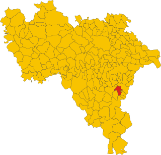
Soragna is a town and comune in the province of Parma of northern Italy with a population of about 4,800.

Scanno is a town and district in the province of L'Aquila, in the Abruzzo region of central Italy.

Rocca San Felice is a town and comune in the province of Avellino, Campania, southern Italy.

Calascio is a comune and village in the province of L'Aquila, in the Abruzzo region of central Italy. It is located in the Gran Sasso e Monti della Laga National Park.

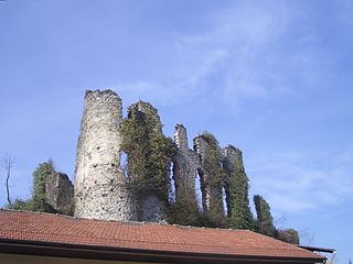
Oricola is a comune and town in the province of L'Aquila, Abruzzo, central Italy, located near the regional boundary with Latium. It is commanded by a mid-15th century rocca (fortress) and, in its communal territory, is home to the remains of several ancient Italic settlements. The church of Santa Restituta contains a 13th-century fresco.

Tornimparte is a comune and town in the province of L'Aquila in the Abruzzo region of central-southern Italy.
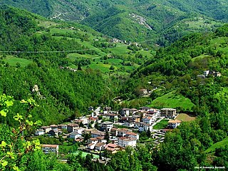
Valle Castellana is a village and comune in the Province of Teramo, in the Abruzzo region of central Italy. It is a member of the Italian community of surrounding mountain villages, Monti della Laga. It is located in the natural park known as the Gran Sasso e Monti della Laga National Park.
Lanzo Torinese is a comune (municipality) in the Metropolitan City of Turin, region of Piedmont, northwestern Italy. It is located about 30 kilometres (19 mi) northwest of Turin at the mouth of the Valli di Lanzo.
Rocca Canavese is a comune (municipality) in the Metropolitan City of Turin in the Italian region Piedmont, located about 30 kilometres (19 mi) northwest of Turin.

Soncino is a comune (municipality) in the Province of Cremona in the Italian region Lombardy, located about 60 kilometres (37 mi) east of Milan and about 30 kilometres (19 mi) northwest of Cremona.

Chiusa di Pesio is a comune (municipality) of 3,650 inhabitants in the Province of Cuneo in the Italian region Piedmont, located about 80 km south of Turin and about 15 km south-east of Cuneo, on the border with France.
Montecalvo Versiggia is a comune (municipality) in the Province of Pavia in the Italian region Lombardy, located about 60 kilometres (37 mi) south of Milan and about 25 kilometres (16 mi) southeast of Pavia.
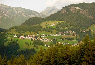
Colle Santa Lucia is a comune (municipality) in the Province of Belluno in the Italian region of Veneto, located about 120 kilometres (75 mi) north of Venice and about 40 kilometres (25 mi) northwest of Belluno. As of 31 December 2004, it had a population of 408 and an area of 15.3 square kilometres (5.9 sq mi). The population speaks a Venetian dialect called Ladin Venetian that is heavily influenced by the Ladin language.
Serramazzoni is a comune (municipality) in the Province of Modena in the Italian region Emilia-Romagna, located about 45 kilometres (28 mi) west of Bologna and about 30 kilometres (19 mi) southwest of Modena.

Mondavio is a comune (municipality) in the Province of Pesaro e Urbino in the Italian region Marche, located about 45 kilometres (28 mi) west of Ancona and about 30 kilometres (19 mi) south of Pesaro.

Vicopisano is a comune (municipality) in the Province of Pisa in the Italian region Tuscany, located about 50 kilometres (31 mi) west of Florence and about 15 kilometres (9 mi) east of Pisa. It occupies the former valley of the Arno River, bounded by the Monte Pisano from north.

Castiglione d'Orcia is a comune (municipality) in the Province of Siena in the Italian region of Tuscany, located about 90 kilometres (56 mi) southeast of Florence and about 40 kilometres (25 mi) southeast of Siena, in the Val d'Orcia, not far from the Via Cassia.

Piancastagnaio is a comune (municipality) in the Province of Siena in the Italian region Tuscany, located about 110 kilometres (68 mi) southeast of Florence and about 60 kilometres (37 mi) southeast of Siena.

Sigillo is a comune (municipality) in the province of Perugia in the Italian region Umbria, located about 35 km northeast of Perugia.

Ficulle is a comune (municipality) in the Province of Terni in the Italian region Umbria, located about 40 km southwest of Perugia and about 60 km northwest of Terni.


