Castle of Lorca (Spanish: Castillo de Lorca) in Lorca, Murcia, Spain, is a fortress of medieval origin constructed between the 9th and 15th centuries. It consists of a series of defensive structures that, during the Middle Ages, made the town and the fortress an impregnable point in the southeast part of the Iberian Peninsula. Lorca Castle was a key strategic point of contention between Christians and Muslims during the Reconquista. It is listed as a Site of Cultural Interest.[1]
It is 640 m long and 120 m wide, and one of the largest castles in Spain.
History
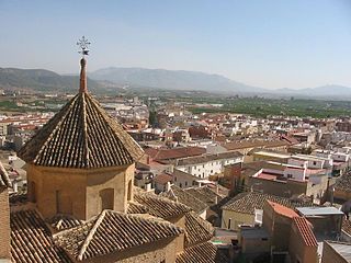
Panoramic view of the town and the castle at night
Archaeological excavations have revealed that the site of the castle has been inhabited since Neolithic times. There were archaeological excavations conducted between 1999 and 2011, in conjunction with other excavations conducted in the centre of the town of Lorca. The excavations revealed the existence of an Argaric town that extended from the castle to the actual site of the current town. The excavations revealed funerary sites, homes, and a wall.
It has not been determined exactly when a castle or fortress was first built on the hill. The first written documentation referring to a castle at Lorca is of Muslim origin, which in the 9th century, indicates that the city of Lurqa was an important town in the area ruled by Theudimer (Tudmir), who ruled seven cities in southeastern Spain, mentioned in the Treaty of Orihuela that was preserved by the Andalusian historian Ibn Adarí in the thirteenth century:[2]Orihuela, Valentila (possibly an equivalent for Valencia), Alicante, Mula, Bigastro, Eyya (probably Ojós), and Lorca.[3]
During Muslim rule, Lorca Castle was an impregnable fortress and its interior was divided into two sections by the Espaldón Wall. In the western part, there was an area used to protect livestock and grain in times of danger. The eastern part had a neighbourhood called the barrio de Alcalá.
Lorca was conquered by the Castilian Infante Don Alfonso, the future Alfonso X, in 1244, and the fortress became a key defensive point against the Kingdom of Granada. For 250 years, Lorca Castle was a watchpoint on the border between the Christian kingdom of Murcia and the Muslim state of Granada.
Due to this geographic position, the Castilian monarchs repopulated the town and maintained the defensive structures of Lorca.
Alfonso X ordered:
...por saber que he de poblar los alcaçares et la villa de Lorca de christianos que yo gane de moros... et porque ayan mas et mas do et otorgo a todos los christianos vezinos et moradores en los alcaçares et en la villa de Lorca [...] casas mayores hy pobladas con sus cuerpos [...] todas cosas pora siempre et jamas
Alfonso X ordered the construction of the towers known as the Alfonsina and Espolón Towers, and strengthened and fixed the walls. Hardly a trace of the Muslim fortress remained due to this reconstruction. Muslim traces remain in the foundation stones and the wall known as the muro del Espaldón.
The neighbourhood of Alcalá, at the base of the castle, was repopulated after the Reconquista and during construction of the hotel, the Parador de Nacional de Turismo, the remains of the Jewish quarter (Judería) of Lorca, of 14th-century origin, were found.
The Jewish Quarter was found within the alcazaba, the Moorish fortification, separated from the rest of the city by its walls. The physical separation had the purpose of protecting the Jewish people in the town from harm, but also had the result of keeping Christians and Jews separate, with the Christians inhabiting the lower part of town.
Fortaleza del Sol.
The remains of the Jewish Quarter extended over an area of 5,700 square m, and 12 homes and a synagogue have been found; the synagogue dates from the 14th century and is the only one found in the Murcia. The streets of the town had an irregular layout, adapted to the landscape, and is divided into four terraces. The synagogue was in the central location, and around it were the homes. The homes were of rectangular shape, with various compartmentalized rooms. The living quarters were elevated and a common feature was benches attached to the walls, kitchens, stand for earthenware jars, or cupboards.
The angular stone found in the archaeological excavation is associated with the synagogue. It is found, partially excavated, in the floor to gain height in the interior while on the outside not exceeding in height the rest of the building. In this manner, the building adhered to laws of the period.
Excavation of the synagogue.
Access to the synagogue is available via a patio in whose side there are two corridors, and the area for women is accessed via a separate corridor. The interior of the synagogue conserves the place where the Torah was kept, and examples of yeseria of Gothic style. The plinth where the bimah was located has also survived, and along the perimeter of the interior of the temple were benches where the male worshippers would sit. The women had a separate area, known as the matroneum; in Lorca's synagogue the matroneum was located above the vestibule.
With the disappearance of the frontier after the conquest of Granada in 1492, Lorca Castle no longer became as important as before. With the expulsion of the Jews by order of Ferdinand and Isabella, Lorca Castle was also depopulated as a result. The castle was abandoned completely, and was almost a complete ruin by the 18th century. In the 19th century, the castle was refurbished due to the War of Spanish Independence. The walls and structures were repaired or modified and its medieval look changed. A battery of cannons was installed, for example, during this time. On June 4, 1931, Lorca Castle was declared a National Historic Monument and on March 5 the historic centre of Lorca including the castle was declared a Conjunto Histórico-Artístico (Historic-Artistic Group).[5]
Medieval re-enactment for the "Lorca Taller del Tiempo" in Lorca Castle.
Lorca Taller del Tiempo (“Lorca Time Workshop”) is a company that uses the castle as a theme park for medieval re-enactments and includes a touristic train that travels throughout the city, departing from the Visitor Centre (formerly the Convent of La Merced).
Parador
Currently, a parador (luxury hotel) has been built within the castle.[8] As a result, archaeological discoveries have been found, including the Jewish Quarter.[9]
Murcia is a city in south-eastern Spain, the capital and most populous city of the autonomous community of the Region of Murcia, and the seventh largest city in the country. It had a population of 460,349 inhabitants in 2021. The total population of the metropolitan area was 672,773 in 2020, covering an urban area of 1,230.9 km2. It is located on the Segura River, in the southeast of the Iberian Peninsula. It has a climate with hot summers, mild winters, and relatively low precipitation.
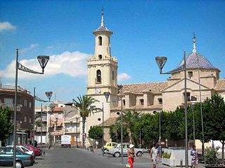
Lorca is a municipality and city in the autonomous community of the Region of Murcia in south-eastern Spain, 58 kilometres (36 mi) southwest of the city of Murcia. The municipality had a population of 95,515 in 2020, up from the 2001 census total of 77,477. Lorca is the municipality with the second largest surface area in Spain, 1,675.21 km2 (646.80 sq mi), after Cáceres. The city is home to Lorca Castle and the Collegiate church dedicated to St. Patrick.
Theodemir or Theudimer was a Visigothic comes (count) prominent in the southeast of Carthaginensis during the last decades of the Visigothic kingdom and for several years after the Arab conquest. He ruled seven cities in southeastern Spain, mentioned in the Treaty of Orihuela that was preserved by the Andalusian historian Ibn Adarí in the thirteenth century: Orihuela, Valentila, Alicante, Mula, Bigastro, Eyya, and Lorca.
This is a timeline of notable events during the period of Muslim presence in Iberia, starting with the Umayyad conquest in the 8th century.
Mula is a municipality of Spain belonging to the Region of Murcia. It is located in southeastern Iberia. It has a total area of 633.84 km2 and, as of 1 January 2020, a registered population of 17,021.
Totana is a municipality in the Region of Murcia in Spain. It has a population of 32008. The local economy is largely dependent on agriculture and related industries. It has a railway station providing a service on the Cercanías Murcia/Alicante commuter line, providing connections to Alicante and Murcia.
Treaty of Orihuela was an early Dhimmi treaty imposed by the invading Umayyad Caliphate on the Christians in the city of Orihuela in the Iberian Peninsula in 713.
Xativa Castle is a castle located in the city of Xàtiva near Valencia, Spain. It consists of a twin fortification divided between the older "Castillo Menor", built on the Iberian and Roman remains of the site, and the more recent "Castillo Mayor", built during the medieval period. It sits at a height of 310 meters above the modern-day city.
The history of Alicante spans thousands of years. Alicante has been regarded as a strategic military location on the Mediterranean coast of Spain since ancient times. It is protected on the southwest by Cape Santa Pola and on the southeast by Cape Huerta. The fortified complex of Santa Bárbara Castle, the older parts of which were built in the 9th century, dominates the city from a height of 160 m atop Mount Benacantil, a rocky massif overlooking the sea.
Calatrava la Vieja is a medieval site and original nucleus of the Order of Calatrava. It is now part of the Archaeological Parks of the Community of Castile-La Mancha. Situated at Carrión de Calatrava, Calatrava during the High Middle Ages was the only important city in the Guadiana River valley. It thus guarded the roads to Cordova and Toledo.
The Region of Murcia is an autonomous community of Spain located in the southeastern part of the Iberian Peninsula, on the Mediterranean coast. The region is 11,313 km2 (4,368 sq mi) in area and had a population of 1,511,251 as at the start of 2020. About a third of its population lives in the capital, Murcia, and a seventh in the second city, Cartagena. At 2,014 m (6,608 ft), the region's highest point is Los Obispos Peak in the Massif of Revolcadores.
Aledo is a municipality in the Region of Murcia, southern Spain.
The Castle of Jimena de la Frontera is a castle located in Jimena de la Frontera, Spain. It was declared Bien de Interés Cultural in 1931.
The border of Granada was a border region that existed between the Nasrid kingdom of Granada and the kingdoms of Murcia, Jaén, Córdoba and Seville following the integration of those former Muslim territories within the Crown of Castile in the mid-13th century. The delineation of this border region underwent several changes subsequently, but on the death of Alfonso XI in 1350, the Granadine border was fixed geographically, in general terms, until the beginning of the Granada War in the late 15th century. This territory was also referred to as La Banda Morisca.
Alarcón is a municipality in the province of Cuenca, in the autonomous community of Castilla-La Mancha, Spain.
Fortuna is a town and a municipality in the autonomous Region of Murcia in southeastern Spain. It is located in the northeast of the region and in Comarca Oriental. The municipality shares borders with Abanilla at its east, Jumilla and Abarán at is north, Blanca at its northwest, Molina at its west and southwest and Murcia and Santomera at its south.
Abū ʿAbd Allāh Muḥammad ibn Saʿd ibn Muḥammad ibn Aḥmad ibn Mardanīsh, called al-Judhāmī or al-Tujībī was the king of Murcia from AD 1147 until his death. He established his rule over the cities of Murcia, Valencia and Dénia as the power of the Almoravid emirate declined, and he opposed the spread of the Almohad caliphate. Christian sources refer to him as the "Wolf King".
The Castle of Burgos was a castle and alcázar, located in the city of Burgos, in the hill of San Miguel to 75 metres (246 ft) above the city and to 981 metres (3,219 ft) above the sea. This hill was the subject of archaeological surveys by General Centeno in the years 1925 and 1926 trying to find Napoleonic military files from when the French in their retreat blew up the fortress. According to the results obtained in this excavation the origin of the castle dates to the Visigoths, and its oldest parts, to the Romans.
Sagunto Castle is a fortress overlooking the town of Sagunto, near Valencia in Spain. The site's history extends back over two thousand years and includes Iberian, Roman and medieval remains. During the Islamic period, the castle was known as Murbĩtar and Morvedre. The castle was declared a National Monument in 1931.
Paradores de Turismo de España S.M.E.S.A., branded as Paradores, is a Spanish state-owned chain of luxury hotels that are usually located in historic buildings or in nature areas with a special appeal. Its first parador was inaugurated on 9 October 1928 in Navarredonda de Gredos (Ávila). As of 2023, it operates ninety-seven paradores in Spain and one in Portugal, with 5,986 rooms in total. Every parador has its own restaurant offering the regional gastronomy of its area.
References
↑ Disposición Adicional Segunda de la Ley 16/1985, de 25 de junio del Patrimonio Histórico Español.
↑ Translated as “...to know that we must populate the castle and the town of Lorca with Christians that I won from the Moors...so that there may be more and more people I ask that all of the neighboring Christian inhabitants inhabit the castle and town of Lorca [...] in large homes and habitations with their bodies [...] everywhere now and for ever
This page is based on this Wikipedia article Text is available under the CC BY-SA 4.0 license; additional terms may apply. Images, videos and audio are available under their respective licenses.