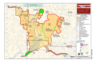
The Black Rock Desert is a semi-arid region (in the Great Basin shrub steppe eco-region), of lava beds and playa, or alkali flats, situated in the Black Rock Desert–High Rock Canyon Emigrant Trails National Conservation Area, a silt playa 100 miles (160 km) north of Reno, Nevada that encompasses more than 300,000 acres (120,000 ha) of land and contains more than 120 miles (200 km) of historic trails. It is in the northern Nevada section of the Great Basin with a lakebed that is a dry remnant of Pleistocene Lake Lahontan.

Hamilton is an abandoned mining town located in the White Pine Range, in western White Pine County, Nevada, United States.

Crescent Valley is a census-designated place (CDP) in Eureka County, Nevada, United States, directly off Nevada State Route 306. It is the site of Crescent Valley Elementary School, Crescent Valley Fair Grounds, and Crescent Valley Community Park. The census-designated place (CDP) of Crescent Valley had a population of 392 as of the 2010 census.

Dyer is an unincorporated town, located in Fish Lake Valley, Esmeralda County, Nevada, United States. It had a population of 290 as of the 2018 American Community Survey. The town serves the surrounding area's sparse rural population of mainly ranchers and indigenous Paiute people. The town has a gas station/store, cafe, post office and airport.

Lee is an unincorporated community in Elko County, Nevada, United States. The community is located on the reservation land belonging to, and constituting the sole organized community of, the South Fork Band of the Te-Moak Tribe of Western Shoshone Indians of Nevada. Lee is located at the western foothills of the Ruby Mountains range, within the Elko Micropolitan Statistical Area.

North Fork is an unincorporated community in Elko County, Nevada, United States. The ZIP Code of North Fork, Nevada is 89801.

Ursine is an unincorporated community and census-designated place in Lincoln County, Nevada, United States. It is located in the foothills of the White Rock Mountains on Eagle Valley about two miles downstream from the Eagle Valley Reservoir and Spring Valley State Park. The population was 91 at the 2010 census.

Carp, Nevada is an extinct town in Lincoln County, Nevada, United States located 35 miles (56 km) south of Caliente. It sits on the Meadow Valley Wash, which empties into Lake Mead.

Cobre is a ghost town in Elko County, Nevada, United States.

Elgin is a ghost town located between Caliente and Carp, Nevada on the eastern banks of the Meadow Valley Wash off of Nevada State Route 317.

Sunnyside is a small unincorporated community in the White River Valley of eastern Nevada, near the southern terminus of the Egan Range. The site is located on State Route 318 approximately 31 miles by road south of Lund in White Pine County, the closest town, and 63 miles by road north of Hiko in Lincoln County.

Fairview is a ghost town in Churchill County, Nevada, in the United States of America.
Sprucemont is an ghost town in Elko County, in the U.S. state of Nevada. The GNIS classifies it as a populated place.

Saint Joseph is a ghost town in Clark County, Nevada, that was located on the east bank of the Muddy River west of the north end of the Perkins Field in the Moapa Valley.
Excelsior is a ghost town in Elko County, in the U.S. state of Nevada.

Bernice is an ghost town in Churchill County, in the U.S. state of Nevada. It was approximately 20 miles (32 km) northeast of Dixie Valley.
Silver Zone is an extinct town in Elko County, in the U.S. state of Nevada. The GNIS classifies it as a populated place.

Willow Point is an extinct town in Humboldt County, in the U.S. state of Nevada. Willow Point is located in Paradise Valley, south of the town of Paradise Valley and about 20 miles northeast of Winnemucca.

Johnnie is a populated place in Nye County, in the U.S. state of Nevada about 15 miles north of Pahrump.

Pleasant Valley, is a ghost town, a historical mining town, and a former populated place in White Pine County, Nevada. There was a post office from March 1892 until April 1894.


