Cazenovia Creek | |
---|---|
Location | |
Country | United States |
State | New York |
County | Erie |
Physical characteristics | |
Source | |
• location | Aurora |
• coordinates | 42°45′38″N78°38′42″W / 42.76056°N 78.64500°W [1] |
Mouth | Buffalo River |
• location | South Buffalo |
• coordinates | 42°51′40″N78°49′36″W / 42.86111°N 78.82667°W [1] |
Basin features | |
Tributaries | |
• left | West Branch Cazenovia Creek |
• right | East Branch Cazenovia Creek |
Cazenovia Creek is a creek in Western New York, United States. It is a tributary of the Buffalo River, which empties into Lake Erie. Cazenovia Creek and its watershed are entirely within Erie County. [1]
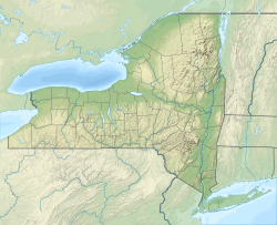
Cazenovia Creek is formed from its two branches east of the Village of East Aurora and flows through the Towns of Aurora, Elma, West Seneca, and the City of Buffalo. It joins the Buffalo River in the South Buffalo neighborhood.
The East Branch of Cazenovia Creek flows through the Village of East Aurora and has its sources in the Southtowns of Erie County, primarily in the towns of Colden, Wales, Holland, and Sardinia. The West Branch of Cazenovia Creek rises from sources in the towns of Colden, Concord, and Sardinia.
Cazenovia Creek is named after Theophilus Cazenove, an agent of the Holland Land Company.
In 1897, landscape architect Frederick Law Olmsted drew up plans for a park near the south city line of Buffalo. A farm at that location was purchased in 1890, and Cazenovia Park, straddling Cazenovia River, was built at that location. The park is in the South Buffalo section of the city.
Cazenovia Creek is known for its annual ice jams in the early spring when temperatures rise.
Cazenovia Creek also has a wide variety of fish that run through its waters. Species include catfish, large and small mouth bass, and rainbow and brown trout. Water levels can rise and fall very quickly and the current can be very strong at times.
The Erie Canal is a historic canal in upstate New York that runs east–west between the Hudson River and Lake Erie. Completed in 1825, the canal was the first navigable waterway connecting the Atlantic Ocean to the Great Lakes, vastly reducing the costs of transporting people and goods across the Appalachians. In effect, the canal accelerated the settlement of the Great Lakes region, the westward expansion of the United States, and the economic ascendancy of New York State. It has been called "The Nation's First Superhighway."
Erie County is a county along the shore of Lake Erie in western New York State. As of the 2020 census, the population was 954,236. The county seat is Buffalo, which makes up about 28% of the county's population. Both the county and Lake Erie were named for the regional Iroquoian language-speaking Erie tribe of Native Americans, who lived in the area before 1654. They were later pushed out by the more powerful Iroquoian nations tribes.
Aurora is a town in Erie County, New York, United States. The population was 13,782 at the 2010 census. It is one of the "Southtowns" of Erie County and is also erroneously called "East Aurora", the name of its principal village. The town is centrally located in the county, southeast of Buffalo.
Sardinia is a town in Erie County, New York, United States. The town lies in the southeast corner of Erie County and is considered one of the county's "Southtowns". The town is southeast of Buffalo. The population was 2,775 at the 2010 census. The town is reportedly named after an old Christian hymn, Sardinia, and the homonymous Mediterranean island.
Tonawanda is a town in Erie County, New York, United States. As of the 2020 census, the town had a population of 72,636. The town is at the north border of the county and is the northern inner ring suburb of Buffalo. It is sometimes referred to, along with its constituent village of Kenmore, as "Ken-Ton". The town was established in 1836, and up to 1903 it included what is now the city of Tonawanda.
Tonawanda Creek is a small tributary of the Niagara River in Western New York, United States. After rising in Wyoming County, the stream flows through Genesee County before forming part of the boundary between Erie County and Niagara County.
The Buffalo River drains a 447-square-mile (1,160 km2) watershed in Western New York state, emptying into the eastern end of Lake Erie at the City of Buffalo. The river has three tributaries: Cayuga Creek, Buffalo Creek, and Cazenovia Creek.
Ellicott Creek is a stream in Western New York, United States. It is a tributary of Tonawanda Creek, which in turn flows into the Niagara River.
New York State Route 78 (NY 78) is a 73.49-mile-long (118.27 km) state highway in western New York in the United States. While it is signed north–south, the southern portion runs in an east–west direction across Wyoming and Erie counties, from its beginning at a junction with NY 19 north of the village of Gainesville to the village of East Aurora. The part of the route north of East Aurora follows a generally north–south alignment to an intersection with NY 18 in the Niagara County town of Newfane, just south of the Lake Ontario shoreline. The route is most closely identified in the region with Transit Road, a major north–south trunk road through the center of Erie and Niagara counties; however, NY 78 does not follow Transit Road for its entire length, nor does Transit Road comprise more than half its length. The highway joins Transit Road north of East Aurora and stays with the road until nearly its end in the city of Lockport.
New York State Route 400 (NY 400) is a 16.91-mile (27.21 km) freeway located within Erie County, New York, in the United States. The northwest end is connected to the New York State Thruway and the southeast end terminates at NY 16 in the town of Aurora. NY 400, known as the Aurora Expressway, roughly parallels NY 16 between the two locations. It is most commonly used to carry traffic from Buffalo to the village of East Aurora, where Fisher-Price and Moog, Inc are headquartered. It is a busy commuter route to the southern suburbs. NY 400 is signed as a north–south route, although about half of the route runs more east–west.
New York State Route 240 (NY 240) is a 51.64-mile (83.11 km) state highway in western New York in the United States. The southern terminus of the route is at an intersection with NY 242 in the Ellicottville community of Ashford Junction in northern Cattaraugus County. Its northern terminus is at a junction with NY 324 and Interstate 290 (I-290) in Amherst in northern Erie County. The route passes through the villages of Springville and Orchard Park, where it meets NY 39 and U.S. Route 20A (US 20A), respectively. Much of NY 240 between Concord and Aurora follows the west branch of Cazenovia Creek. The northern part of NY 240 in Erie County, named Harlem Road, is a major north–south route through the suburbs east of the city of Buffalo.
South Buffalo is a neighborhood that makes up the southern third of the City of Buffalo, New York. Traditionally known for its large Irish-American community, this community also has a strong presence of various other nationalities. The once-heavily industrialized district was home to many steel mills, automotive parts manufacturers, petroleum refineries, foundries, and machine shops. However, due to increasing deindustrialization and rising unemployment, the area has experienced growing problems with poverty and population decline.
The Niagara Frontier refers to the stretch of land in the United States that is south of Lake Ontario and north of Lake Erie, and extends westward to Cleveland, Ohio. The term dates to the War of 1812, when the northern border was in contention between the United States and British forces in Canada. It refers only to the land east of the Niagara River and north of Lake Erie within the United States. The western side of the Niagara River, on the Canada/Ontario side, is the Niagara Peninsula; it is considered part of the Golden Horseshoe.
The geography of New York (state) varies widely. Most of New York is dominated by farms, forests, rivers, mountains, and lakes. New York's Adirondack Park is larger than any U.S. National Park in the contiguous United States. Niagara Falls, on the Niagara River as it flows from Lake Erie to Lake Ontario, is a popular attraction. The Hudson River begins near Lake Tear of the Clouds and flows south through the eastern part of the state without draining lakes George or Champlain. Lake George empties at its north end into Lake Champlain, whose northern end extends into Canada, where it drains into the Richelieu River and then the St. Lawrence. Four of New York City's five boroughs are on the three islands at the mouth of the Hudson River: Manhattan Island, Staten Island, and Brooklyn and Queens on Long Island.
Lake Erie Basin consists of Lake Erie and surrounding watersheds, which are typically named after the river, creek, or stream that provides drainage into the lake. The watersheds are located in the states of Indiana, Michigan, New York, Ohio, and Pennsylvania in the United States, and in the province of Ontario in Canada. The basin is part of the Great Lakes Basin and Saint Lawrence River Watershed, which feeds into the Atlantic Ocean. 80% of the lake's water flows in from the Detroit River, with only 9% coming from all of the remaining watersheds combined. A littoral zone serves as the interface between land and lake, being that portion of the basin where the lake is less than 15 feet (4.6 m) in depth.
Scajaquada Creek is a stream in Erie County, New York, United States. The name is derived from Philip Kenjockety, a Native American described as the oldest resident of the region upon his death in 1808.
Eighteen Mile Creek is a tributary of Lake Erie located in southern Erie County, New York, United States. The creek is the second largest tributary of Lake Erie in New York State.
The Southtowns is a region of Western New York, United States, that lies within the snowbelt or ski country. It includes the southern suburbs of Buffalo, New York. This is the common name for the southern part of Erie County, New York.
Griffins Mills is a hamlet in the town of Aurora in Erie County, New York, United States. It lies on the West Branch of Cazenovia Creek in the area once known as West Aurora. Griffins Mills was founded in the early 19th century at the site of a mill. It is located in zip code 14170.
Sparkill Creek, is a tributary of the Hudson River in Rockland County, New York and Bergen County, New Jersey in the United States. It flows through the Sparkill Gap in the Hudson Palisades, which was created by a fault line which provided the only sea-level break in the Palisades.