Cedar Grove, Washington County, Maryland

Last updated

Cedar Grove is an unincorporated community in Washington County, Maryland, United States [1] and can be found on the NHRP. The community lies approximately two miles south of MD Route 63 when traveling between Williamsport and Downsville; it is located along the northern bank of the Potomac River, just opposite the Whiting's Neck (West Virginia) promontory.

Unincorporated area Region of land not governed by own local government

In law, an unincorporated area is a region of land that is not governed by a local municipal corporation; similarly an unincorporated community is a settlement that is not governed by its own local municipal corporation, but rather is administered as part of larger administrative divisions, such as a township, parish, borough, county, city, canton, state, province or country. Occasionally, municipalities dissolve or disincorporate, which may happen if they become fiscally insolvent, and services become the responsibility of a higher administration. Widespread unincorporated communities and areas are a distinguishing feature of the United States and Canada. In most other countries of the world, there are either no unincorporated areas at all, or these are very rare; typically remote, outlying, sparsely populated or uninhabited areas.

Washington County, Maryland County in Maryland

Washington County is located in the western part of the U.S. state of Maryland. As of the 2010 census, the population was 147,430. Its county seat is Hagerstown. Washington County was the first county in the United States to be named for the Revolutionary War general George Washington. Washington County is one of three Maryland counties recognized by the Appalachian Regional Commission as being part of Appalachia.

Maryland U.S. state in the United States

Maryland is a state in the Mid-Atlantic region of the United States, bordering Virginia, West Virginia, and the District of Columbia to its south and west; Pennsylvania to its north; and Delaware to its east. The state's largest city is Baltimore, and its capital is Annapolis. Among its occasional nicknames are Old Line State, the Free State, and the Chesapeake Bay State. It is named after the English queen Henrietta Maria, known in England as Queen Mary, who was the wife of King Charles I.

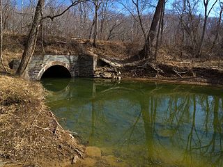
The C&O Canal National Historic Park, which runs parallel to the river, is a destination for locals and tourists alike. McMahon's Mill (also known as Charles' Mill), located just off the towpath was constructed in [ref date]; a campground and museum of the same name can be found just up the road, showcasing Civil War-era weapons and artifacts, as well as providing accommodations for RVs and traveling groups. Due to flooding in past years, a segment of the canal just east of Cedar Grove remains closed, and those traveling along the canal have been forced to use the Avis Mill Road (which passes by the museum and mill) as a detour.

American Civil War Internal war in the U.S. over slavery

The American Civil War was a civil war fought in the United States from 1861 to 1865, between the North and the South. The Civil War began primarily as a result of the long-standing controversy over the enslavement of black people. War broke out in April 1861 when secessionist forces attacked Fort Sumter in South Carolina shortly after Abraham Lincoln had been inaugurated as the President of the United States. The loyalists of the Union in the North, which also included some geographically western and southern states, proclaimed support for the Constitution. They faced secessionists of the Confederate States in the South, who advocated for states' rights in order to uphold slavery.

Related Research Articles

Garrett County, Maryland County in Maryland

Garrett County (gərɛt) is the westernmost county of the U.S. state of Maryland. As of the 2010 census, the population was 30,097, making it the third-least populous county in Maryland. Its county seat is Oakland. The county was named for John Work Garrett (1820–1884), president of the Baltimore and Ohio Railroad. Created from Allegany County, Maryland in 1872, it was the last Maryland county to be formed.

Catonsville, Maryland Census-designated place in Maryland, United States

Catonsville is a census-designated place (CDP) in Baltimore County, Maryland, United States. The population was 41,567 at the 2010 census. The community lays to the west of Baltimore along the city's border. Catonsville contains the majority of the University of Maryland, Baltimore County (UMBC), a major public research university with close to 14,000 students.

Roanoke Rapids, North Carolina City in North Carolina, United States

Roanoke Rapids is a city in Halifax County, North Carolina, United States. The population was 15,754 at the 2010 census. It is the principal city of the Roanoke Rapids Micropolitan Statistical Area, and is also an anchor city of the Rocky Mount-Wilson-Roanoke Rapids CSA, with a total population of 297,726 as of 2018.

Wisconsin Avenue major thoroughfare in Washington, D.C., and its Maryland suburbs, United States

Wisconsin Avenue is a major thoroughfare in Washington, D.C., and its Maryland suburbs. The southern terminus begins in Georgetown just north of the Potomac River, at an intersection with K Street under the elevated Whitehurst Freeway. The section of Wisconsin Avenue in Georgetown was called High Street before the street names in Georgetown were changed in 1895 to conform to those of the L'Enfant plan for the federal city.

Boulevard Bridge bridge in United States of America

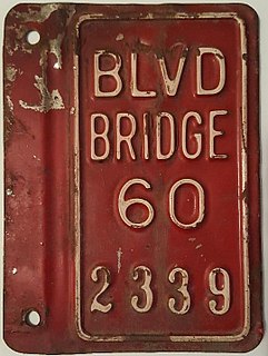
Boulevard Bridge in the independent city of Richmond, Virginia is a toll bridge which carries State Route 161 across the James River.

Caplinger Mills is an unincorporated community in northern Cedar County, Missouri, United States. Several homes are located in the community, along with an old mill. It is on the Sac River.

Mill Creek is a 14.5-mile-long (23.3 km) tributary of Opequon Creek, belonging to the Potomac River and Chesapeake Bay watersheds, located in Berkeley County in West Virginia's Eastern Panhandle. Its name reflects its past as a popular site for various types of mills, beginning with one constructed by Morgan Morgan in the mid-18th century near his cabin in present-day Bunker Hill.

Rivanna River river in the United States of America

The Rivanna River is a 42.1-mile-long (67.8 km) tributary of the James River in central Virginia in the United States. The Rivanna's tributaries originate in the Blue Ridge Mountains; via the James River, it is part of the watershed of Chesapeake Bay.

Derwood, Maryland unincorporated area in Montgomery County, Maryland, United States

Derwood is an unincorporated area and census-designated place in east-central Montgomery County, Maryland. It lies just north of Rockville, southeast of Gaithersburg, southwest of Olney, and northwest of the greater Silver Spring, Maryland area. Derwood, originally "Deer Park" then "Deer Wood," is home to approximately 15,600 people.

Virginia State Route 39 state highway in Virginia, United States

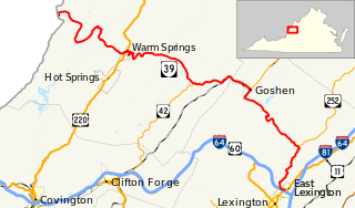
State Route 39 is a primary state highway in the U.S. state of Virginia. The state highway runs 59.17 miles (95.22 km) from the West Virginia state line near Mountain Grove, where the highway continues as West Virginia Route 39, east to U.S. Route 11 in East Lexington. SR 39 connects Lexington with several communities formed around hot springs in Bath County. In Rockbridge County, the state highway passes through the town of Goshen and Goshen Pass, a gorge formed by the Maury River.

Weverton is an unincorporated community hamlet located in the southern tip of Washington County, Maryland, United States, near the north shore of the Potomac River. Its population is approximately 500. Weverton is located at the intersection of MD Route 67 and U.S. Route 340. The nearest incorporated communities are Harpers Ferry, West Virginia and Brunswick,. Weverton's approximate elevation is 475 feet (145 m) above sea level.

Box Grove(Census Tract 5350400.01) is an original community in Markham, Ontario.

Rochdale Branch Canal

The Rochdale Branch Canal was a branch of the Rochdale Canal in north-west England which led close to Rochdale Town Centre. It was in use from 1794, and was bordered by the landscaped gardens of Lark Mill House on the western bank until the 1850s. A number of industries grew up around the branch, ranging from cotton mills and an iron and brass foundry in the early years, to a bakery and jam manufactory, woolen mills and sawmills later on. The branch declined with the main canal, and was little used after the 1920s, although not officially abandoned until 1952. It was filled in during the 1960s, and the site of the main basins now lies beneath the car park of a retail shopping centre.

Atwell Mill Grove

Atwell Mill Grove is a giant sequoia grove in the east fork of the Kaweah watershed area in California. Can be accessed via the Mineral King Road which branches off California State Route 198 below the south entrance to Sequoia National Park.

Muddy Branch tributary of the Potomac River in Maryland, United States

Muddy Branch is a tributary stream of the Potomac River in Montgomery County, Maryland, United States, located about 14 miles (23 km) northwest of Washington, D.C.

Kister, California Unincorporated community in California, United States

Kister is an unincorporated community in Butte County, California. It lies at an elevation of 4826 feet and is located at 39°49′20″N121°21′48″W.

Communities in Norfolk County, Ontario

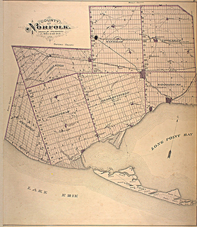
Norfolk County in the Canadian province of Ontario consists of a long list of communities. Its four designated population centres are Simcoe, Port Dover, Delhi, and Waterford.

Balls Mills is an unincorporated community on Route 973 in Hepburn Township, Lycoming County, Pennsylvania. It is located seven miles north of Williamsport on the Mill Creek, which flows southwest into the Lycoming Creek. English immigrant John Ball founded a saw mill in the village in the 1790s and, after he drowned, his son Bill Ball opened a wool mill and named the place Balls Mills with the apostrophe omitted. Blooming Grove Road provides access to Williamsport, where it becomes Market Street. The village uses the Cogan Station zip code of 17728.

Oak Point, Washington Unincorporated community in Washington

Oak Point, also known as Oakpoint, is an unincorporated community in Cowlitz County, Washington. Oak Point is located northwest of the city of Longview, reached by traveling westbound out of the city along Washington State Route 4, also known as Ocean Beach Highway, and turning north onto Mill Creek Road. The Oak Point community is part of the Longview School District, a K-12 school district of about 6,600 students.

Devore, Indiana Unincorporated Community in Indiana, United States

Devore is an unincorporated community in the southwest portion of Taylor Township, Owen County, in the U.S. state of Indiana. It lies just south of the intersection of County Road 1000 North and County Road 100 East, which is a community about ten miles north of the city of Spencer, the county seat of Owen County. Its elevation is 755 feet, and it is located at 39°25′47″N86°45′10″W. This community is also known as Mill Grove.

References

  1. "Geographic Names Information System". Cedar Grove (Populated Place). U.S. Geological Survey. 2009-01-29.

Coordinates: 39°31′54″N77°49′20″W / 39.53167°N 77.82222°W / 39.53167; -77.82222

Geographic coordinate system Coordinate system

A geographic coordinate system is a coordinate system that enables every location on Earth to be specified by a set of numbers, letters or symbols. The coordinates are often chosen such that one of the numbers represents a vertical position and two or three of the numbers represent a horizontal position; alternatively, a geographic position may be expressed in a combined three-dimensional Cartesian vector. A common choice of coordinates is latitude, longitude and elevation. To specify a location on a plane requires a map projection.