Related Research Articles

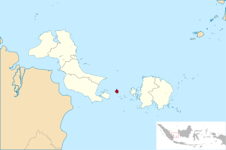
The Bangka Belitung Islands is a province of Indonesia. Situated off the southeastern coast of Sumatra, the province comprises two main islands, Bangka and Belitung and numerous smaller ones. Bangka Belitung is bordered by the Bangka Strait to the west, the Natuna Sea to the north, the Java Sea is to the south and the Karimata Strait to the east. The province's capital and largest city is Pangkal Pinang. The province covers an area of 16,424.06 km2 and, as of the 2020 census, the population of Bangka Belitung was 1,517,590.

The Riau Islands is a province of Indonesia. It comprises a total of 1,796 islands scattered between Sumatra, Malay Peninsula, and Borneo including the Riau Archipelago. Situated on one of the world's busiest shipping lanes along the Malacca Strait and the South China Sea, the province shares water borders with neighboring countries such as Singapore, Malaysia, and Brunei. The Riau Islands also has a relatively large potential of mineral resources, energy, as well as marine resources. The capital of the province is Tanjung Pinang and the largest city is Batam.

Natuna Regency is an islands regency located in the northernmost part of the Province of Riau Islands. It contains at least 154 islands, of which 127 of them are reported as uninhabited. This archipelago, with 264,198.37 sq km area, contains the island district of Pulau Laut, Bunguran/Greater Natuna Island, the island district of Pulau Tiga, the island district of Midai, the island district of Subi, and the island district of Serasan.

Bangka is an island lying east of Sumatra. It used to be administratively part of Sumatra, Indonesia, but has been split off to form the main part of a new Bangka Belitung Province, being one of its namesakes alongside the smaller Belitung Island across the Gaspar Strait. The island had a population of about 1.1 million in 2017. It is the 9th largest island in Indonesia and the provincial capital, Pangkal Pinang, lies on the island. The island is administratively divided into four regencies and a chartered city.

Belitung is an island on the east coast of Sumatra, Indonesia in the Java Sea. It covers 4,800.6 km2 (1,853.5 sq mi), and had a population of 271,869 in 2014. Administratively, it forms part of the province of Bangka-Belitung Islands. The island is known for its pepper and for its tin. It was in the possession of the United Kingdom from 1812 until Britain ceded control of the island to the Netherlands in the Anglo-Dutch Treaty of 1824. Its main town is Tanjung Pandan. The United Nations Educational, Scientific and Cultural Organization has declared 17 tourist attractions in the Belitung Geopark as world geoparks.

The Lingga Regency is a group of islands in Indonesia, located south of Singapore, along both sides of the equator, off the eastern coast of Riau Province on Sumatra island. They are south of the populated Riau Archipelago, known for the industrial island of Batam and the tourist-frequented island of Bintan, although the Lingga Islands themselves are rarely visited due to the infrequent local transportation. The equator goes through the northern tip of Lingga Island, the main island in the archipelago.

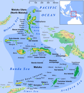
The Babar Islands(Indonesian: Kepulauan Babar) are located in Maluku Province, Indonesia between latitudes 7 degrees 31 minutes South to 8 degrees 13 minutes South and from longitudes 129 degrees 30 minutes East to 130 degrees 05 minutes East. The group now constitutes five districts (kecamatan) within the Maluku Barat Daya Regency of Maluku province.

Bawean is an island of Indonesia located approximately 150 kilometers north of Surabaya in the Java Sea, off the coast of Java. It is administered by Gresik Regency of East Java province. It is approximately 15 km (9.3 mi) in diameter and is circumnavigated by a single narrow road. Bawean is dominated by an extinct volcano at its center that rises to 655 meters above sea level. Its population as of the 2010 Census was about 70,000 people, but more than 26,000 of the total were temporarily living outside, working in other parts of Indonesia, Singapore and Malaysia). As a result, females constituted about 77% of the actual population of the island, which is thus often referred to as "the Island of Women". The 2020 Census revealed a population of 80,289.

Kisar, also known as Yotowawa, is a small island in the Southwestern Moluccas in Indonesia, located to the northeast of Timor Island. Most of the island is included within the Southernmost Islands District within the Southwest Islands Regency of Maluku Province. The District previously also includes the larger Romang Island further north, but this with its own outliers was subsequently split off to form its own district. The rest of the island forms the North Kisar District within the regency. It is one of the 92 officially listed outlying islands of Indonesia. The principal town is Wonreli, with 6,652 inhabitants at the 2010 Census.

Weh Island, often known as Sabang after the largest city, is a small active volcanic island to the northwest of Sumatra, 45 minutes by fast regular ship or 2 hours by ferry from mainland, Banda Aceh. It was originally connected to the Sumatran mainland and became separated by sea after the volcano's last eruption in the Pleistocene era. The island is situated in the Andaman Sea. The largest city on the island, Sabang, is the northernmost outpost of Indonesia.

PT Perusahaan Listrik Negara (Persero) is an Indonesian government-owned corporation which has a monopoly on electricity distribution in Indonesia and generates the majority of the country's electrical power, producing 176.4 TWh in 2015. It was included in the Fortune Global 500 lists of 2014 and 2015.

The Gaspar Strait is a strait separating the Indonesian islands Belitung and Bangka and connecting the Java Sea to the South China Sea.

West Bangka Regency is a regency (kabupaten) of Bangka Belitung Islands Province, Indonesia. It comprises the western part of Bangka Island, together with a numver of small islands off its coast. The regency covers an area of 2,820.61 km2 and had a population of 175,110 at the 2010 Census, rising to 217,332 at the 2020 census. The town of Muntok is its regency seat.

South Bangka Regency is a regency (kabupaten) of Bangka Belitung Islands Province, Indonesia, with the town of Toboali as its regency seat. It also includes several small islands off the coast of Bangka in the Gaspar Strait, such as Lepar and Pongok. The regency covers an area of 3,607.08 km2 and had a population of 172,476 at the 2010 Census and 213,966 at the 2020 Census.

West Manggarai Regency is one of the eight regencies which comprise the island of Flores, located in the province of East Nusa Tenggara in Indonesia. It covers a land area of 3,141.47 km2, and had a population of 221,703 at the 2010 Census, rising to 251,689 at the 2015 Intermediate Census and to 256,317 at the 2020 Census. The regency's capital is the town of Labuan Bajo.

Bangka Island is a small island located off the northeastern tip of Sulawesi, Indonesia. Bangka is known for its unspoiled beaches and dive tourism. It belongs administratively to the district of East Likupang in the North Minahasa regency, North Sulawesi province. The island has three main coastal villages: Lihunu, Kahuku and Libas. Controversy exists over a Chinese company's development of an iron ore mining facility on the island, as the company's permits were revoked by Indonesian courts.

Lepar is an island in Indonesia, located off the southeastern coast of Bangka. Administratively part of South Bangka in Bangka Belitung province, it is the third-largest island in the province after its much larger namesakes Bangka and Belitung, with an area of 169 square km. Lepar sits in the Gaspar Strait which separates the two larger islands. It stretches about 22 km east-west and 17 km north-south, with the towns of Tanjunglabu, Tanjungsangkar and Penutuk being the main population centers. It is governed as its own district of Lepar Pongok, which used to include a nearby, medium-sized island of Pongok until 2012 when it separated as its own district of Pongok Islands.

Pongok, sometimes known as Liat, is an Indonesian island which is part of the Pongok Islands District of the South Bangka Regency, Bangka Belitung Province. It comprises over 95% of the district's area and most of its population, with an area of 48.3 square km. It is the 5th largest island in the province, being far smaller than Bangka and Belitung in addition to the islands of Lepar and Mendanau.

Mendanau is an island in the Bangka Belitung province of Indonesia. Located about 6 km off the west coast of Belitung and 20 km from the town of Tanjung Pandan, it is the fourth largest island in the province after Bangka, Belitung and Lepar with an area of approximately 113 square kilometers. Administratively it forms - with about 27 satellite islands - the Selat Nasik District of Belitung Regency, and it is home to over 4,000 people mostly spread in 3 settlements.
References
- ↑ "Pongok Islands Subdistrict in Numbers 2017" (PDF) (in Indonesian). Toboali: Statistics Indonesia . Retrieved 3 October 2017.
- ↑ Syafrudin (26 May 2011). "Anak Pulau Celagen Butuh Uluran Tangan". Bangka Pos (in Indonesian). Retrieved 5 October 2017.
- ↑ "Pemekaran Lepar Pongok. Pulau Celagen Masuk Kecamatan Baru". Radar Bangka (in Indonesian). 10 March 2012. Retrieved 5 October 2017.
- ↑ Nurmayanti (27 September 2017). "Perjuangan Petugas PLN Terangi Warga Pulau Pongok dan Celagen". Liputan 6 (in Indonesian). Retrieved 5 October 2017.
- ↑ Dahnur, Heru (11 June 2016). "Potret Maritim di Kepulauan Pongok dan Seember Kepiting untuk Makan Siang". KOMPAS.com (in Indonesian). Retrieved 5 October 2017.