Hawke's Bay is a region on the east coast of New Zealand's North Island. The region is named for Hawke Bay, which was named in honour of Edward Hawke. The region's main centres are the cities of Napier and Hastings, while the more rural parts of the region are served by the towns of Waipukurau, Waipawa, and Wairoa.
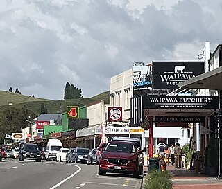
Waipukurau is the largest town in the Central Hawke's Bay District on the east coast of the North Island of New Zealand. It is located on the banks of the Tukituki River, 7 kilometres south of Waipawa and 50 kilometres southwest of Hastings.

A system of counties of New Zealand was instituted after the country dissolved its provinces in 1876, and these counties were similar to other countries' systems, lasting with little change until 1989, when they were reorganised into district and city councils within a system of larger regions.

Central Hawke's Bay District is in the Hawke's Bay Region in the North Island of New Zealand. Formed in 1989, it covers an area of 3,333 square kilometres, from Pukehou in the north to Takapau in the south, and from the western Ruahine Range to the Pacific coast in the east. It has a population of 16,000, up from 14,142 in the 2018 census and 12,717 in the 2013 census.

Waipawa is the second-largest town in Central Hawke's Bay in the east of the North Island of New Zealand. It has a population of 2,400.

Stratford District Council is the territorial authority for the Stratford District of New Zealand.
Ōtāne is a town in the Central Hawke's Bay District and the Hawke's Bay region, on the east coast of New Zealand's North Island. The small village, has a school, general store, cafe and pub, and is located just off State Highway 2.

Wairarapa is a New Zealand parliamentary electorate. It was first created in 1858 and existed until 1881. It was recreated in 1887 and has since existed continuously. The current Wairarapa electorate MP is Mike Butterick.

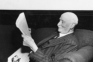
Sir George Hunter was a New Zealand politician of the Reform Party. Born in Wellington, he took over his father's large landholding in the Hawke's Bay at age 18. He was a breeder of sheep and race horses, with his horse Cynisca winning the Wellington Cup three times in a row. Hunter was prominent in local politics, and represented the Waipawa electorate in the House of Representatives for a total of 22 years.

Albert Edward Jull was a New Zealand politician of the Liberal Party, the United Party and from 1938 the National Party.
The Old Bed of Waipawa River is a river of the Hawke's Bay region of New Zealand's North Island. It flows roughly parallel with and north of the Waipawa River, which it almost meets to the east of Waipawa. It flows into the Tukituki River via the Papanui Stream, south west of Lake Poukawa. The Waipawa changed its course during a flood in 1868. In the Cyclone Gabrielle event of February 2023 the flooded river broke its banks south of Waipapa town and reverted to its old bed, causing significant damage to farms and property. The Coronation Park stop bank in Waipawa was repaired on 16 February, returning the Waipawa to its post 1868 course.
Wairarapa and Hawke's Bay is a former parliamentary electorate in the Wellington region of New Zealand from 1853 to 1859, when it was extended into previously unincorporated territories, split in two, and replaced by the County of Hawke, with its southern portion being the newly created Wairarapa electorate. It is the first general electorate to have been abolished in New Zealand.

William Cowper Smith was a Liberal Party Member of Parliament in New Zealand.
Gisborne District Council is the unitary authority for the Gisborne District of New Zealand. The council consists of a mayor and 13 ward councillors. The district consists of the city of Gisborne and a largely rural region on the east coast of the North Island.
Hauraki District Council is the territorial authority for the Hauraki District of New Zealand. The council consists of the mayor of Hauraki and 13 ward councillors.
The Mayor of Central Hawke's Bay officiates over the Central Hawke's Bay District of New Zealand's North Island.
Ashley Clinton is a rural community in the Central Hawke's Bay District and Hawke's Bay Region of New Zealand's North Island.

Hastings District Council is the territorial authority for the Hastings District of New Zealand.

The Hawke's Bay District Health Board was a district health board with the focus on providing healthcare to Hawke's Bay, New Zealand. In July 2022, it was merged into the national health service Te Whatu Ora.

Napier City Council is the territorial authority of Napier, Hawke's Bay Region, New Zealand.


