Ceresara

Last updated
Ceresara
Sareşére  (Emilian)
Comune
Comune di Ceresara
Ceresara Via Roma.jpg
Italy provincial location map 2015.svg
Red pog.svg
Ceresara
Location of Ceresara in Italy
Coordinates: 45°16′N10°34′E / 45.267°N 10.567°E / 45.267; 10.567 Coordinates: 45°16′N10°34′E / 45.267°N 10.567°E / 45.267; 10.567
Country Italy
Region Lombardy
Province Province of Mantua (MN)
Frazioni San Martino Gusnago, Villa Cappella
Area
  Total 37.8 km2 (14.6 sq mi)
Population (Dec. 2004)
  Total 2,544
  Density 67/km2 (170/sq mi)
Demonym(s) Ceresaresi
Time zone CET (UTC+1)
  Summer (DST) CEST (UTC+2)
Postal code46040
Dialing code 0376
Website Official website

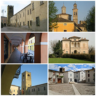
Ceresara (Upper Mantovano: Sareşére) is a comune (municipality) in the Province of Mantua in the Italian region Lombardy, located about 110 kilometres (68 mi) east of Milan and about 20 kilometres (12 mi) northwest of Mantua. As of 31 December 2004, it had a population of 2,544 and an area of 37.8 square kilometres (14.6 sq mi). [1]

<i>Comune</i> third-level administrative divisions of the Italian Republic

The comune is a basic administrative division in Italy, roughly equivalent to a township or municipality.

Province of Mantua Province of Italy

The Province of Mantua is a province in the Lombardy region of northern Italy. Its capital is the city of Mantua. It is bordered to the north-east by the Province of Verona, to the east by that of Rovigo, to the south by those of Ferrara, Modena, Reggio Emilia and Parma, to the west by the Province of Cremona and to the north-west by that of Brescia.

Lombardy Region of Italy

Lombardy is one of the twenty administrative regions of Italy, in the northwest of the country, with an area of 23,844 square kilometres (9,206 sq mi). About 10 million people, forming one-sixth of Italy's population, live in Lombardy and about a fifth of Italy's GDP is produced in the region, making it the most populous and richest region in the country and one of the richest regions in Europe. Milan, Lombardy's capital, is the second-largest city and the largest metropolitan area in Italy.

Contents

The municipality of Ceresara contains the frazioni (subdivisions, mainly villages and hamlets) San Martino Gusnago and Villa Cappella.

"Frazione" is the Italian name given in administrative law to a type of territorial subdivision of a comune; for other administrative divisions, see municipio, circoscrizione, quartiere. It is cognate to the English word fraction, but in practice is roughly equivalent to "parishes" or "wards" in other countries.

Ceresara borders the following municipalities: Casaloldo, Castel Goffredo, Gazoldo degli Ippoliti, Goito, Guidizzolo, Medole, Piubega, Rodigo.

Casaloldo Comune in Lombardy, Italy

Casaloldo is a comune (municipality) in the Province of Mantua in the Italian region Lombardy, located about 110 kilometres (68 mi) east of Milan and about 25 kilometres (16 mi) northwest of Mantua. As of 31 December 2004, it had a population of 2,436 and an area of 16.8 square kilometres (6.5 sq mi).

Castel Goffredo Comune in Lombardy, Italy

Castel GoffredoItalian pronunciation: [kaˈstɛl ɡofˈfreːdo] is a comune in the province of Mantua, in Lombardy, northern Italy, lying 35 kilometres (22 mi) from Mantua and a few more from Brescia. It lies in a region of springs at the foot of the slopes that drain into Lake Garda, towards the plain of the Po. Castel Goffredo borders the following municipalities: Castiglione delle Stiviere, Medole, Ceresara, Casaloldo, Asola, Acquafredda, Carpenedolo.

Gazoldo degli Ippoliti Comune in Lombardy, Italy

Gazoldo degli Ippoliti is a comune (municipality) in the Province of Mantua in the Italian region Lombardy, located about 110 kilometres (68 mi) east of Milan and about 15 kilometres (9 mi) west of Mantua.

Demographic evolution

Ceresara

Related Research Articles

Borgofranco sul Po Comune in Lombardy, Italy

Borgofranco sul Po is a comune (municipality) in the Province of Mantua in the Italian region Lombardy, located about 170 kilometres (110 mi) southeast of Milan and about 35 kilometres (22 mi) southeast of Mantua.

Casalmoro Comune in Lombardy, Italy

Casalmoro is a comune (municipality) in the Province of Mantua in the Italian region Lombardy, located about 100 kilometres (62 mi) east of Milan and about 35 kilometres (22 mi) northwest of Mantua. As of 1 January 2007, it had a population of 2,154 and an area of 13.9 square kilometres (5.4 sq mi).

Casalromano Comune in Lombardy, Italy

Casalromano is a comune (municipality) in the Province of Mantua in the Italian region Lombardy, located about 100 kilometres (62 mi) southeast of Milan and about 35 kilometres (22 mi) west of Mantua. As of 31 December 2004, it had a population of 1,568 and an area of 11.9 square kilometres (4.6 sq mi).

Castelbelforte Comune in Lombardy, Italy

Castelbelforte is a comune (municipality) in the Province of Mantua in the Italian region Lombardy, located about 140 kilometres (87 mi) east of Milan and about 9 kilometres (6 mi) northeast of Mantua. As of 31 December 2004, it had a population of 2,636 and an area of 22.3 square kilometres (8.6 sq mi).

Curtatone Comune in Lombardy, Italy

Curtatone is a comune (municipality) in the Province of Mantua in the Italian region Lombardy, located about 130 kilometres (81 mi) southeast of Milan and about 7 kilometres (4 mi) southwest of Mantua.

Gonzaga, Lombardy Comune in Lombardy, Italy

Gonzaga is a comune (municipality) in the Province of Mantua in the Italian region Lombardy, located about 140 kilometres (87 mi) southeast of Milan and about 25 kilometres (16 mi) south of Mantua.

Guidizzolo Comune in Lombardy, Italy

Guidizzolo is a comune (municipality) in the Province of Mantua in the Italian region Lombardy, located about 110 kilometres (68 mi) east of Milan and about 25 kilometres (16 mi) northwest of Mantua. The bordering municipalities of Guidizzolo are Cavriana, Ceresara, Goito, Medole and Solferino.

Medole Comune in Lombardy, Italy

Medole is a comune (municipality) in the Province of Mantua in the Italian region Lombardy, located about 110 kilometres (68 mi) east of Milan and about 40 kilometres (25 mi) northwest of Mantua.

Moglia Comune in Lombardy, Italy

Moglia is a comune (municipality) in the Province of Mantua in the Italian region Lombardy, located about 150 kilometres (93 mi) southeast of Milan and about 30 kilometres (19 mi) southeast of Mantua.

Piubega Comune in Lombardy, Italy

Piubega is a comune (municipality) in the Province of Mantua in the Italian region Lombardy, located about 110 kilometres (68 mi) east of Milan and about 20 kilometres (12 mi) northwest of Mantua. As of 31 December 2004, it had a population of 1,722 and an area of 16.4 square kilometres (6.3 sq mi).

Ponti sul Mincio Comune in Lombardy, Italy

Ponti sul Mincio is a beautiful comune (municipality) in the Province of Mantua in the Italian region Lombardy, located about 120 kilometres (75 mi) east of Milan and about 25 kilometres (16 mi) northwest of Mantua. As of 31 December 2004, it had a population of 2,037 and an area of 11.8 square kilometres (4.6 sq mi).

Quingentole Comune in Lombardy, Italy

Quingentole is a comune (municipality) in the Province of Mantua in the Italian region Lombardy, located about 160 kilometres (99 mi) southeast of Milan and about 30 kilometres (19 mi) southeast of Mantua.

Redondesco Comune in Lombardy, Italy

Redondesco is a comune (municipality) in the Province of Mantua in the Italian region Lombardy, located about 110 kilometres (68 mi) southeast of Milan and about 20 kilometres (12 mi) west of Mantua. As of 31 December 2004, it had a population of 1,378 and an area of 19.1 square kilometres (7.4 sq mi).

Rodigo Comune in Lombardy, Italy

Rodigo is a comune (municipality) in the Province of Mantua in the Italian region Lombardy, located about 120 kilometres (75 mi) east of Milan and about 14 kilometres (9 mi) northwest of Mantua.

Roverbella Comune in Lombardy, Italy

Roverbella is a comune (municipality) in the Province of Mantua in the Italian region Lombardy, located about 130 kilometres (81 mi) east of Milan and about 11 kilometres (7 mi) north of Mantua.

San Benedetto Po Comune in Lombardy, Italy

San Benedetto Po is a comune (municipality) in the Province of Mantua in the Italian region Lombardy, located about 150 kilometres (93 mi) southeast of Milan and about 15 kilometres (9 mi) southeast of Mantua. It is best known as the location of the Polirone Abbey.

San Giorgio Bigarello Comune in Lombardy, Italy

San Giorgio Bigarello, until 2018 as San Giorgio di Mantova is a comune (municipality) in the Province of Mantua in the Italian region Lombardy, located about 130 kilometres (81 mi) east of Milan and about 3 kilometres (2 mi) east of Mantua.

San Martino dallArgine Comune in Lombardy, Italy

San Martino Dall'argine is a comune (municipality) in the Province of Mantua in the Italian region Lombardy, located about 110 kilometres (68 mi) southeast of Milan and about 25 kilometres (16 mi) southwest of Mantua.

Sustinente Comune in Lombardy, Italy

Sustinente is a comune (municipality) in the Province of Mantua in the Italian region Lombardy, located about 140 kilometres (87 mi) southeast of Milan and about 11 kilometres (7 mi) southeast of Mantua.

References

  1. All demographics and other statistics: Istituto Nazionale di Statistica (Istat).