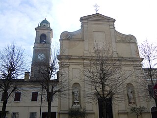
| San Giacomo delle Segnate | |
|---|---|
| Comune | |
| Comune di San Giacomo delle Segnate | |
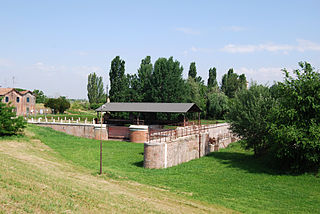
 Villa Arrigona. | |
 San Giacomo delle Segnate Location of San Giacomo delle Segnate in Italy | |
| Coordinates: 44°58′N11°2′E / 44.967°N 11.033°E Coordinates: 44°58′N11°2′E / 44.967°N 11.033°E | |
| Country | Italy |
| Region | Lombardy |
| Province | Mantua (MN) |
| Frazioni | Malcantone |
| Government | |
| • Mayor | Giuseppe Brandani |
| Area | |
| • Total | 15.98 km2 (6.17 sq mi) |
| Elevation | 16 m (52 ft) |
| Population (30 November 2016) [1] | |
| • Total | 1,598 |
| • Density | 100/km2 (260/sq mi) |
| Demonym(s) | Sangiacomesi |
| Time zone | CET (UTC+1) |
| • Summer (DST) | CEST (UTC+2) |
| Postal code | 46020 |
| Dialing code | 0376 |
San Giacomo delle Segnate is a comune (municipality) in the Province of Mantua in the Italian region Lombardy, located about 160 kilometres (99 mi) southeast of Milan and about 30 kilometres (19 mi) southeast of Mantua.

The comune is a basic administrative division in Italy, roughly equivalent to a township or municipality.

The Province of Mantua is a province in the Lombardy region of northern Italy. Its capital is the city of Mantua. It is bordered to the north-east by the Province of Verona, to the east by that of Rovigo, to the south by those of Ferrara, Modena, Reggio Emilia and Parma, to the west by the Province of Cremona and to the north-west by that of Brescia.

Lombardy is one of the twenty administrative regions of Italy, in the northwest of the country, with an area of 23,844 square kilometres (9,206 sq mi). About 10 million people, forming one-sixth of Italy's population, live in Lombardy and about a fifth of Italy's GDP is produced in the region, making it the most populous and richest region in the country and one of the richest regions in Europe. Milan, Lombardy's capital, is the second-largest city and the largest metropolitan area in Italy.
San Giacomo delle Segnate borders the following municipalities: Concordia sulla Secchia, Quistello, San Giovanni del Dosso.

Concordia sulla Secchia is a comune (municipality) in the Province of Modena in the Italian region Emilia-Romagna, located about 50 kilometres (31 mi) northwest of Bologna and about 30 kilometres (19 mi) north of Modena.
Quistello is a comune (municipality) in the Province of Mantua in the Italian region Lombardy, located about 150 kilometres (93 mi) southeast of Milan and about 20 kilometres (12 mi) southeast of Mantua.

San Giovanni del Dosso is a comune (municipality) in the Province of Mantua in the Italian region Lombardy, located about 160 kilometres (99 mi) southeast of Milan and about 30 kilometres (19 mi) southeast of Mantua.