A site at Cessford Burn has the remains of an ancient farmstead attached to Cessford Castle in the historic county of Roxburghshire (now an administrative area of Scottish Borders Region), between Kelso and Morebattle, in the parish of Eckford. The extant foundation stones of the dwellings, which can be seen to this day, are situated on the north bank of the Cessford Burn. Seven shiels, or thatched cottages, once housed the families of the farm steward, the shepherd and the ploughman. The farmstead was burned to the ground by the English many times, including the border campaign of the Earl of Surrey in May, 1523 and again by the Earl of Hertford in 1545, and during the Rough Wooing of Mary, Queen of Scots, by Henry VIII of England.
The families living in these shiels were in the service of the Kers of Cessford, latterly the Dukes of Roxburghe, who were granted by Royal Charters of both James I of Scotland and James II of Scotland, to hold these lands of the Crown. This encompassed Cessford (or Kerr) Castle, the dwellings at Cessford Burn, and the castleton of Cessford, lying just outside the north gate to the castle. Cessford Castle, in ruins today, stands upon the ridge opposite Cessford Burn on the south bank. The castleton is no longer extant, but aerial photographs and Matthew Stobie's 1770 map of Roxburghshire show that the village lay hard by the castle to the northwest on the Morebattle road; about 140 souls lived in Cessford village during those times.
Along the quiet, green banks of Cessford Burn is Habbie Kerr's cave, where local citizens had sought safety and shelter since the fifth century CE. Just south of Cessford Castle, there once stood an ancient ash tree known as the "Crow Tree", where summary Jeddart Justice was carried out.
A branch of the old Border family Nisbet were shepherds in Cessford Burn from about 1665 until they emigrated to Canada and New York in 1822, due to the farm consolidations of the late 18th century on the Scottish Borders. Also see Nisbet, Roxburghshire.
The Scottish Borders is one of 32 council areas of Scotland. It borders the City of Edinburgh, Dumfries and Galloway, East Lothian, Midlothian, South Lanarkshire, West Lothian and, to the south-west, south and east, the English unitary authorities of Cumberland and Northumberland. The administrative centre of the area is Newtown St Boswells.
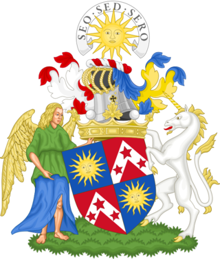
Marquess of Lothian is a title in the Peerage of Scotland, which was created in 1701 for Robert Kerr, 4th Earl of Lothian. The Marquess of Lothian holds the subsidiary titles of Earl of Lothian, Earl of Lothian, Earl of Ancram (1633), Earl of Ancram, Viscount of Briene (1701), Lord Newbattle (1591), Lord Jedburgh (1622), Lord Kerr of Newbattle (1631), Lord Kerr of Nisbet, Langnewtoun, and Dolphinstoun (1633), Lord Kerr of Newbattle, Oxnam, Jedburgh, Dolphinstoun and Nisbet (1701), and Baron Ker, of Kersheugh in the County of Roxburgh (1821), all but the last in the Peerage of Scotland. As The Lord Ker in the Peerage of the United Kingdom, previous marquesses sat in the House of Lords before 1963, when Scottish peers first sat in the House of Lords in their own right. The holder of the marquessate is also the Chief of Clan Kerr.
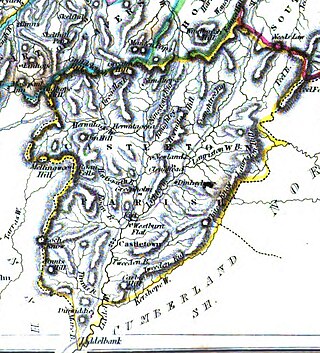
Roxburghshire or the County of Roxburgh is a historic county and registration county in the Southern Uplands of Scotland. It borders Dumfriesshire to the west, Selkirkshire and Midlothian to the north-west, and Berwickshire to the north. To the south-west it borders Cumberland and to the south-east Northumberland, both in England.
Clan Kerr is a Scottish clan whose origins lie in the Scottish Borders. During the Middle Ages, it was one of the prominent border reiver clans along the present-day Anglo-Scottish border and played an important role in the history of the Border country of Scotland.
Cessford Castle is a large ruined mid-15th century L-plan castle near the village of Cessford, midway Jedburgh and Kelso, in the historic county of Roxburghshire, now a division of the Scottish Borders. The Castle is caput of the Barony of Cessford, and the principal stronghold of the Kers/Kerrs, notorious Border Reivers, many of whom served as Wardens of the Middle March.
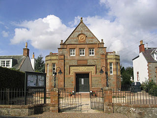
Morebattle is a village in the Scottish Borders area of Scotland, on the B6401, seven miles south of Kelso, Scottish Borders, beside the Kale Water, a tributary of the River Teviot. The St. Cuthbert's Way long distance footpath passes through the village.
Nisbet is a small hamlet on the B6400, in Roxburghshire, along the River Teviot, in the Scottish Borders area of Scotland. It is located 5.5 kilometres (3.4 mi) north of Jedburgh and 5 kilometres (3.1 mi) south of Roxburgh.
Ferniehirst Castle is an L-shaped construction on the east bank of the Jed Water, about a mile and a half south of Jedburgh, in the Scottish Borders area of Scotland, and in the former county of Roxburghshire. It is an ancient seat of the Clan Kerr, and after a period of institutional use it was restored for residential use by Peter Kerr, 12th Marquess of Lothian, in the late 20th century.
Holydean Castle was a castle sited near Melrose in Bowden, 1.25 miles SW of the village, in the Scottish Borders region of Scotland, and the former Roxburghshire.
Bowden is a village in the Roxburghshire area of the Scottish Borders, situated 3 miles south of Melrose, 2 miles west of Newtown St Boswells and tucked in the shadow of the Eildon Hills, Scotland.
The Kale Water is a 20 miles (32 km) long tributary of the River Teviot in the Scottish Borders area of Scotland. Its feeder burns in the Cheviot Hills are the Long Burn, Hawkwillow Burn and the Grindstone Burn, east of Leithope Forest near the Anglo-Scottish Border.
Eckford is a small village located between the larger towns of Kelso and Jedburgh in the Scottish Borders. The village is in close proximity to both the River Teviot and its tributary the Kale Water, and the A698 and the B6401 which run approximately parallel to the respective rivers.
Mowhaugh is a hamlet and farm steading near the Calroust Burn and the Bowmont Water, near Morebattle, in the Scottish Borders area of Scotland, and in the former Roxburghshire. It is situated about 5 miles (8 km) from the Anglo-Scottish Border.
Liddel Castle is a ruined castle in Liddesdale, by the Liddel Water, near Castleton in the Scottish Borders area of Scotland, in the former county of Roxburghshire. Liddel Castle is a scheduled monument.
Castleton is a civil parish in the Scottish Borders area of Scotland, in the former Roxburghshire, in the extreme south of the Borders area. It is bounded by Northumberland (England), Dumfries and Galloway, and the parishes of Hobkirk, Southdean and Teviothead. The village of Castleton was commenced in 1793. It was built as a result of the land clearances in the 1790s when people were forced to move from Old Castleton village. While the parish retained the name Castleton, the village later became identified as New Castleton or Newcastleton. The parish is also known by its older name Liddesdale
Saughtree is a hamlet in the Scottish Borders at the junction of the B6357 and an unnamed road from Kielder village in Northumberland, England. It is at the confluence of the River Liddle [Liddel Water] and Dawston Burn. The valley of the Liddle is known as Liddesdale. The nearest settlements on the B6357 are Bonchester Bridge, Newcastleton and Kielder village. It is approximately 6 km from the border with England.
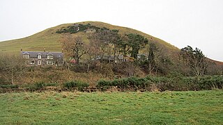
Cessford is a hamlet and former barony about a mile south of the B6401 road, in the Scottish Borders area of Scotland. The placename is from Gaelic 'ceis' and means 'the wattled causeway over the ford'; spellings vary between Cesfuird, Cesford, Cessfoord, Cessfuird, and Cessfurde.
Dinlabyre is a village on the B6357 in Liddesdale, on the edge of the Newcastleton Forest, close to Castleton, in the Scottish Borders area of Scotland, in the former Roxburghshire.
Mangerton Tower is a ruined Scottish tower castle house formerly belonging to the Armstrong family.
This page is based on this Wikipedia article Text is available under the CC BY-SA 4.0 license; additional terms may apply. Images, videos and audio are available under their respective licenses.