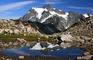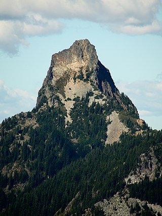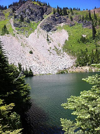
The North Cascades are a section of the Cascade Range of western North America. They span the border between the Canadian province of British Columbia and the U.S. state of Washington and are officially named in the U.S. and Canada as the Cascade Mountains. The portion in Canada is known to Americans as the Canadian Cascades, a designation that also includes the mountains above the east bank of the Fraser Canyon as far north as the town of Lytton, at the confluence of the Thompson and Fraser Rivers.

The Enchantments is a region within the Alpine Lakes Wilderness area of Washington state's Cascade Mountain Range. At an elevation of 4,500 feet, it is home to over 700 alpine lakes and ponds surrounded by the vast peaks of Cashmere Crags, which rate among the best rock-climbing sites in the western United States. The highest peak, Dragontail Peak, stretches 8,840 feet high. The Enchantments is located 15 miles southwest of the popular Bavarian-themed town Leavenworth, Washington in the United States and is regarded as one of the most spectacular regions in the Cascade Range.

The Sawtooth Range is a mountain range of the Rocky Mountains in central Idaho, United States, reaching a maximum elevation of 10,751 feet (3,277 m) at the summit of Thompson Peak. It encompasses an area of 678 square miles (1,756 km2) spanning parts of Custer, Boise, Blaine, and Elmore counties, and is bordered to the east by the Sawtooth Valley. Much of the mountain range is within the Sawtooth Wilderness, part of the Sawtooth National Recreation Area and Sawtooth National Forest.

Mount Hinman is located on the border of Snoqualmie and Wenatchee National Forests in the U.S. state of Washington. Mount Hinman is less than 2 mi (3.2 km) west of Mount Daniel and both are within the Alpine Lakes Wilderness. Hinman Glacier is situated on the north flank of Mount Hinman and Foss Glacier is to the northeast. The mountain was named in 1934 for Dr. Harry B. Hinman, a founder of the Everett branch of The Mountaineers club.

Overcoat Peak is in Mount Baker-Snoqualmie National Forest in the U.S. state of Washington. Overcoat Peak is less than .40 mi (0.64 km) northwest of Chimney Rock and both are within the Alpine Lakes Wilderness. Overcoat Glacier is on the east slopes of Overcoat Peak.

Chikamin Peak is a 7,000+ ft mountain summit located in the cascade Range, in Kittitas County of Washington state. It is situated within the Alpine Lakes Wilderness, on land managed by the Okanogan–Wenatchee National Forest. The mountain's name "Chikamin" derives from Chinook Jargon meaning "money" or "metal", and was submitted by Edmond S. Meany, president of The Mountaineers. This name was officially adopted in 1916 by the U.S. Board on Geographic Names. Chikamin Peak is the highest point of Chikamin Ridge, 6 mi (9.7 km) northeast of Snoqualmie Pass. Other notable peaks on Chikamin Ridge include Four Brothers and Three Queens. Precipitation runoff from this mountain drains into tributaries of the Yakima River. The Pacific Crest Trail traverses the southwest slope of Chikamin Ridge, and from the trail a scramble up a gully leads to the summit and several alpine lakes including Chikamin Lake and Spectacle Lake.

Kaleetan Peak is a prominent 6,259-foot (1,908-metre) mountain summit located in King County of Washington state. It's part of the Cascade Range and is within the Alpine Lakes Wilderness. Kaleetan Peak is situated four miles northwest of Snoqualmie Pass on land managed by Mount Baker-Snoqualmie National Forest. It's immediately west of Melakwa Pass and Chair Peak, and north of Melakwa Lake. Precipitation runoff on the mountain drains into tributaries of the Snoqualmie River. The nearest higher peak is Snoqualmie Mountain, 2.89 miles (4.65 km) to the east. The mountain's name "Kaleetan" derives from Chinook Jargon which means "arrow".

Garfield Mountain, also known as Mount Garfield, is a multi-peak summit located in King County of Washington state. It's located on the western edge of the Cascade Range and is within the Alpine Lakes Wilderness on land managed by Mount Baker-Snoqualmie National Forest. Mount Garfield is more notable for its large, steep rise above local terrain than for its absolute elevation. Precipitation runoff from the mountain drains into tributaries of the Snoqualmie River. Topographic relief is significant as it rises over 4,400 feet above the river in approximately one mile. The mountain's name honors James A. Garfield, the 20th President of the United States.

Alta Mountain is a 6,240+ ft mountain summit located in Kittitas County of Washington state. It is set within the Alpine Lakes Wilderness which is part of the Cascade Range. Alta Mountain is situated on land managed by Wenatchee National Forest. Precipitation runoff from the mountain drains into tributaries of the Yakima River.

The Tooth is the descriptive name for a 5,604 ft, fin-like, andesite pillar located in King County of Washington state. It is part of the Cascade Range and is within the Alpine Lakes Wilderness. The Tooth is located northwest of Snoqualmie Pass and the Alpental ski area on land managed by Mount Baker-Snoqualmie National Forest. The nearest higher peak is Bryant Peak, 0.44 miles (0.71 km) to the northwest. Originally called Denny Horn and Denny Tooth, The Tooth became the officially recognized name in 1918, with Denny referring to its position on the high ridge between Denny Mountain and Chair Peak. The Tooth is a popular rock climbing destination, even in winter. The easiest route is class 4 scrambling, but solid rock provides technical routes, with the South Face considered a classic 5.4 climb that was first done in 1928 by Anderson and Wunderling.

Preacher Mountain is a broad summit located in King County of Washington state. It's located at the western edge of the Cascade Range and is within the Alpine Lakes Wilderness on land managed by Mount Baker-Snoqualmie National Forest. The nearest higher peak is Kaleetan Peak, 3.11 miles (5.01 km) to the southeast. The Pulpit is situated 2.19 miles to the northwest. Precipitation runoff from the mountain drains into tributaries of the Snoqualmie River.

Summit Chief Mountain is a 7,464-foot (2,275-meter) mountain summit located on the county line separating King County and Kittitas County in Washington state. It is entirely within the Alpine Lakes Wilderness, on land managed by Mount Baker-Snoqualmie National Forest. Summit Chief Mountain is situated on the crest of the Cascade Range, nine miles northeast of Snoqualmie Pass. Precipitation runoff from the west side of the mountain drains into tributaries of the Snoqualmie River, whereas the east side drains into tributaries of the Yakima River. The nearest higher peak is Chimney Rock, 1.29 miles (2.08 km) to the southwest.

Snowgrass Mountain is a 7,993-foot (2,436-metre) mountain summit located in Chelan County of Washington state. Snowgrass Mountain is situated northeast of Frosty Pass and within the Alpine Lakes Wilderness. Snowgrass Mountain is the second-highest peak in the Chiwaukum Mountains, a subset of the Cascade Range. Its nearest higher peak is Big Chiwaukum, 1.23 mi (1.98 km) to the north. Precipitation runoff from Snowgrass drains into tributaries of the Wenatchee River.

Big Chiwaukum is a prominent 8,081-foot (2,463-metre) mountain summit located in Chelan County of Washington state. Big Chiwaukum is situated northeast of Frosty Pass, and within the Alpine Lakes Wilderness. Big Chiwaukum is the highest peak in the Chiwaukum Mountains, a subset of the Cascade Range. In the Wenatchee dialect, Chiwaukum means many little creeks running into one big one. Its nearest higher peak is Cashmere Mountain, 10.35 mi (16.66 km) to the south-southeast. Precipitation runoff from Big Chiwaukum drains into tributaries of the Wenatchee River.

Malachite Peak is a 6,261-foot (1,908-metre) mountain summit located 5.5 mi (8.9 km) south of Skykomish, in eastern King County of Washington state. It's part of the Cascade Range, and is situated one mile north of Lake Malachite in the Alpine Lakes Wilderness, on land managed by Mount Baker-Snoqualmie National Forest. Precipitation runoff from the mountain drains into tributaries of the Skykomish River. The nearest higher neighbor is Camp Robber Peak, 3.66 mi (5.89 km) to the south. The first ascent of this peak may have been in 1937 by a team from the United States Geological Survey. The USGS named the peak about 1975 based on a triangulation station marked as "Malachite".

Fortune Peak is a 7,382-foot (2,250-metre) mountain summit located along the common border of Kittitas County and Chelan County, in Washington state. Fortune Peak is the second-highest point in the Teanaway area of the Wenatchee Mountains. It is situated 0.74 mi (1.19 km) south-southwest of Ingalls Peak, and southwest of Lake Ingalls, on the Alpine Lakes Wilderness boundary, on land managed by Wenatchee National Forest. Precipitation runoff from the peak drains northwest into Fortune Creek, a tributary of Cle Elum River; south into tributaries of Teanaway River; or east into Ingalls Creek which is part of the Wenatchee River drainage basin. This peak is unofficially named for its position at the head of Fortune Creek. This creek was where the Queen of the Hills and Ruby Mines were located. Queen of the Hills was a lode gold mine, whereas the Ruby Mine produced antimony, copper, lead, and silver with a by-product of gold.

Mount Margaret is a 5,850-ft mountain summit located in the Wenatchee National Forest, in the Alpine Lakes Wilderness, in Kittitas County of Washington state. It is situated in the Cascade Range, 4.5 mi (7.2 km) east of Interstate 90, and on the south aspect of Rampart Ridge. Its nearest higher neighbor is Alta Mountain, 4.93 mi (7.93 km) to the north. Keechelus Lake is a short distance west and Kachess Lake further east.
Bear Lakes is a set of small freshwater lakes located on the southwest skirt of Canoe Peak, in King County, Washington. Several mines are located in the vicinity of Bear Lakes. Access is from Bear Creek Trail which continues along abandoned and mostly overgrown mine routes. Cable reels and other mining artifacts are frequent along the trail and in the surrounding areas of the lake. Lake Kanim is a short distance north over Canoe Peak towards Lennox Mountain, and Paradise Lakes are west of Bear Lakes.
Lake Kanim is a set of small freshwater lakes located on a clif of the south skirt of Lennox Mountain, in King County, Washington. Lake Kanim is the nascent source of the North Fork of the Snoqualmie River. The lake and its accompanying waterfall were named after Jerry Kanim who was the leader of Snoqualmie people.

Raymond Peak is a 10,014-foot-elevation (3,052 meter) mountain summit located in Alpine County, California, United States.


