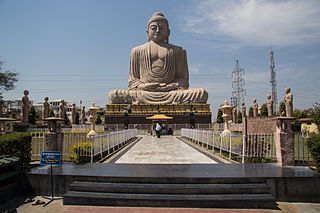
Saharsa is one of the thirty-eight districts of Bihar, India. Saharsa city is the administrative headquarters of this district. Saharsa district is a part of the Kosi Division and it became a district on 1 April 1954 and has subsequently become smaller with other districts being carved from it, most notably Madhepura in 1981. Saharsa is located in the Mithila region, one of the earliest centers of Brahmanical civilization in India. Saharsa is considered as the heart Of whole Mithila region. it is the place which gave birth to Many Legends. legends like Mandan Mishra, lakshminatinath baba, Ubhai Bharti, etc. The region of Bangaon and Mahisi is considered as one of the most civil servants producing area of the Nation. Mandan Mishra whose conversation with the Sankracharya was considered as one of the most intellectual conversations in the world was done in [Mahismati village], nowadays Mahisi village of saharsa district. During the journey of " Dharm vijay" Yatra of Sankaracharya, he visited Mahisi village of Saharsa district of Bihar which was then called Mahishmati Village and the point is, after winning in all discussions in all over the nation, He lost the Sastrartha there. So, it is said that it is the most educationally fertile land in the state. The beauty of the Geographical privileges, historical and Cultural heritages proposes itself as the capital of Proposed Mithila State.Most of the people in saharsa district speaks Maithili ( 85%) along with Angika ( 7%) and Hindi ( 8%). People of all communities residing here or belonging from here follow maithil culture. Around 52% population of the saharsa district is maithil brahmin consisting mainly of surnames Jha, Thakur and Misar ( Mishra)

Ashoknagar Kalyangarh is a city and a municipality in Barasat Sadar subdivision of North 24 Parganas district in the state of West Bengal, India.

Naugachia is a town and a notified area in Bhagalpur district in the Indian state of Bihar. It is a block and a division of the Bhagalpur district and also a police district.
Maudihan is a village in the Rohtas District of Bihar state, India. It is 14 km north of Dehri-On-Sone, an industrial city. It is located on Dehri-Patna road. It is also referred to as 'Maudiha'.
Bharaul is a small village situated in Bachhwara tehsil and located in Begusarai district of Bihar. It is one of 91 villages in Bachhwara Block along with villages like Rudauli and Arwa. Bharaul and Aagapur Kothi are on river-side of the Balan River opposite of each other. The nearest railway station from Bharaul is Bachhwara Junction which is 5.5 km away from the village. The main language of Bharoul is Maithili. Hindi is also spoken by most of the settlers. Bharaul village has a higher literacy rate compared to Bihar. In 2011, the literacy rate of Bharaul village was 71.64% compared to 63.80% of Bihar. In Bharaul, male literacy stood at 79.37% while female literacy rate was 62.45%.
Sihaul is a village with population of about 11,000 in the sub-district of Satar Kataiya, where it ranks as the third most populous village. The sub-district forms a part of Saharsa district in the state Bihar, India. The geographical area of the village is 9 km2 (3.5 sq mi) and it is the third biggest village by area in the sub-district. Population density of the village is 1287 persons per km2.
Maheshkhunt is a village in Khagaria district of Bihar state, India.
Bangaon is an ancient northern Indian village situated in the Saharsa district of Bihar. Some historians believe that 'Apannigam' referred in Buddhistic literature is Bangaon. It is the first digital village in Bihar. It is the largest village, both by area and population, of the state. The origin of the name Bangaon is unknown. However the literal meaning of the village name indicates that this area might have been densely populated with forests thus the name Ban (Forest) gaon (village).Bangaon is part of Kahra Block of the district. Some of the neighbouring places include Bariahi, Bangaon, Chainpur, Mahishi and Bihara (north). Bangaon is divided into three panchayats namely Bangaon North, Bangaon South and Bangaon East. Each panchayat is headed by a mukhiya. Saint Laxminath Gosain (Babajee) lived in this village until his death.
Baghwa is a village situated in the south and north corner of Saharsa district in the north Indian state of Bihar. It is a small village, by population but its area is not that small. It is surrounded by two water channels, being Sathrath and Balwa dhar (koshi) which part it from Khagaria.
Harinagar is a small village in Kusheswar Asthan West Block in Darbhanga district in Bihar, India. Harinagar is a panchayat in itself, made up of Harinagar, Aso, Majhiyam, Chatar, Darvepur, Mahrajpur, Maibi-Kachhua, Dharisham etc. Harinagar panchayat is the border of Darbhanga district and Samastipur district. Its sub post office is in Singhia, a village in Smastipur district.whatsapp no=[ 9576733999]
Bharauli is a medium-sized village of Saharsa district, Kahra Block. On one end of the village, there is a Krishna Temple (Thakurbadi) and at the other end there is a Ram Temple Durga mandir. There are also three Shiv and Hanuman Temples. Of all the hindu festivals, Most celebrated festivals are Rama Navami, Durga Puja, Diwali, Chhath observed with acts of worship, offerings to deities, fasting, vigil, rituals, fairs, charity, celebrations, Puja, Homa, aarti etc..
Kumai is a village in Kumai Bhadon Panchayat in Gaurabauram Block of Darbhanga district in the Indian state of Bihar.
Majhaul is a large Village in Nauhatta Block in Saharsa District of Bihar State of India, with total 700-800 families residing. It belongs to Kosi Division. Majhaul Village, with population of 3698 is Nauhatta sub district's the 13th most populous village, located in Nauhatta sub district of Saharsa district. Total geographical area of Majhaul village is 1-2 km2 and it is the 9th smallest village by area in the Nauhatta sub district. Population density of the village is 3489 persons per km2. Nearest town of the village is Supaul and distance from Majhaul village to Supaul is 22 km. The village has its own post office and the pin code of Majhaul village is 852123. The village comes under Shahpur Panchayat. Nauhatta is the sub district headquarters and the distance from the village is 5 km. District headquarters of the village is Saharsa which is 27 km away, And 167 km from State capital Patna. It is contiguous with Kumhrauli to its north, Fequrahi to the south, Telwa to the east, Kosi River to the west. It comes under Shahpur-Majhaul Panchayath and Mahisi constituency. The Majhaul village has population of 3698 of which 1919 are males while 1779 are females as per Population Census 2011.
Gazi Paita 'गाजीपैता' is a village in Sonbarsa Raj, Saharsa District, Bihar state. It belongs to Kosi Division.
Birpur is a village in vaishali district, Bihar which is situated at the river island called Raghopur Diyara Island. It is one of the largest village in Raghopur community block. People of this village are mostly dependent on agriculture.People in this area has long tradition of joining armed forces. Its population is approximately 20,000 and peoples of this village are living their life in peaceful manner. Birpur is named upon Raja Bir Singh, a migrant from Jodhpur in the 17th century. Birpur has a strongly populated politically affluent Schedule Caste Community and most of them work outside and bring revenue to this place which helps flourish the local community and enhance purchasing power. Birpur is also known for a famous personality Shri "Ramdeep Das" who participated in freedom movement and went to Delhi and later went to Kolkata along with his followers to protest against the British government and thus respected among other communities,once Mrs. Indira Gandhi(Prime Minister of India) also made a personal visit to Birpur to meet and recognize Shri "Ramdeep Das" in 70'S.The Yadav community of entire region is politically strong and hence the Ex-Chief Minister Shri "Lalu Prasad Yadav" chose Raghopur as his political stronghold to win several times followed by his wife Ex-Chief Minister Shrimati Rabri Devi and recently their son Tejaswi Yadav keeping this Raghopur area as his constituency. Birpur comes under Raghopur community block and a police station is Jurawanpur. It is one of the largest village in the Raghopur block in terms of area and population. its pin code is 844508. One post office is there which is located at one its tola(blocks in village) called SatGhar. literacy rate of this village is very low around 33%. Higher education facility is not available in the village and also there is no any good hospitals only small private clinic exists here, which is organised by non-professional or we can call it as a jhola chhap doctor means one who doesn't have any degree. Vajjika and Maithili are the languages which people speaks. It is spread over in the area of 20 km.

Lahanda is a village in Odisha, India. It is located in the Attabira block of Bargarh district.
Rajdham is a village in Gogari block of Khagaria district of Bihar State, India.
Khajuraha is an ancient northern Indian village situated in the Saharsa district of Bihar. It is the one of the largest panchayats, both by area and population, of the state. The origin of the name Khajuraha is unknown. Khajuraha is part of the Sonbarsa Raj block of the Saharsa district. Some of the neighbouring places include Chandi Sthan, Biratpur, Lagma, and Golma. Saint Pritamnath (Babajee) lived in this village.