| Chak Tok Ich'aak I | |
|---|---|
| Ajaw of Tikal 14th in the line | |
Stela 26 at Tikal bears the name Chak Tok Ich'aak, although it is unclear if it is referring to Chak Tok Ich'aak I or Chak Tok Ich'aak II. [1] | |
| Reign | 360?-378 |
| Predecessor | K'inich Muwaan Jol |
| Successor | Yax Nuun Ahiin I |
| Died | January 15, 378 |
| Father | K'inich Muwaan Jol |
| Mother | Lady Bahlam Way |
| Religion | Maya religion |

Chak Tok Ich'aak I [N 1] also known as Great Paw, Great Jaguar Paw, and Toh Chak Ich'ak (died January 15, 378) was an ajaw of the Maya city of Tikal. He took the throne on August 7, 360? and reigned until his death in 378, apparently at the hands of invaders from central Mexico. [N 2] [2]

Ajaw or Ahau ('Lord') is a pre-Columbian Maya political title attested from epigraphic inscriptions. It is also the name of the 20th day of the tzolkʼin, the Maya divinatory calendar, on which a king's kʼatun-ending rituals would fall.

The Maya civilization was a Mesoamerican civilization developed by the Maya peoples, and noted for its logosyllabic script—the most sophisticated and highly developed writing system in pre-Columbian Americas—as well as for its art, architecture, mathematics, calendar, and astronomical system. The Maya civilization developed in an area that encompasses southeastern Mexico, all of Guatemala and Belize, and the western portions of Honduras and El Salvador. This region consists of the northern lowlands encompassing the Yucatán Peninsula, and the highlands of the Sierra Madre, running from the Mexican state of Chiapas, across southern Guatemala and onwards into El Salvador, and the southern lowlands of the Pacific littoral plain.

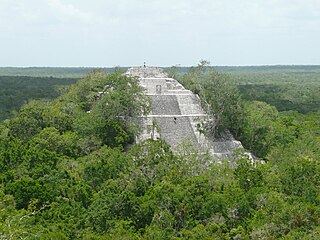
Tikal is the ruin of an ancient city, which was likely to have been called Yax Mutal, found in a rainforest in Guatemala. It is one of the largest archaeological sites and urban centers of the pre-Columbian Maya civilization. It is located in the archaeological region of the Petén Basin in what is now northern Guatemala. Situated in the department of El Petén, the site is part of Guatemala's Tikal National Park and in 1979 it was declared a UNESCO World Heritage Site.
Contents

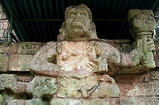
Born to K'inich Muwaan Jol and Lady Bahlam Way, Chak Tok Ich'aak I is one of Tikal's best known kings. His name is recorded on a number of ceramic pieces and stelae. Stela 39, which was discovered by archaeologists in the Mundo Perdido complex, was produced to commemorate the K'atun ending in 376. It depicts the king standing upon a bound captive while holding an ax decorated with jaguar markings that was probably used as either a weapon or an instrument of sacrifice.
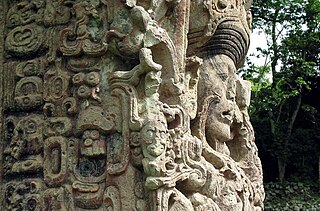
Maya stelae are monuments that were fashioned by the Maya civilization of ancient Mesoamerica. They consist of tall, sculpted stone shafts and are often associated with low circular stones referred to as altars, although their actual function is uncertain. Many stelae were sculpted in low relief, although plain monuments are found throughout the Maya region. The sculpting of these monuments spread throughout the Maya area during the Classic Period, and these pairings of sculpted stelae and circular altars are considered a hallmark of Classic Maya civilization. The earliest dated stela to have been found in situ in the Maya lowlands was recovered from the great city of Tikal in Guatemala. During the Classic Period almost every Maya kingdom in the southern lowlands raised stelae in its ceremonial centre.

The Mundo Perdido is the largest ceremonial complex dating from the Preclassic period at the ancient Maya city of Tikal, in the Petén Department of northern Guatemala. The complex was organised as a large E-Group astronomical complex consisting of a pyramid aligned with a platform to the east that supported three temples. The Mundo Perdido complex was rebuilt many times over the course of its history. By AD 250–300 its architectural style was influenced by the great metropolis of Teotihuacan in the Valley of Mexico, including the use of the talud-tablero form. During the Early Classic period the Mundo Perdido became one of the twin foci of the city, the other being the North Acropolis. From AD 250 to 378 it may have served as the royal necropolis. The Mundo Perdido complex was given its name by the archaeologists of the University of Pennsylvania.
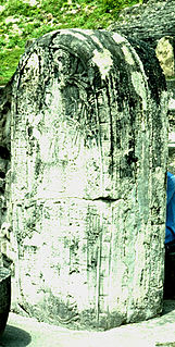
His name also appears on the fragmentary Stela 26 from Tikal's North Acropolis, which he may have dedicated. Both stelae were deliberately smashed soon after being dedicated. [3] Another stela from the distant site of El Temblor may have been created to mark his accession to power, but it is possible that it may instead have been dedicated to a namesake. [2]

The North Acropolis of the ancient Maya city of Tikal in Guatemala is an architectural complex that served as a royal necropolis and was a centre for funerary activity for over 1300 years. The acropolis is located near the centre of the city and is one of the most studied of Maya architectural complexes. Excavations were carried out from 1957 to 1969 by the University of Pennsylvania, directed by Edwin M. Shook and William Coe.
El Temblor is an archaeological site in Petén Department, Guatemala which was once the location of a settlement of the Maya civilization. First recorded in 1974 by Ian Graham of Harvard University's Peabody Museum, the little-known site represents a medium-sized and compact settlement about 18 kilometres (11 mi) south-south-east of the ruined Mayan city of Tikal and about 13 kilometres (8.1 mi) north-east of the ruins of Ixlu. It is situated in a wooded area called Paso del Carmen, a few kilometers east of the modern village of El Caoba. It is designated TMB in the Corpus of Maya Hieroglyphic Inscriptions.
His palace was located in the Central Acropolis and was identified from a carved clay vessel which had been interred under the western staircase as part of a dedication ritual. [3] Unusually, it was never built over by later rulers, and was kept in repair for centuries as an apparently revered monument. [2]

The Central Acropolis of the ancient Maya city of Tikal is an architectural complex located immediately to the south of the Great Plaza. Tikal is one of the most important archaeological sites of the pre-Columbian Maya civilization and is located in the Petén Department of northern Guatemala. The complex served dual administrative and residential purposes. The Central Acropolis was first established in the Late Preclassic period of Mesoamerican chronology, and it remained in use until approximately 950 AD.
Stela 31 from Tikal records that Chak Tok Ich'aak I died on the same day that Siyaj K'ak', probably a war-leader from Teotihuacan, entered Tikal. The arrival of Siyaj K'ak' probably represented a forcible takeover, perhaps a conquest, which resulted in the death of Chak Tok Ich'aak I. The dead ruler's entire lineage was overthrown and a new line of rulers took power in their place, starting with Yax Nuun Ahiin I. [4]

Teotihuacan, , is an ancient Mesoamerican city located in a sub-valley of the Valley of Mexico, located in the State of Mexico 40 kilometres (25 mi) northeast of modern-day Mexico City, known today as the site of many of the most architecturally significant Mesoamerican pyramids built in the pre-Columbian Americas. After the collapse of Teotihuacan central Mexico was dominated by the Toltecs of Tula until about AD 1150. At its zenith, perhaps in the first half of the 1st millennium CE, Teotihuacan was the largest city in the pre-Columbian Americas, with a population estimated at 125,000 or more, making it at least the sixth largest city in the world during its epoch. The city covered 8 square miles; 80 to 90 percent of the total population of the valley resided in Teotihuacan. Apart from the pyramids, Teotihuacan is also anthropologically significant for its complex, multi-family residential compounds, the Avenue of the Dead, and its vibrant murals that have been well-preserved. Additionally, Teotihuacan exported fine obsidian tools that are found throughout Mesoamerica. The city is thought to have been established around 100 BCE, with major monuments continuously under construction until about 250 CE. The city may have lasted until sometime between the 7th and 8th centuries CE, but its major monuments were sacked and systematically burned around 550 CE.

Yax Nuun Ahiin I, also known as Curl Snout and Curl Nose, was a 4th-century ruler of the Maya city of Tikal. His name when transcribed is YAX-?-AH:N, translated "First? Crocodile". He took the throne on September 12, 379, and reigned until his death. He is referred to by the Mayan title ajaw, meaning lord.