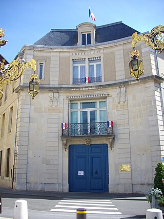
Meurthe-et-Moselle is a département in the Grand Est region of France, named after the rivers Meurthe and Moselle. Its prefecture and largest city is Nancy and it borders the departments of Meuse to the west, Vosges to the south, Moselle and Bas-Rhin and it borders the Belgian province of Luxembourg and the country of Luxembourg by the canton of Esch-sur-Alzette to the north. It had a population of 733,760 in 2019.

Vosges is a department in the Grand Est region, Northeastern France. It covers part of the Vosges mountain range, after which it is named. Vosges consists of three arrondissements, 17 cantons and 507 communes, including Domrémy-la-Pucelle, where Joan of Arc was born. In 2019, it had a population of 364,499 with an area of 5,874 km2 (2,268 sq mi); its prefecture is Épinal.

The GR 5 is a GR footpath that starts in the Netherlands, crosses Belgium and Luxembourg before crossing France from north to south. It is part of the European walking route E2. This trail is famous for its route through the French Alps from Lake Geneva to Nice called Grande Traversée des Alpes.

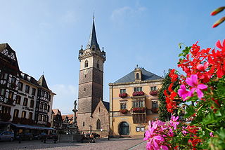
Obernai is commune in the Bas-Rhin department in Alsace in north-eastern France. It lies on the eastern slopes of the Vosges mountains.

The Château du Birkenfels is a ruined castle in the commune of Ottrott in the French département of Bas-Rhin. Originally constructed in the 13th century, it was burned down in the 14th century and restored in the 15th. It is surrounded by the Obernai Forest.

Andlau is a commune in the Bas-Rhin department in Alsace, Grand Est region of northeastern France.

Barr is a commune in the Bas-Rhin department in the Alsace region of north-eastern France.

Innenheim is a commune in the Bas-Rhin department in Alsace in north-eastern France.

Bellefosse is a commune in the Bas-Rhin department in Grand Est in northeastern France, historically and culturally part of Alsace.

Fouday is a commune in the Bas-Rhin department in Grand Est in north-eastern France.

Ottrott is a commune in the Bas-Rhin department in Grand Est in north-eastern France. It lies southwest of Strasbourg. The vineyards in and around Ottrott produce the red Rouge d'Ottrott, a geographical denomination within the registered designation of origin Alsace AOC.

Solbach is a commune in the Bas-Rhin department in Grand Est in north-eastern France.

Thé Route des Crêtes is an 89 km (55 mi) road in the Vosges Mountains in Eastern France, which passes through the Parc naturel régional des Ballons des Vosges. It connects Sainte-Marie-aux-Mines (north) with Cernay (south) and runs on the border of the departements of Haut-Rhin (68) and Vosges (88). Most of the route is at an elevation in excess of 950 m (3,117 ft), with the highest point being at the Col du Grand Ballon. The road is generally open from April to November, but most of the route is closed in the winter by snow.

The Col de la Schlucht is a mountain pass in the Vosges Mountains of France. On the west side lies the historical region of Lorraine, on the east side lies the historical region of Alsace.

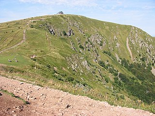
The Hohneck is, at 1,363 m (4,472 ft) the third highest summit of the Vosges Mountains and the highest point of Lorraine. On its summit stands a mountain hut, clearly visible in the distance. Nearby the mountain's top is located the ski resort of La Bresse Hohneck.

The 6th constituency of the Bas-Rhin is a French legislative constituency in the Bas-Rhin département.

Le Tanet (Tanneck) is one of the highest peaks of the Vosges Mountains in the department of Haut-Rhin, Alsace in France. Its height is 1292m, above the sea level and it is located about 5 km away from the Hohneck and north of the Col de la Schlucht. Near the Tanet the Route des Cretes crosses the Col de la Schlucht and the Lac Blanc. About the ridge runs the GR 5 across the border between Alsace and Lorraine. From the east the Tanet is accessible via a ski slope from the Auberge du Tanet - Seestaedtlé.

The Col des Bagenelles is a mountain pass at an altitude of 904 meters (2,966 ft) in the Vosges.

The Col de Prat-de-Bouc is a mountain pass at an altitude of 1,392 meters located in the Mounts of Cantal, in the department of the same name, within the Massif Central. It is situated east of the Plomb du Cantal. At the foot of the pass lies the Lioran resort and the Prat de Bouc - Haute Planèze Nordic area.

The Oppidum du Fossé des Pandours is an urban center of the Celtic people known as the Mediomatrici. It was established near the Saverne Pass, within the territory of the modern communes of Saverne and Ottersthal (Bas-Rhin). It is the largest oppidum in the region of Alsace.


