Fitzroy Island National Park is a gazetted protected area covering Fitzroy Island, in Far North Queensland, Queensland, Australia. Fitzroy Island, is a continental island located 22 kilometres (14 mi) east of Cairns on the mainland.

Forbes Islands is a national park in Queensland, Australia, 1,962 km northwest of Brisbane in the Great Barrier Reef Marine Park Queensland and is located about 40 km North East of Iron Range National Park and Lockhart River in the Cape Weymouth area in the Coral Sea just off the small locality of Portland Roads.
Lizard Island is an island on the Great Barrier Reef in Queensland (Australia), 1624 km northwest of Brisbane and part of the Lizard Island Group that also includes Palfrey Island. It is part of the Lizard Island National Park. Lizard Island is within Cook Shire.
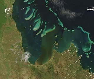
Princess Charlotte Bay is a large bay on the east coast of Far North Queensland at the base of Cape York Peninsula, 350 km north northwest of Cairns. Princess Charlotte Bay is a part of the Great Barrier Reef Marine Park and it is a habitat for the dugong.

Lockhart River is a town in the Aboriginal Shire of Lockhart River and a locality split between the Aboriginal Shire of Lockhart River and the Shire of Cook, in Queensland, Australia. At the 2006 census, Lockhart River had a population of 542, which increased to 642 at the 2011 Census.

Night Island is part of the Great Barrier Reef Marine Park west of Cape Melville, Queensland, Australia. It lies east of Coen between the first three-mile opening and the second three-mile opening of the Barrier Reef about 100 km south-east of Lockhart River. It is part of the Islands North of Port Stewart Important Bird Area. The indigenous people of the island were the Kawadji.
Sherrard Island is an island in the Aboriginal Shire of Lockhart River in Queensland, Australia.
Sunter Island is an island in the Aboriginal Shire of Lockhart River, Queensland, Australia.
Lloyd Island is an island in the Aboriginal Shire of Lockhart River, Queensland, Australia.
Clerke Island is an island about 1 km East of Cape Grenville in the Great Barrier Reef Marine Park, Queensland, Australia, in Temple Bay about 200 km north-east of Iron Range National Park and Lockhart River on the Cape York Peninsula. It is around 29 hectares or 0.29 square km in size.
Harvey Island is an island about 1 km east of Cape Grenville in the Great Barrier Reef Marine Park Queensland, Australia, in Temple Bay about 200 km north-east of Iron Range National Park and Lockhart River on Cape York Peninsula. It is around 7 hectares or 0.07 square km in size.
Perry Island is an island about 1 kilometre (0.62 mi) east of Cape Grenville in the Great Barrier Reef Marine Park Queensland, Australia, in Temple Bay about 200 kilometres (120 mi) north-east of Iron Range National Park and Lockhart River in the Cape York Peninsula. It is around 7 hectares or 0.07 square km in size.
Nob Island is an island about 1 km east of Cape Grenville in the Great Barrier Reef Marine Park Queensland, Australia, in Temple Bay about 200 km north-east of Iron Range National Park and Lockhart River on Cape York Peninsula. It is around 1 hectares or 0.01 square km in size.
Quoin Island is a national park in the Great Barrier Reef Marine Park Queensland, Australia, 1,947 km northwest of Brisbane. It is situated about 30 km North East of Iron Range National Park and Lockhart River in the Cape Weymouth area near Portland Roads

The Shire of Cook is a local government area in Far North Queensland, Australia. The Shire covers most of the eastern and central parts of Cape York Peninsula, the most northerly section of the Australian mainland.

Cape Grenville, is a small, east-facing promontory along the Queensland, Australia coast of Cape York Peninsula. It lies between Shelburne Bay to the north and Temple Bay to the south. The nearest significant settlement is Weipa, along the western coast of Cape York.

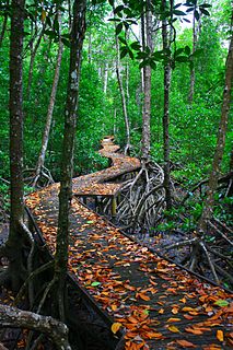
The geography of Queensland in the north-east of Australia, is varied. It includes tropical islands, sandy beaches, flat river plains that flood after monsoon rains, tracts of rough, elevated terrain, dry deserts, rich agricultural belts and densely populated urban areas.
Great Palm Island, also known as Palm Island, or by the Aboriginal name Bwgcolman; is a tropical island with a resident community of about 2,000 people. The island has an area of 55 km2 (21 sq mi). The official area figure of 70.9 km² refers to Aboriginal Shire of Palm Island and includes nine smaller islands. It is in Queensland, Australia, off the east coast of northern Queensland, situated 65 kilometres (40 mi) northwest of Townsville, and 800 kilometres (500 mi) north of the Tropic of Capricorn. The Australia Post lists the local post office as Palm Island, QLD. It is the main island of the Greater Palm group, and consists of small bays, sandy beaches and steep forested mountains rising to a peak of 548 metres (1,798 ft). The ocean surrounding the island is part of the Great Barrier Reef Marine Park where extraction and fishing are regulated.
Haggerstone Island is a privately owned resort island, 10 km (6 mi) southeast of Cape Grenville in the Great Barrier Reef Marine Park of Far North Queensland, Australia.