Charleston Municipal Airport

Last updated
Charleston Municipal Airport

Charleston Municipal Airport-MS-17Feb1996-USGS.jpg

Summary
Airport type Public
Owner City of Charleston
Serves Charleston, Mississippi
Elevation  AMSL 175 ft / 53 m
Coordinates 33°59′29″N090°04′43″W / 33.99139°N 90.07861°W / 33.99139; -90.07861
Runways
Direction Length Surface
ft m
18/36 3,000 914 Asphalt
Statistics (2012)
Aircraft operations 5,700

Charleston Municipal Airport( FAA LID : 09M) is a city owned, public use airport located two  nautical miles (4  km) south of the central business district of Charleston, a city in Tallahatchie County, Mississippi, United States. [1] It is included in the National Plan of Integrated Airport Systems for 2011–2015, which categorized it as a general aviation facility. [2]

Federal Aviation Administration United States Government agency dedicated to civil aviation matters

The Federal Aviation Administration (FAA) is a governmental body of the United States with powers to regulate all aspects of civil aviation in that nation as well as over its surrounding international waters. Its powers include the construction and operation of airports, air traffic management, the certification of personnel and aircraft, and the protection of U.S. assets during the launch or re-entry of commercial space vehicles. Powers over neighboring international waters were delegated to the FAA by authority of the International Civil Aviation Organization.

A location identifier is a symbolic representation for the name and the location of an airport, navigation aid, or weather station, and is used for manned air traffic control facilities in air traffic control, telecommunications, computer programming, weather reports, and related services.

Airport location where aircraft take off and land

An airport is an aerodrome with extended facilities, mostly for commercial air transport. Airports often have facilities to store and maintain aircraft, and a control tower. An airport consists of a landing area, which comprises an aerially accessible open space including at least one operationally active surface such as a runway for a plane to take off or a helipad, and often includes adjacent utility buildings such as control towers, hangars and terminals. Larger airports may have airport aprons, taxiway bridges, air traffic control centres, passenger facilities such as restaurants and lounges, and emergency services. In some countries, the US in particular, they also typically have one or more fixed-base operators, serving general aviation.

Contents

Facilities and aircraft

Charleston Municipal Airport covers an area of 47 acres (19 ha) at an elevation of 175 feet (53 m) above mean sea level. It has one runway designated 18/36 with an asphalt surface measuring 3,000 by 50 feet (914 x 15 m). For the 12-month period ending January 4, 2012, the airport had 5,700 general aviation aircraft operations, an average of 15 per day. [1]

Acre unit of area

The acre is a unit of land area used in the imperial and US customary systems. It is traditionally defined as the area of one chain by one furlong, which is exactly equal to 10 square chains, ​1640 of a square mile, or 43,560 square feet, and approximately 4,047 m2, or about 40% of a hectare. Based upon the International yard and pound agreement of 1959, an acre may be declared as exactly 4,046.8564224 square metres. The acre is a statute measure in the United States and was formerly one in the United Kingdom and almost all countries of the former British Empire, although informal use continues.

Hectare metric unit of area

The hectare is an SI accepted metric system unit of area equal to a square with 100-metre sides, or 10,000 m2, and is primarily used in the measurement of land. There are 100 hectares in one square kilometre. An acre is about 0.405 hectare and one hectare contains about 2.47 acres.

Elevation Height of a geographic location above a fixed reference point

The elevation of a geographic location is its height above or below a fixed reference point, most commonly a reference geoid, a mathematical model of the Earth's sea level as an equipotential gravitational surface . The term elevation is mainly used when referring to points on the Earth's surface, while altitude or geopotential height is used for points above the surface, such as an aircraft in flight or a spacecraft in orbit, and depth is used for points below the surface.

See also

Related Research Articles

Houston Municipal Airport

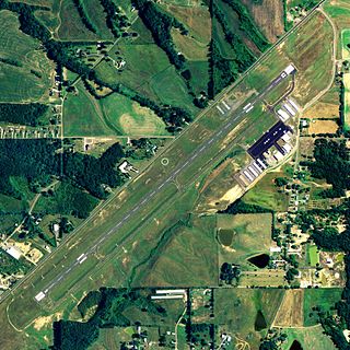
Houston Municipal Airport is a public use airport in Chickasaw County, Mississippi, United States. It is owned by the City of Houston and located two nautical miles (4 km) southwest of its central business district. This airport is included in the National Plan of Integrated Airport Systems for 2011–2015, which categorized it as a general aviation facility.

Baker City Municipal Airport

Baker City Municipal Airport is three miles north of Baker City, in Baker County, Oregon. The National Plan of Integrated Airport Systems for 2011–2015 categorized it as a general aviation facility.

Abbeville Municipal Airport

Abbeville Municipal Airport is a city-owned, public-use airport located three nautical miles north of the central business district of Abbeville, a city in Henry County, Alabama, United States. It is the only airport that serves the city of Abbeville.

Albertville Regional Airport

Albertville Regional Airport, also known as Thomas J. Brumlik Field, is a city-owned, public-use airport located three nautical miles southwest of the central business district of Albertville, in Marshall County, Alabama, United States. It was formerly known as Albertville Municipal Airport.

Camden Municipal Airport

Camden Municipal Airport is a city-owned, public-use airport located three nautical miles (6 km) southwest of the central business district of Camden, a city in Wilcox County, Alabama, United States.

Centre Municipal Airport

Centre Municipal Airport is a city-owned, public-use airport located three nautical miles east of the central business district of Centre, a city in Cherokee County, Alabama, United States. It is owned by the City of Centre.

Clayton Municipal Airport (Alabama)

Clayton Municipal Airport is a city-owned, public-use airport located two nautical miles west of the central business district of Clayton, a city in Barbour County, Alabama, United States.

Florala Municipal Airport

Florala Municipal Airport is a city-owned public-use airport located three nautical miles northeast of the central business district of Florala, a city in Covington County, Alabama, United States.

Greensboro Municipal Airport

Greensboro Municipal Airport is a city-owned public-use airport located three nautical miles southwest of the central business district of Greensboro, a city in Hale County, Alabama, United States.

Headland Municipal Airport airport in Alabama, United States

Headland Municipal Airport is a city-owned, public-use airport located two nautical miles northeast of the central business district of Headland, a city in Henry County, Alabama, United States.

Jackson Municipal Airport (Alabama)

Jackson Municipal Airport is a city-owned public airport two miles south of Jackson, in Clarke County, Alabama.

Philadelphia Municipal Airport

Philadelphia Municipal Airport is a public use airport in Neshoba County, Mississippi, United States. It is owned by the City of Philadelphia and located two nautical miles (4 km) northwest of its central business district. This airport is included in the National Plan of Integrated Airport Systems for 2011–2015, which categorized it as a general aviation facility.

Yazoo County Airport

Yazoo County Airport is five miles northwest of Yazoo City in unincorporated Yazoo County, Mississippi. It is owned by the County of Yazoo.

Blytheville Municipal Airport airport

Blytheville Municipal Airport is a public use airport located three nautical miles east of the central business district of Blytheville, in Mississippi County, Arkansas, United States. It is owned by the City of Blytheville.

Davenport Municipal Airport (Washington)

Davenport Airport, also known as Davenport Municipal Airport, is a city-owned, public-use airport located one nautical mile (2 km) west of the central business district of Davenport, a city in Lincoln County, Washington, United States. It is included in the National Plan of Integrated Airport Systems for 2011–2015, which categorized it as a general aviation facility.

Osceola Municipal Airport (Arkansas)

Osceola Municipal Airport is a city-owned, public-use airport located two nautical miles (4 km) southwest of the central business district of Osceola, a city in Mississippi County, Arkansas, United States. It is included in the National Plan of Integrated Airport Systems for 2011–2015, which categorized it as a general aviation facility.

Boone Municipal Airport

Boone Municipal Airport is a city-owned public-use airport located two nautical miles (4 km) southeast of the central business district of Boone, a city in Boone County, Iowa, United States. It is included in the National Plan of Integrated Airport Systems for 2011–2015, which categorized it as a general aviation facility.

Creston Municipal Airport

Creston Municipal Airport is a city-owned public-use airport located three nautical miles (6 km) south of the central business district of Creston, a city in Union County, Iowa, United States. It is included in the National Plan of Integrated Airport Systems for 2011–2015, which categorized it as a general aviation facility.

Denison Municipal Airport

Denison Municipal Airport is a city-owned, public-use airport located two nautical miles (4 km) southwest of the central business district of Denison, a city in Crawford County, Iowa, United States. It is included in the National Plan of Integrated Airport Systems for 2011–2015, which categorized it as a general aviation facility.

Webster City Municipal Airport

Webster City Municipal Airport is a city-owned public-use airport located three nautical miles (6 km) southwest of the central business district of Webster City, in Hamilton County, Iowa, United States. It is included in the National Plan of Integrated Airport Systems for 2015–2019, which categorized it as a general aviation facility.

References

  1. 1 2 3 FAA Airport Master Record for 09M ( Form 5010 PDF ). Federal Aviation Administration. Effective April 5, 2012.
  2. "2011–2015 NPIAS Report, Appendix A" (PDF). National Plan of Integrated Airport Systems. Federal Aviation Administration. October 4, 2010. Archived from the original (PDF, 2.03 MB) on 2012-09-27.
The National Map

The National Map is a collaborative effort of the United States Geological Survey (USGS) and other federal, state, and local agencies to improve and deliver topographic information for the United States. The purpose of the effort is to provide "...a seamless, continuously maintained set of public domain geographic base information that will serve as a foundation for integrating, sharing, and using other data easily and consistently".