Lincoln–Lemington–Belmar is a neighborhood in Pittsburgh, Pennsylvania. It is located in the northeastern section of the city and spans the Allegheny River. Lincoln–Lemington–Belmar houses PBF 15 Engine, and is covered by PBP Zone 5 and the Bureau of EMS Medic 1.
Elliott is a small, hilly neighborhood in Pittsburgh, Pennsylvania's West End Region. Elliott is represented on the Pittsburgh City Council by the council member for District 2, and uses the ZIP code 15220.

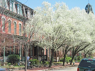
Central Lawrenceville is a neighborhood in the northeast of Pittsburgh, Pennsylvania in the United States. It has a zip code of 15201, and has representation on Pittsburgh City Council by the council member for District 7. It is home to Allegheny Cemetery. Central Lawrenceville is the home of the Pittsburgh Bureau of Fire's 6 Engine and 6 Truck.
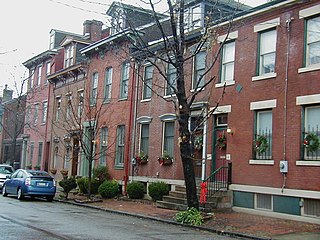
Central Northside is a neighborhood in the North Side of the city of Pittsburgh, Pennsylvania, USA. It has a zip code of 15212, and has representation on Pittsburgh City Council by the council member for District 6. Originally known as "The Buena Vista Tract", it is densely filled with restored row houses, community gardens and tree lined streets and alleyways.

East Allegheny, also known as Deutschtown, is a neighborhood on Pittsburgh's North Side. It has a ZIP Code of 15212, and has representation on Pittsburgh City Council by the council member for District 1. The Pittsburgh Bureau of Fire houses 32 Engine and 32 Truck in Deutschtown.

Esplen is a neighborhood in Pittsburgh, Pennsylvania's west city area. It has a zip code of 15204, and has representation on Pittsburgh City Council by the council member for District 2.

Fairywood is a neighborhood on Pittsburgh, Pennsylvania's west end. It has a zip code of 15205, and has representation on Pittsburgh City Council by the council member for District 2. It is the westernmost neighborhood in the City of Pittsburgh.

Fineview is a neighborhood on Pittsburgh, Pennsylvania's North Side. It has zip codes of both 15212 and 15214, and has representation on Pittsburgh City Council by the council member for District 6 and District 1. Fineview was known to older generations as Nunnery Hill. Its modern name derives from the expansive views of downtown Pittsburgh. The most famous of these views is from the Fineview Overlook at the corner of Catoma and Meadville streets.
Manchester is a neighborhood on Pittsburgh, Pennsylvania's North Side. It has a ZIP code of 15233, and has representation on Pittsburgh City Council by the council member for District 6. Manchester houses PBF Battalion 1 & 37 Engine, and is covered by PBP Zone 1 and the Bureau of EMS Medic 4. The neighborhood includes the Manchester Historic District, which protects, to some degree, 609 buildings over a 51.6-acre (20.9 ha) area. The district was listed on the National Register of Historic Places in 1975.
Morningside is a neighborhood on Pittsburgh, Pennsylvania's East End. It has two zip codes, 15201 and 15206, and has a representation on Pittsburgh City Council by Deb Gross for District 7.
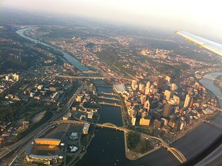
The North Shore is a neighborhood in Pittsburgh, Pennsylvania's North Side. It has a zip code of 15212, and has representation on Pittsburgh City Council by both the council members for District 1 and 6. The neighborhood is home to Heinz Field, PNC Park and The Andy Warhol Museum.

Windgap is a neighborhood in the west area of Pittsburgh, Pennsylvania, United States. It has a zip code of 15204, and has representation on Pittsburgh City Council by the council member for District 2.
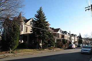
Westwood is a neighborhood in Pittsburgh, Pennsylvania's West End Region. Beginning as a part of the now-defunct Township of Chartiers and existing for a short time as an independent borough, Westwood was annexed by the City of Pittsburgh in three pieces: the eastern third in 1872, and the remaining sectors progressing west in 1921 and 1927. Westwood is a quiet residential community inhabited by a large variety of residents, and exhibits an eclectic mix of architectural styles that span many periods. Among these is the John Frew House, one of the oldest surviving structures west of the Allegheny Mountains, which dates to 1790. Westwood also contains a public primary school bearing the community's name, as well as a public swimming pool, a playground, and ballfields. The neighborhood's main thoroughfare is Noblestown Road, and Noble Manor is its major commercial district. It has a zip codes of both 15205 and 15220, and has representation on Pittsburgh City Council by the council member for District 2. The Pittsburgh Bureau of Fire houses 29 Engine in Westwood.

West End Village is a neighborhood in Pittsburgh, Pennsylvania's west city area. It has a zip code of 15220, and has representation on Pittsburgh City Council by the council member for District 2.

Perry North is a neighborhood in Pittsburgh, Pennsylvania, USA's north city area. It lies within zip codes 15212 and 15214, and has representation on Pittsburgh City Council by the council member for District 1. The highest elevation in Pittsburgh is 1,370 feet at the Brashear Reservoir at the top of Observatory Hill. The Pittsburgh Bureau of fire houses 34 Engine in Perry North.
The Chartiers branch of the Pennsylvania Railroad followed Chartiers Creek from Carnegie to Washington, passing Bridgeville, present day Southpointe, and Canonsburg. It is 23.6 miles (38.0 km) long and construction was completed in 1867 and is still in use today, after passing through at least seven different owners.
Pekowi was the name of one of the five divisions of the Shawnee, a Native American people, during the 18th century. The other four divisions were the Chalahgawtha, Mekoche, Kispoko, and Hathawekela. Together these divisions formed the loose confederacy that was the Shawnee tribe.
Chartiers Run is a tributary of the Allegheny River located in Westmoreland County in the U.S. state of Pennsylvania. It was named after Peter Chartier, a trapper of French and Native American parentage who established a trading post at the mouth of Chartiers Creek in 1743.
Chartiers Run is a tributary of Chartiers Creek in Washington County, Pennsylvania in the United States. It was named after Peter Chartier, a trapper of French and Native American parentage who established a trading post at the mouth of Chartiers Creek in 1743.

Indian Old Fields was an unincorporated community located in Clark County, Kentucky, United States.
