
McKees Rocks, also known as "The Rocks", is a borough in Allegheny County in Western Pennsylvania, United States, along the south bank of the Ohio River. Part of the Pittsburgh metropolitan area, its population was 5,920 at the time of the 2020 census.

Chartiers Township is a township in Washington County, Pennsylvania, United States. The population was 8,628 at the 2020 census. Along with the borough of Houston, the township makes up the Chartiers-Houston School District. It is part of the Pittsburgh metropolitan area.
Sheraden is a neighborhood that is located in the West End of Pittsburgh, Pennsylvania in the United States. Nearby neighborhoods include Windgap, Chartiers City, Crafton Heights, Esplen, and Elliott.
Highland Park is a neighborhood in the northeastern part of Pittsburgh, Pennsylvania. Highland Park, the neighborhood, fully encompasses the park with the same name.
Elliott is a small, hilly neighborhood in Pittsburgh, Pennsylvania, United States' West End Region. Elliott is represented on the Pittsburgh City Council by the council member for District 2, and uses the ZIP code 15220.

The Pittsburgh, Cincinnati, Chicago and St. Louis Railroad, commonly called the Pan Handle Route, was a railroad that was part of the Pennsylvania Railroad system. Its common name came from its main line, which began at Pittsburgh, Pennsylvania, crossed the Northern Panhandle of West Virginia, and continued west to Bradford, Ohio, where it split into a northern line to Chicago and a southern one through Indianapolis, Indiana, to East St. Louis, Illinois.

Chartiers is a neighborhood in Pittsburgh, Pennsylvania's West End. It has a zip code of 15204, and has representation on Pittsburgh City Council by the council member for District 2. The neighborhood was named after Peter Chartier, a trapper of French and Native American parentage who established a trading post at the mouth of Chartiers Creek in 1743.

Chateau is a North Side neighborhood in Downtown Pittsburgh, Pennsylvania. It has representation on Pittsburgh City Council by the council member for District 6. It is on the banks of the Ohio River and is separated from the neighborhood of Manchester by PA Route 65.

Marshall-Shadeland is a neighborhood on Pittsburgh, Pennsylvania's North Side. It has a zip codes of both 15212 and 15214, and has representation on Pittsburgh City Council by the council member for District 1.

Windgap is a neighborhood in the West End of Pittsburgh, Pennsylvania, United States. It has a zip code of 15204, and has representation on Pittsburgh City Council by the council member for District 2.

West End Village is a neighborhood in Pittsburgh, Pennsylvania's west city area. It has a zip code of 15220, and has representation on Pittsburgh City Council by the council member for District 2.

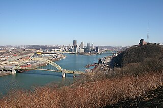
A large metropolitan area that is surrounded by rivers and hills, Pittsburgh has an infrastructure system that has been built out over the years to include roads, tunnels, bridges, railroads, inclines, bike paths, and stairways; however, the hills and rivers still form many barriers to transportation within the city.
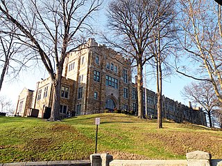
Brashear High School is a large, urban, magnet, public school in the Beechview neighborhood of Pittsburgh, Pennsylvania, United States. Brashear is one of four high schools in the Pittsburgh Public Schools. In the 2010–2011 school year, the school had 1,214 pupils with 615 males and 566 females. It employed 87 teachers. Since then, the school has acquired students from the transition with Langley High School. It is currently the largest high school in the district, with approximately 1,480 students and 105 teachers.

Buckman is a neighborhood in the Southeast section of Portland, Oregon. The neighborhood is bounded by the Willamette River on the west, E Burnside St. on the north, SE 28th Ave. on the east, and SE Hawthorne Blvd. on the south.
Columbus, the state capital and Ohio's largest city, has numerous neighborhoods within its city limits. Neighborhood names and boundaries are not officially defined. They may vary or change from time to time due to demographic and economic variables.

Thaddeus Stevens Elementary School is located at 824 Crucible Street in the Elliott neighborhood of Pittsburgh, Pennsylvania.
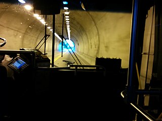
The Cork Run Tunnel, also known as the Berry Street Tunnel, is one of nine tunnels built in Pittsburgh, Pennsylvania on the original Pittsburgh and Steubenville Railroad. The tunnel was built beginning in 1851 as a single-track bore 2,100 feet (640 m) long, approached by deep open cuts, to connect central Pittsburgh with points to the west, on the south side of the Ohio River. A shaft was sunk from the overlying ridge to a point near the midpoint of the tunnel to speed construction and to provide ventilation. Work was suspended in 1856 due to financial troubles, and resumed in 1862. The tunnel was completed in 1865.
South Central is a neighborhood in Wichita, Kansas, United States. A mixed commercial and residential area on the east bank of the Arkansas River, it is among the city’s oldest neighborhoods.
South City is a neighborhood in Wichita, Kansas, United States. A mixed commercial, industrial, and residential area, it lies on the east bank of the Arkansas River in the south-central part of the city.
