Banksville (Pittsburgh)

Last updated
Banksville
Pgh locator banksville.svg
Coordinates: 40°24′43″N80°02′20″W / 40.412°N 80.039°W / 40.412; -80.039
Country United States
State Pennsylvania
County Allegheny County
City Pittsburgh
Area
[1]
  Total0.969 sq mi (2.51 km2)
Population
 (2010) [1]
  Total4,144
  Density4,300/sq mi (1,700/km2)

Banksville is a neighborhood in Pittsburgh, Pennsylvania (20th ward). The neighborhood of Banksville is located in the West End of the city and borders the South Hills region. Real estate agencies frequently refer to the Banksville area as Greentree City due to Banksville's shared border with the borough of Green Tree. It has two zip codes of both 15220 and 15216, and has representation in Pittsburgh City Council by the council member for District 2 (West Neighborhoods). Theresa Kail-Smith is the current Councilperson for district two. Banksville's primary corridor, Banksville Road, is frequently used as a gateway between the South Hills of Pittsburgh and downtown Pittsburgh via the Fort Pitt Tunnels. Banksville, formerly Union Township, joined the City of Pittsburgh around 1928.

Contents

Historical population
YearPop.±%
1940 1,214    
1950 1,328+9.4%
1960 2,641+98.9%
1970 4,927+86.6%
1980 3,831−22.2%
1990 4,769+24.5%
2000 4,540−4.8%
2010 4,144−8.7%
[2] [3] [ better source needed ]
Source: University of Pittsburgh [4]

History

Former coal mine entrance AzzeriaOven.jpg
Former coal mine entrance

The first known European inhabitant of Banksville was Isaac Sellers, who settled in the area in 1773. According to the "History of Allegheny County", "the earliest settlers were subjected to frequent alarms by marauding Indians." Shortly after his settlement, he was joined by James Kearns and William Chess, both from Ireland. [5] The 400-acre (1.6 km2) land, known as "The Experiment" and located on the waters of Little Saw-Mill Run, was sold in 1784 to David and Agnes Carnahan of Ireland. Just before David's death, 250 acres (1.0 km2) of the land was split between David's 3 children—William, Alexander and Joseph. [6] The land was named Banksville by Alexander Carnahan (1789–1879) in honor of the family of his second wife — Eliza Banks. [7]

Alexander Carnahan laid out Banksville just after the Civil War. The town was a farming community as well as a prosperous mining town whose settlers were mostly Scotch-Irish.

The Little Saw Mill Run Railroad, owned by the Harmony Society, was operated between Banksville and the West End beginning in April 1853.

Banksville was formerly a part of Union Township before being annexed into the city of Pittsburgh in 1907. [8]

Banksville Related Mining activities: Coal Ridge Mine; Venture Mine, operated by Gray and Bell; Enterprise Mine, operated by Hartley and Marshall; Pittsburgh, Carnegie and Western Railroad; Westside Belt Railroad Company.

Community organizations

City Steps

The Banksville neighborhood has 5 distinct flights of city steps - all of which are open and in a safe condition. In Banksville, the Steps of Pittsburgh quickly connect pedestrians to public transportation and many businesses along Banksville Road. [9]

The Anise Way city steps in the Banksville neighborhood of Pittsburgh, PA. Anise Way City Steps Banksville Pittsburgh.jpg
The Anise Way city steps in the Banksville neighborhood of Pittsburgh, PA.

Recreation

Residents have convenient access to the Banksville park, operated by the Pittsburgh Citiparks. The park features a playground, swimming pool, tennis courts, basketball court, batting cages, and ballfield.

Surrounding communities

Banksville has five borders, including the Pittsburgh neighborhoods of Ridgemont to the north and Beechview to the east, the boroughs of Dormont to the south and Green Tree to the west, and the municipality of Mt. Lebanon to the southwest.

See also

Related Research Articles

<span class="mw-page-title-main">Green Tree, Pennsylvania</span> Borough in Pennsylvania, United States

Green Tree is a borough in Allegheny County, Pennsylvania, United States. The population was 4,941 at the 2020 census. It is a suburb of the Pittsburgh metropolitan area. Green Tree is connected to Pittsburgh via the Fort Pitt Tunnel.

<span class="mw-page-title-main">Sheraden</span> Neighborhood of Pittsburgh in Allegheny County, Pennsylvania, United States

Sheraden is a neighborhood that is located in the West End of Pittsburgh, Pennsylvania in the United States. Nearby neighborhoods include Windgap, Chartiers City, Crafton Heights, Esplen, and Elliott.

<span class="mw-page-title-main">Highland Park (Pittsburgh neighborhood)</span> Neighborhood of Pittsburgh in Allegheny County, Pennsylvania, United States

Highland Park is a neighborhood in the northeastern part of Pittsburgh, Pennsylvania. Highland Park, the neighborhood, fully encompasses the park with the same name.

<span class="mw-page-title-main">Lincoln–Lemington–Belmar</span> Neighborhood of Pittsburgh in Allegheny County, Pennsylvania, United States

Lincoln–Lemington–Belmar is a neighborhood in Pittsburgh, Pennsylvania. It is located in the northeastern section of the city and spans the Allegheny River. Lincoln–Lemington–Belmar houses PBF 15 Engine, and is covered by PBP Zone 5 and the Bureau of EMS Medic 1.

<span class="mw-page-title-main">Brookline (Pittsburgh)</span> Neighborhood of Pittsburgh in Allegheny County, Pennsylvania, United States

Brookline is a neighborhood in the South Hills of Pittsburgh, Pennsylvania, United States. It takes its name from the town in Massachusetts, which early settlers felt bore a resemblance to the area.

<span class="mw-page-title-main">Allentown, Allegheny County, Pennsylvania</span> Neighborhood in Allegheny County, Pennsylvania, United States

Allentown is a neighborhood located in southern portion of the city of Pittsburgh, Allegheny County, Pennsylvania. The ZIP code used by residents is 15210, and has representation on the Pittsburgh City Council by the council member for District 3.

<span class="mw-page-title-main">Spring Hill–City View</span> Neighborhood of Pittsburgh in Allegheny County, Pennsylvania, United States

Spring Hill is a neighborhood on Pittsburgh, Pennsylvania's North Side. Spring Hill was named for the abundance of springs near the site. According to a 1977 Neighborhood Atlas, "Germans immigrated there from 1850 to 1920, giving the neighborhood a Bavarian atmosphere. Local street names include Rhine, Woessner, Haslage, Zoller and Goehring. In 1959 ACTION-Housing opened Spring Hill Gardens, a moderate rent, racially integrated, 209-unit apartment project at Buente and Rhine Streets. Spring Hill Gardens was Pittsburgh's first multi-family housing project backed by the Federal Housing Authority."

<span class="mw-page-title-main">California-Kirkbride</span> Neighborhood of Pittsburgh in Allegheny County, Pennsylvania, United States

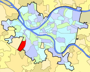
California-Kirkbride is a neighborhood on Pittsburgh, Pennsylvania's North Side.

<span class="mw-page-title-main">Beechview (Pittsburgh)</span> Place in Pennsylvania, United States

Beechview is a neighborhood in Pittsburgh, Pennsylvania's southwestern side. It has a zip code of 15216, and has representation on Pittsburgh City Council by both the council member for District 4 and for District 2. Beechview was founded in 1905 after the introduction of a comprehensive light rail transit system. It is Pittsburgh Fire Bureau Zone 4-10 and houses Engine Company #28. It is located in Zone 6 for Pittsburgh Police. While Beechview took an economic downturn in the late 20th century, its proximity to downtown Pittsburgh, convenient access to light rail transit, sweeping vistas and new businesses have allowed Beechview to stabilize economically.

<span class="mw-page-title-main">Central Lawrenceville</span> Neighborhood of Pittsburgh in Allegheny County, Pennsylvania, United States

Central Lawrenceville is a neighborhood in the northeast of Pittsburgh, Pennsylvania in the United States. It has a zip code of 15201, and has representation on Pittsburgh City Council by the council member for District 7. It is home to Allegheny Cemetery. Central Lawrenceville is the home of the Pittsburgh Bureau of Fire's 6 Engine and 6 Truck.

<span class="mw-page-title-main">Central Northside</span> Neighborhood of Pittsburgh in Allegheny County, Pennsylvania, United States

Central Northside is a neighborhood in the North Side of the city of Pittsburgh, Pennsylvania, USA. It has a zip code of 15212, and has representation on Pittsburgh City Council by the council member for District 6. Originally known as "The Buena Vista Tract", it is densely filled with restored row houses, community gardens and tree lined streets and alleyways.

<span class="mw-page-title-main">Hays (Pittsburgh)</span> Neighborhood of Pittsburgh in Allegheny County, Pennsylvania, United States

Hays is a neighborhood in the 31st Ward of the east side of Pittsburgh, Pennsylvania. It is represented on the Pittsburgh City Council by the representative of District 5. It occupies ZIP codes 15227, 15207, and 15236. It is named after James H. Hays, who opened a coal-mining operation called Hays and Haberman Mines in 1828.

<span class="mw-page-title-main">Marshall-Shadeland</span> Neighborhood of Pittsburgh in Allegheny County, Pennsylvania, United States

Marshall-Shadeland is a neighborhood on Pittsburgh, Pennsylvania's North Side. It has a zip codes of both 15212 and 15214, and has representation on Pittsburgh City Council by the council member for District 1.

<span class="mw-page-title-main">Morningside (Pittsburgh)</span> Neighborhood of Pittsburgh in Allegheny County, Pennsylvania, United States

Morningside is a neighborhood in Pittsburgh, Pennsylvania's East End. It has two Zip Codes, 15201 and 15206.

<span class="mw-page-title-main">Ridgemont (Pittsburgh)</span> Neighborhood of Pittsburgh in Allegheny County, Pennsylvania, United States

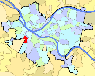
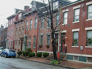
Ridgemont is a neighborhood in Pittsburgh, Pennsylvania's West End. It has zip codes of both 15220 and 15216, and has representation on Pittsburgh City Council by the council member for District 2.

<span class="mw-page-title-main">Spring Garden (Pittsburgh)</span> Neighborhood of Pittsburgh in Allegheny County, Pennsylvania, United States

Spring Garden is a small neighborhood on Pittsburgh, Pennsylvania's North Side. It takes its name from Spring Garden Avenue, which follows the floor of the valley that separates the two adjacent hilltop neighborhoods of Spring Hill and Troy Hill. Like those neighborhoods, Spring Garden was initially settled by the descendants of Germans and Austrians who had emigrated from Europe to East Allegheny in Allegheny City. These initial residents of Spring Garden worked in slaughterhouses, rendering factories, and tanneries located in this valley neighborhood.

<span class="mw-page-title-main">Troy Hill (Pittsburgh)</span> Neighborhood of Pittsburgh in Allegheny County, Pennsylvania, United States

Troy Hill is a neighborhood on Pittsburgh, Pennsylvania's North Side. It has a zip code of 15212, and has representation on Pittsburgh City Council by the council member for District 1.

<span class="mw-page-title-main">Westwood (Pittsburgh)</span> Neighborhood of Pittsburgh in Allegheny County, Pennsylvania, United States

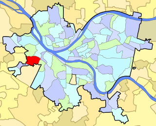
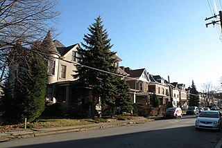
Westwood is an American neighborhood that is located in the West End Region of Pittsburgh, Pennsylvania.

<span class="mw-page-title-main">West End (Pittsburgh)</span> Neighborhood of Pittsburgh in Allegheny County, Pennsylvania, United States

West End Village is a neighborhood in Pittsburgh, Pennsylvania's west city area. It has a zip code of 15220, and has representation on Pittsburgh City Council by the council member for District 2.

<span class="mw-page-title-main">Perry North</span> Neighborhood of Pittsburgh in Allegheny County, Pennsylvania, United States

Perry North is a neighborhood in Pittsburgh, Pennsylvania, USA's north city area. It lies within zip codes 15212 and 15214, and has representation on Pittsburgh City Council by the council member for District 1. The highest elevation in Pittsburgh is 1,370 feet at the Brashear Reservoir at the top of Observatory Hill. The Pittsburgh Bureau of fire houses 34 Engine in Perry North.

References

  1. 1 2 "PGHSNAP 2010 Raw Census Data by Neighborhood". Pittsburgh Department of City Planning. 2012. Retrieved 21 June 2013.
  2. "PGHSNAP - Neighborhoods: All Raw Data".
  3. "Census:Pittsburgh" (PDF). Archived from the original (PDF) on August 10, 2007. Retrieved 2 September 2012.
  4. "Pittsburgh Census Tracts". pitt.libguides.com. Retrieved January 2, 2018.
  5. History of Allegheny County, Pennsylvania. 1899.
  6. Cushing, Thomas (2000). A Genealogical and Biographical History of Allegheny County, Pennsylvania.
  7. "City of Pittsburgh - Banksville". Archived from the original on January 6, 2011. Retrieved October 2, 2010.
  8. "Map of Union Township". 1896. Retrieved October 2, 2010.
  9. Regan, Bob (2015). Pittsburgh Steps, The Story of the City's Public Stairways. Globe Pequot. ISBN   978-1-4930-1384-5.

Further reading