Greenfield (Pittsburgh)

Last updated

Greenfield
Pgh locator greenfield.svg
Coordinates: 40°25′19″N79°56′31″W / 40.422°N 79.942°W / 40.422; -79.942
Country United States
State Pennsylvania
County Allegheny County
City Pittsburgh
Area
[1]
  Total
0.773 sq mi (2.00 km2)
Population
 (2010) [1]
  Total
7,294
  Density9,400/sq mi (3,600/km2)

Greenfield is a neighborhood in the city of Pittsburgh, in the state of Pennsylvania in the United States. It is part of the city's 15th Ward along with Hazelwood and Glen Hazel. [2] Greenfield is adjacent to the neighborhoods of Squirrel Hill to the north and east (including Schenley Park, which shares a long border with Greenfield), Hazelwood to the south and west, and Oakland to the northwest. [3] Greenfield includes the geographically and culturally distinct sub-neighborhood of Four Mile Run, also known as Rusyn Valley. [4] Pittsburgh Fire Station #12 is located in the neighborhood on Winterburn Avenue.

Contents

History

In 1768, a large tract of woodland was purchased for $10,000 under the Treaty of Fort Stanwix made with the Native Americans. This area included what became Greenfield and neighboring Hazelwood, which today are both part of the city's 15th ward. By the late 1800s, many of Greenfield's residents were of Irish, Polish, Slovak, Italian, Hungarian, and Carpatho-Rusyn descent. They resided in Greenfield and traveled to Hazelwood, Homestead and Duquesne to work in the steel mills. [4]

During the Civil War, Greenfield (part of Squirrel Hill at the time) [5] was the site of a small redoubt, Fort Black on Bigelow Street between Parade and Shields Streets, also known as Fort Chess or Fort Squirrel Hill. [6]

City steps

A neighborhood with uneven and hilly topography, Greenfield has 26 distinct flights of city steps - many of which are open and in a safe condition. In Greenfield, the Steps of Pittsburgh quickly connect pedestrians to public transportation, business districts, and playgrounds and provide an easy way to travel through this hilly, densely populated area. [7]

The city steps connecting Greenfield Avenue to Blanton Street in Greenfield, Pittsburgh. Photo by Laura Zurowski. City steps Greenfield Avenue to Blanton Street Greenfield Pittsburgh.jpg
The city steps connecting Greenfield Avenue to Blanton Street in Greenfield, Pittsburgh. Photo by Laura Zurowski.

Points of interest

Greenfield contains two small business districts along Greenfield Avenue and Murray Avenue. A major travel route is along Beechwood Boulevard, connecting I-376 to the Waterfront shopping district in Homestead. As a predominantly residential neighborhood, Greenfield boasts three baseball fields, four basketball courts, two hockey rinks, two soccer fields, and a swimming pool. It is also home to seven churches and one synagogue; the largest is St. Rosalia, a Roman Catholic church. Greenfield is known among locals for very steep hills, a chaotic street grid off the main roads, and a preponderance of single lane 2-way streets, which does not usually lead to congestion as the neighborhood is not heavily traveled (excluding Murray and Greenfield Avenues and Beechwood Boulevard, which are all multi-lane streets).

Similar to other Pittsburgh neighborhoods, Greenfield hosts a holiday parade and fireworks every December. The fireworks, which are usually sponsored by Zambelli Fireworks, are shot off from Magee Field.

Spanning I-376 and connecting Greenfield to Oakland is the Beechwood Boulevard Bridge, known more popularly as the Greenfield Bridge. It was built in the 1920s and eventually demolished on December 28, 2015. It was replaced by a new bridge that became available for public use in October, 2017.

Notable residents

See also

Related Research Articles

<span class="mw-page-title-main">Squirrel Hill</span> Neighborhood of Pittsburgh in Allegheny County, Pennsylvania, United States

Squirrel Hill is a residential neighborhood in the East End of Pittsburgh, Pennsylvania, United States. The city officially divides it into two neighborhoods, Squirrel Hill North and Squirrel Hill South, but it is almost universally treated as a single neighborhood.

<span class="mw-page-title-main">Oakland (Pittsburgh)</span> Place in Pennsylvania, United States

Oakland is the academic and healthcare center of Pittsburgh and one of the city's major cultural centers. Home to three universities, museums, hospitals, shopping venues, restaurants, and recreational activities, this section of the city also includes two city-designated historic districts: the mostly residential Schenley Farms Historic District and the predominantly institutional Oakland Civic Center Historic District, as well as the locally-designated Oakland Square Historic District.

<span class="mw-page-title-main">Hazelwood (Pittsburgh)</span> Neighborhood of Pittsburgh in Allegheny County, Pennsylvania, United States

Hazelwood is a neighborhood of Pittsburgh, Pennsylvania in the United States. It is represented on Pittsburgh City Council by Barb Warwick. It is bordered by Greenfield and Oakland on the north, Squirrel Hill and Glen Hazel on the east, and the Monongahela River on the south and west. The Pittsburgh Bureau of Fire houses 13 Engine and 13 Truck in Hazelwood.

<span class="mw-page-title-main">Downtown Pittsburgh</span> Neighborhood in Allegheny County, Pennsylvania, United States

Downtown Pittsburgh, colloquially referred to as the Golden Triangle, and officially the Central Business District, is the urban downtown center of Pittsburgh, Pennsylvania, United States. It is located at the confluence of the Allegheny River and the Monongahela River whose joining forms the Ohio River. The triangle is bounded by the two rivers.
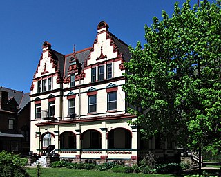
<span class="mw-page-title-main">Highland Park (Pittsburgh neighborhood)</span> Neighborhood of Pittsburgh in Allegheny County, Pennsylvania, United States

Highland Park is a neighborhood in the northeastern part of Pittsburgh, Pennsylvania. Highland Park, the neighborhood, fully encompasses the park with the same name.
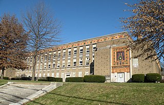
<span class="mw-page-title-main">Lincoln–Lemington–Belmar</span> Neighborhood of Pittsburgh in Allegheny County, Pennsylvania, United States

Lincoln–Lemington–Belmar is a neighborhood in Pittsburgh, Pennsylvania. It is located in the northeastern section of the city and spans the Allegheny River. Lincoln–Lemington–Belmar houses PBF 15 Engine, and is covered by PBP Zone 5 and the Bureau of EMS Medic 1.

<span class="mw-page-title-main">Allegheny County belt system</span> Road design in Pennsylvania, US

The Allegheny County Belt System color codes various county roads to form a unique system of routes in Allegheny County, Pennsylvania, and around the city of Pittsburgh.

<span class="mw-page-title-main">Swisshelm Park</span> Neighborhood of Pittsburgh in Allegheny County, Pennsylvania, United States

Swisshelm Park is a neighborhood located in the southeast corner of Pittsburgh, Pennsylvania. It is represented on the Pittsburgh City Council by Barbara Warwick. Swisshelm Park houses PBF 19 Engine, and is covered by PBP Zone 4 and the Bureau of EMS Medic 7.

<span class="mw-page-title-main">Lawrenceville (Pittsburgh)</span> Place in Pennsylvania, United States

Lawrenceville is one of the largest neighborhood areas in Pittsburgh in the U.S. state of Pennsylvania. It is located northeast of downtown, and like many of the city's riverfront neighborhoods, it has an industrial past. The city officially divides Lawrenceville into three neighborhoods, Upper Lawrenceville, Central Lawrenceville, and Lower Lawrenceville, but these distinctions have little practical effect. Accordingly, Lawrenceville is almost universally treated as a single large neighborhood.

<span class="mw-page-title-main">Troy Hill (Pittsburgh)</span> Neighborhood of Pittsburgh in Allegheny County, Pennsylvania, United States

Troy Hill is a neighborhood on Pittsburgh, Pennsylvania's North Side. It has a zip code of 15212, and has representation on Pittsburgh City Council by the council member for District 1.

<span class="mw-page-title-main">Transportation in Pittsburgh</span> Transportation in Pittsburgh, Pennsylvania, United States

A large metropolitan area that is surrounded by rivers and hills, Pittsburgh has an infrastructure system that has been built out over the years to include roads, tunnels, bridges, railroads, inclines, bike paths, and stairways; however, the hills and rivers still form many barriers to transportation within the city.
<span class="mw-page-title-main">Pennsylvania Route 65</span> State highway in Pennsylvania, US

Pennsylvania Route 65 is a major 51-mile-long (82 km) state highway located in western Pennsylvania, United States. The route, traveling north–south from the Interstate 279/U.S. Route 19 Truck concurrency in Pittsburgh north to the PA 108/PA 168 concurrency in New Castle, connects downtown Pittsburgh to the northwestern portion of the Pittsburgh Metropolitan Area. PA 65 is similar in its purpose to PA 18 and PA 51, both of which run parallel to PA 65 at one point or another; however, the three routes pass through different cities for most of their respective alignments.

<span class="mw-page-title-main">Boulevard of the Allies</span> Major road in Pittsburgh, US

The Boulevard of the Allies is a mostly four-lane road in the U.S. state of Pennsylvania, connecting Downtown Pittsburgh with the Oakland neighborhood of the city.

<span class="mw-page-title-main">Calvary Catholic Cemetery (Pittsburgh)</span> Cemetery in Pennsylvania, United States

Calvary Catholic Cemetery is located at 718 Hazelwood Avenue in the Greenfield and Hazelwood neighborhoods of Pittsburgh, Pennsylvania, United States.

<span class="mw-page-title-main">Pennsylvania Route 885</span> State highway in Allegheny County, Pennsylvania, US

Pennsylvania Route 885 is a 14.1-mile-long (22.69 km) north–south state highway in the U.S. state of Pennsylvania. It runs from Pennsylvania Route 837 in Clairton north to Interstate 579 in Pittsburgh. The route is entirely within Allegheny County and serves as a connector between the city of Pittsburgh and its southern suburbs.

Birmingham was a borough in Allegheny County, Pennsylvania, on the South Side of what is now Pittsburgh. Incorporated in 1826 from St. Clair Township, the borough comprised a section of the South Side Flats between what is now South 6th and South 17th Streets.
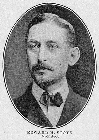
<span class="mw-page-title-main">Edward Stotz</span> American architect

Edward Stotz Sr. (1868–1948) was an American architect who was based in the city of Pittsburgh in the Commonwealth of Pennsylvania. He designed numerous buildings during the late nineteenth and early twentieth centuries that are now listed as significant by the National Register of Historic Places and the Pittsburgh History and Landmarks Foundation.

<span class="mw-page-title-main">Fort Black</span>

Fort Black was a fort built in the Greenfield neighborhood of Pittsburgh, Pennsylvania in 1863, during the Civil War.

<span class="mw-page-title-main">Greenfield Bridge</span> Bridge in Pittsburgh (opened 2017)

The Greenfield Bridge, officially known as the Beechwood Boulevard (Greenfield) Bridge II, is a steel arch bridge located in Pittsburgh, Pennsylvania, United States. The bridge connects the neighborhoods of Greenfield and Squirrel Hill across the valley known as Four Mile Run which separates them. The bridge also spans the Parkway East (I-376), which runs along the bottom of the valley.

References

  1. 1 2 "PGHSNAP 2010 Raw Census Data by Neighborhood". Pittsburgh Department of City Planning. 2012. Retrieved 24 June 2013.
  2. "Pittsburgh City Council Districts". City of Pittsburgh. Retrieved October 9, 2024.
  3. "Pittsburgh Neighborhoods". City of Pittsburgh. Retrieved October 7, 2024.
  4. 1 2 Toker, Franklin (1994) [1986]. Pittsburgh: An Urban Portrait . Pittsburgh: University of Pittsburgh Press. ISBN   0-8229-5434-6.
  5. Anita Kulina. "In the Footsteps of Renegades : A Virtual Tour of Greenfield" (PDF). Brandtstreetpress.com. Retrieved 2 February 2022.
  6. "Pennsylvania Forts: page 8". Northamericanforts.com.
  7. Regan, Bob (2015). Pittsburgh Steps, The Story of the City's Public Stairways. Globe Pequot. ISBN   978-1-4930-1384-5.
  8. "Bulger ho-hums homecoming victory". Archived from the original on 2012-10-14.
  9. 1 2 "O'Connor tribute to be reminiscent of Caliguiri's". Pittsburgh Post Gazette . September 7, 2006.
  10. "Packers.com » Team » Coaches » Mike McCarthy". Packers.com. Archived from the original on 5 May 2018. Retrieved 2 February 2022.