
Allegheny County is a county in Pennsylvania, United States. As of the 2020 census, the population was 1,250,578, making it the state's second-most populous county, after Philadelphia County. Its county seat and most populous city is Pittsburgh, Pennsylvania's second most populous city. The county is part of the Greater Pittsburgh region of the commonwealth, and is the center of the Pittsburgh media market.

Dormont is a borough in Allegheny County, Pennsylvania, United States. The population was 8,244 at the 2020 census. It is a residential suburb of the Pittsburgh metropolitan area. Loosely translated, Dormont means "Mountain of Gold" in French.

McKees Rocks, also known as "The Rocks", is a borough in Allegheny County in Western Pennsylvania, United States, along the south bank of the Ohio River. Part of the Pittsburgh metropolitan area, its population was 5,920 at the time of the 2020 census.

Oakland is the academic and healthcare center of Pittsburgh and one of the city's major cultural centers. Home to three universities, museums, hospitals, shopping venues, restaurants, and recreational activities, this section of the city also includes two city-designated historic districts: the mostly residential Schenley Farms Historic District and the predominantly institutional Oakland Civic Center Historic District, as well as the locally-designated Oakland Square Historic District.

Greenfield is a neighborhood in the city of Pittsburgh, in the state of Pennsylvania in the United States. It is part of the city's 15th Ward along with Hazelwood and Glen Hazel. Greenfield is adjacent to the neighborhoods of Squirrel Hill to the north and east, Hazelwood to the south and west, and Oakland to the northwest. Greenfield includes the geographically and culturally distinct sub-neighborhood of Four Mile Run, also known as Rusyn Valley. Pittsburgh Fire Station #12 is located in the neighborhood on Winterburn Avenue.

Downtown Pittsburgh, colloquially referred to as the Golden Triangle, and officially the Central Business District, is the urban downtown center of Pittsburgh, Pennsylvania, United States. It is located at the confluence of the Allegheny River and the Monongahela River whose joining forms the Ohio River. The triangle is bounded by the two rivers.

The Carnegie Library of Pittsburgh is the public library system in Pittsburgh, Pennsylvania. Its main branch is located in the Oakland neighborhood of Pittsburgh, and it has 19 branch locations throughout the city. Like hundreds of other Carnegie libraries, the construction of the main library, which opened in 1895, and several neighborhood branches, was funded by industrialist Andrew Carnegie. The Pittsburgh area houses the first branches in the United States.
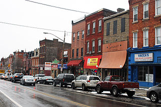
Bloomfield is a neighborhood in Pittsburgh, Pennsylvania. It is located three miles from the downtown area. Bloomfield is sometimes referred to as Pittsburgh's Little Italy because it was settled by Italians from the Abruzzi region and has been a center of Italian–American population. Pittsburgh architectural historian Franklin Toker has said that Bloomfield "is a feast, as rich to the eyes as the homemade tortellini and cannoli in its shop windows are to the stomach." Recently, the neighborhood has attracted young adults and college students as a "hip" neighborhood.
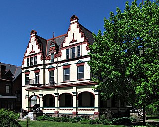
Highland Park is a neighborhood in the northeastern part of Pittsburgh, Pennsylvania. Highland Park, the neighborhood, fully encompasses the park with the same name.

Brookline is a neighborhood in the South Hills of Pittsburgh, Pennsylvania, United States. It takes its name from the town in Massachusetts, which early settlers felt bore a resemblance to the area.

Larimer is a neighborhood in the East End of the city of Pittsburgh, Pennsylvania in the United States. The neighborhood takes its name from William Larimer, who grew up in nearby Westmoreland County and, after making a fortune in the railroad industry, built a manor house overlooking East Liberty along a path that came to be called "Larimer Lane" and later Larimer Avenue.

The South Side Flats is a neighborhood in Pittsburgh, Pennsylvania's South Side area. It is located just south of the Monongahela River. The neighborhood has one of the City of Pittsburgh's largest concentrations of 19th-century homes, which has prompted outsiders to call the neighborhood the City's Georgetown. It includes many bars and restaurants as well as residences. The main throughway in the South Side Flats is East Carson Street. The street is home to a significant portion of Pittsburgh's nightlife.

Lawrenceville is one of the largest neighborhood areas in Pittsburgh in the U.S. state of Pennsylvania. It is located northeast of downtown, and like many of the city's riverfront neighborhoods, it has an industrial past. The city officially divides Lawrenceville into three neighborhoods, Upper Lawrenceville, Central Lawrenceville, and Lower Lawrenceville, but these distinctions have little practical effect. Accordingly, Lawrenceville is almost universally treated as a single large neighborhood.
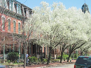
Manchester is a North Side neighborhood in Pittsburgh, Pennsylvania. The neighborhood is represented on Pittsburgh City Council by the District 6. Manchester houses PBF Battalion 1 & 37 Engine, and is covered by PBP Zone 1 and the Bureau of EMS Medic 4. The neighborhood includes the Manchester Historic District, which protects, to some degree, 609 buildings over a 51.6-acre (20.9 ha) area. The district was listed on the National Register of Historic Places in 1975. It uses ZIP code of 15233.
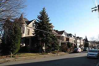
Morningside is a neighborhood in Pittsburgh, Pennsylvania's East End. It has two Zip Codes, 15201 and 15206.

A large metropolitan area that is surrounded by rivers and hills, Pittsburgh has an infrastructure system that has been built out over the years to include roads, tunnels, bridges, railroads, inclines, bike paths, and stairways; however, the hills and rivers still form many barriers to transportation within the city.
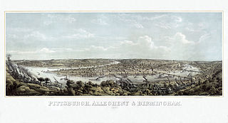
In 1763, King George III provided John Ormsby approximately 2,400 acres (9.7 km2) along the south bank of the Monongahela River as payment for his services during the French and Indian War. The land was then divided into four boroughs: South Pittsburgh, Birmingham, East Birmingham, and Ormsby. The four boroughs were annexed into the City of Pittsburgh in 1872. These areas, collectively, provided for the foundation of the South Side as it is known today.
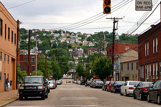
South Side Slopes is a neighborhood in Pittsburgh, Pennsylvania's South Side area. The neighborhood comprises the hills from the South Side Flats neighborhood along the Monongahela River from the Liberty Bridge (west) to beyond Josephine Street (east).
Collins Township was a township in Allegheny County, Pennsylvania, in the northeast part of what is now Pittsburgh. It included most of the present city east of Lawrenceville, north of Penn Avenue, and south of the Allegheny River. It was formed in 1850 from a northern portion of Peebles Township and was named for Thomas Collins, a prominent lawyer. On June 30, 1868, Collins Township along with the borough of Lawrenceville and the townships of Pitt, Oakland, Liberty, and Peebles were incorporated into Pittsburgh. The former Collins Township became wards 18, 19, and 21 of the expanded city.


