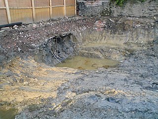
Brownfield is previously-developed land that has been abandoned or underutilized, and which may carry pollution, or a risk of pollution, from industrial use. The specific definition of brownfield land varies and is decided by policy makers and land developers within different countries. The main difference in definitions of whether a piece of land is considered a brownfield or not depends on the presence or absence of pollution. Overall, brownfield land is a site previously developed for industrial or commercial purposes and thus requires further development before reuse.

Urban renewal is a program of land redevelopment often used to address urban decay in cities. Urban renewal involves the clearing out of blighted areas in inner cities in favour of new housing, businesses, and other developments.

Squirrel Hill is a residential neighborhood in the East End of Pittsburgh, Pennsylvania, United States. The city officially divides it into two neighborhoods, Squirrel Hill North and Squirrel Hill South, but it is almost universally treated as a single neighborhood.
The Small Business Liability Relief and Brownfields Revitalization Act was signed into law by President George W. Bush on January 11, 2002. Brownfields are defined as, "A former industrial or commercial site where future use is affected by real or perceived environmental contamination." The Brownfields Law amended the Comprehensive Environmental Response, Compensation, and Liability Act by providing funds to assess and clean up brownfields, clarifying CERCLA liability protections, and providing funds to enhance state and tribal response programs. Other related laws and regulations impact brownfields cleanup and reuse through financial incentives and regulatory requirements.

Atlantic Station is a neighborhood on the northwestern edge of Midtown Atlanta, Georgia, United States comprising a retail district, office space, condominiums, townhomes and apartment buildings. First planned in the mid-1990s and officially opened in 2005, the neighborhood's 138 acres are located on the former brownfield site of the Atlantic Steel mill.

East Liberty is a neighborhood in Pittsburgh, Pennsylvania's East End. It is bordered by Highland Park, Morningside, Stanton Heights, Garfield, Friendship, Shadyside and Larimer, and falls largely within Pittsburgh City Council District 9, with a few areas in District 8. One of the most notable features in the East Liberty skyline is the East Liberty Presbyterian Church, which is an area landmark.

Swisshelm Park is a neighborhood located in the southeast corner of Pittsburgh, Pennsylvania. It is represented on the Pittsburgh City Council by Barbara Warwick. Swisshelm Park houses PBF 19 Engine, and is covered by PBP Zone 4 and the Bureau of EMS Medic 7.
Point Breeze, or South Point Breeze, is a largely residential neighborhood in Pittsburgh, Pennsylvania, USA. The community was named after a tavern once located there.

The South Side Flats is a neighborhood in Pittsburgh, Pennsylvania's South Side area. It is located just south of the Monongahela River. The neighborhood has one of the City of Pittsburgh's largest concentrations of 19th-century homes, which has prompted outsiders to call the neighborhood the City's Georgetown. It includes many bars and restaurants as well as residences. The main throughway in the South Side Flats is East Carson Street. The street is home to a significant portion of Pittsburgh's nightlife.

SouthSide Works is an open-air retail, office, entertainment, and residential complex located on the South Side of the city of Pittsburgh, Pennsylvania, U.S. and just across the Monongahela River from the Pittsburgh Technology Center, the University of Pittsburgh and Carnegie Mellon University. The $300 million complex opened in stages between 2002 and 2004 and offers more than 34 acres (140,000 m2) of shops, offices, hotels and apartments, and has a new urbanist design. The site has over 330,000 square feet (30,000 m2) of specialty retail, restaurant, hotel, and apartment space. In addition, the site has 700,000 square feet (70,000 m2) of office space. The land is now owned by SomeraRoad Inc., which has invested +$100M in updating the live-work-play district and added a dog park, sport court, and town square.

Mixed use is a type of urban development, urban design, urban planning and/or a zoning classification that blends multiple uses, such as residential, commercial, cultural, institutional, or entertainment, into one space, where those functions are to some degree physically and functionally integrated, and that provides pedestrian connections. Mixed-use development may be applied to a single building, a block or neighborhood, or in zoning policy across an entire city or other administrative unit. These projects may be completed by a private developer, (quasi-)governmental agency, or a combination thereof. A mixed-use development may be a new construction, reuse of an existing building or brownfield site, or a combination.
Pittsburgh Technology Center (PTC) is an office park located in the South Oakland neighborhood of Pittsburgh, Pennsylvania. PTC, on the 48 acre site of a former Jones and Laughlin Steel Mill, is a hub of advanced academic and corporate technology research. More than 1,000 people work on site which has become an attractive location for knowledge workers in Pittsburgh's new economy. The center was budgeted at $56.8 million during the summer of 1991. The total development cost, including public and private investment, exceeded $104 million. The Pittsburgh Life Sciences Greenhouse operates wet lab space in its Bridgeside Point I business incubator that has been responsible for assisting over 24 companies. The $46.5 million 150,000 Bridgeside Point II began construction in 2007.
Crawford Square is a New Urbanist apartment and townhome community located in Pittsburgh, Pennsylvania.

Land recycling is the reuse of abandoned, vacant, or underused properties for redevelopment or repurposing.
The Urban Redevelopment Authority of Pittsburgh (URA) is the City of Pittsburgh’s economic development enterprise, committed to building a prosperous and equitable economy for the City. The URA helps bridge public and private interests to invest in financially viable equitable developments that promote housing affordability, economic mobility, entrepreneurship and neighborhood revitalization. Its work creates and sustains quality jobs, thriving neighborhoods, healthy communities and sustainable businesses for the benefit of all Pittsburghers.
Brownfields are defined by the Environmental Protection Agency (EPA) as properties that are complicated by the potential presence of pollutants or otherwise hazardous substances. The pollutants such as heavy metals, polychlorinated biphenyls (PCB), poly- and per-fluoroalkyl substances (PFAS), and volatile organic compounds (VOCs) contaminating these sites are typically due to commercial or industrial work that was previously done on the land. This includes locations such as abandoned gas stations, laundromats, factories, and mills. By a process called land revitalization, these once polluted sites can be remediated into locations that can be utilized by the public.

Berry Lane Park is a park created on a 17.5 acres (0.071 km2) of former brownfield site in the Communipaw-Lafayette Section of Jersey City, New Jersey. Construction of the park, which cost $38 million, began in 2012 and the park officially opened in June 2016. The park is located between Garfield Avenue and Woodward Street near the Garfield Avenue Hudson Bergen Light Rail station. Directly south of Berry Lane Park is Canal Crossing, an adjacent brownfield site slated for a future residential development. The park will be part of the greenway planned along the former route of the Morris Canal.
Environmental, ecological or green gentrification is a process in which cleaning up pollution or providing green amenities increases local property values and attracts wealthier residents to a previously polluted or disenfranchised neighbourhood. Green amenities include green spaces, parks, green roofs, gardens and green and energy efficient building materials. These initiatives can heal many environmental ills from industrialization and beautify urban landscapes. Additionally, greening is imperative for reaching a sustainable future. However, if accompanied by gentrification, these initiatives can have an ambiguous social impact. For example, if the low income households are displaced or forced to pay higher housing costs. First coined by Sieg et al. (2004), environmental gentrification is a relatively new concept, although it can be considered as a new hybrid of the older and wider topics of gentrification and environmental justice. Social implications of greening projects specifically with regards to housing affordability and displacement of vulnerable citizens. Greening in cities can be both healthy and just.

Chevy Commons is a park along the Flint River between Kettering University and downtown Flint, Michigan. Formerly the site of a Chevrolet factory widely known as "Chevy in the Hole", it has been redeveloped and revitalized since 2015 as event space and recreational areas with restored grasslands, meadows, wetlands, and woodlands. It also features green spaces, low-maintenance native plants, and walking trails. In total, the creation of Chevy Commons is expected to cost approximately $17.3 million, and it is part of a broader, $36.8-million project to change the landscape of the Flint River in Downtown Flint. The state of Michigan has committed to developing the site as a state park.

