St. Clair County is the ninth most populous county in Illinois. Located directly east of St. Louis, the county is part of the Metro East region of the Greater St. Louis metropolitan area in southern Illinois. As of the 2020 United States census, St. Clair County had a population of 257,400, making it the third most populous county in Illinois outside the Chicago metropolitan area. Belleville is the county’s seat and largest city.

Marine City is a city in St. Clair County in the U.S. state of Michigan. Located on the west bank of the St. Clair River, it is one of the cities in the River District north of Detroit and south of Lake Huron. In the late 19th century, it was a major center of wooden shipbuilding and lumber processing.

Baldwin Township is a township in Allegheny County, Pennsylvania, United States. The population was 1,984 at the 2020 census, a decrease from the figure of 1,992 tabulated in 2010.

Upper St. Clair is a township with home rule status in southern Allegheny County, Pennsylvania, United States, located approximately 8 miles (13 km) south of Downtown Pittsburgh. It is known for being an affluent suburb with a nationally recognized school district. As of the 2010 census, the township population was 19,229.

Squirrel Hill is a residential neighborhood in the East End of Pittsburgh, Pennsylvania, United States. The city officially divides it into two neighborhoods, Squirrel Hill North and Squirrel Hill South, but it is almost universally treated as a single neighborhood.

Oakland is the academic and healthcare center of Pittsburgh and one of the city's major cultural centers. Home to three universities, museums, hospitals, shopping venues, restaurants, and recreational activities, this section of the city also includes two city-designated historic districts: the mostly residential Schenley Farms Historic District and the predominantly institutional Oakland Civic Center Historic District, as well as the locally-designated Oakland Square Historic District.

Grosse Pointe refers to an affluent coastal area next to Detroit, Michigan, United States, that comprises five adjacent individual cities. From southwest to northeast, they are:

Friendship is a neighborhood of large Victorian houses in the East End of the City of Pittsburgh, Pennsylvania, United States, about four miles (6 km) east of Pittsburgh's Golden Triangle. Friendship is bordered on the north by Garfield, on the east by East Liberty, on the south by Shadyside, and on the west by Bloomfield. It is divided into three Pittsburgh City Council districts.

Homewood is a predominantly African-American neighborhood of Pittsburgh, Pennsylvania, United States, officially divided into three neighborhoods: Homewood North, Homewood South and Homewood West.

East Liberty is a neighborhood in Pittsburgh, Pennsylvania's East End. It is bordered by Highland Park, Morningside, Stanton Heights, Garfield, Friendship, Shadyside and Larimer, and is represented on Pittsburgh City Council by Councilwoman Deborah Gross and Rev. Ricky Burgess. One of the most notable features in the East Liberty skyline is the East Liberty Presbyterian Church, which is an area landmark.

Garfield is a neighborhood in the East End of the City of Pittsburgh, Pennsylvania, United States. Garfield is bordered on the South by Bloomfield and Friendship, on the West by the Allegheny Cemetery, on the North by Stanton Heights, and on the East by East Liberty. Like many parts of Pittsburgh, Garfield is a fairly steep neighborhood, with north-south residential streets running at about a 20% incline from Penn Avenue at the bottom to Mossfield Street at the top. Garfield is divided into “the valley” and “the hilltop.”

Spring Hill is a neighborhood on Pittsburgh, Pennsylvania's North Side. Spring Hill was named for the abundance of springs near the site. According to a 1977 Neighborhood Atlas, "Germans immigrated there from 1850 to 1920, giving the neighborhood a Bavarian atmosphere. Local street names include Rhine, Woessner, Haslage, Zoller and Goehring. In 1959 ACTION-Housing opened Spring Hill Gardens, a moderate rent, racially integrated, 209-unit apartment project at Buente and Rhine Streets. Spring Hill Gardens was Pittsburgh's first multi-family housing project backed by the Federal Housing Authority."

Carrick is a south neighborhood of Pittsburgh, Pennsylvania in the United States. It is served by two zip codes, 15210 and 15227, and has representation on Pittsburgh City Council by the council member for District 4 with a part in District 3.

Beltzhoover is a neighborhood in southern Pittsburgh, Pennsylvania, in an area known as the South Hills.

Hays is a neighborhood in the 31st Ward of the east side of Pittsburgh, Pennsylvania. It is represented on the Pittsburgh City Council by the representative of District 5. It occupies ZIP codes 15227, 15207, and 15236. It is named after James H. Hays, who opened a coal-mining operation called Hays and Haberman Mines in 1828.

Knoxville is a neighborhood in southern Pittsburgh, Pennsylvania. It is part of zip code 15210, and has representation on Pittsburgh City Council by the council member for District 3.
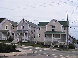
HOPE VI is a program of the United States Department of Housing and Urban Development. It is intended to revitalize the worst public housing projects in the United States into mixed-income developments. Its philosophy is largely based on New Urbanism and the concept of defensible space.

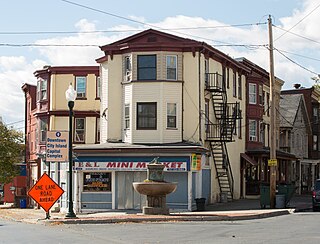
Allison Hill is a neighborhood in Harrisburg, Pennsylvania, in the United States. It is located directly east of downtown Harrisburg on a bluff overlooking the older original borough along the Susquehanna River. The Hill comprises some sub-neighborhoods, such as Hillside Village; others have nicknames such as "The Ville" and the "Third Ward". Primarily, it can be separated into three smaller neighborhoods: North Allison Hill, Central Allison Hill, and South Allison Hill. It was named after William Allison, an early Harrisburg landowner who owned farms on the bluff outside of the then-Borough. First referred to as "Allison's Farm" or "Allison's Hill Farm", it finally became shortened to "Allison Hill" as the City expanded.

The Schenley Farms Historic District, also referred to as the Schenley Farms–Oakland Civic District, is a historic district listed on the National Register of Historic Places that is located in the Oakland section of Pittsburgh, Pennsylvania, United States.
St. Clair Village was a public housing project of the Pittsburgh Housing Authority. Originally built in the 1950s, with 680 apartments, it fell into disrepair and financial difficulty along with much public housing in the city and was demolished in September 2010. Following the destruction of the St. Clair Village in 2010, the area is currently being redeveloped by the Hilltop Urban Farm, with the goal of transforming the site into the largest urban farm in the United States. It occupied the area of Pittsburgh also known as St. Clair.


