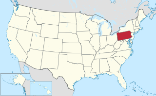
Avalon is a borough in Allegheny County, Pennsylvania, United States, along the Ohio River, 6 miles (10 km) downstream from Pittsburgh. It is a largely residential borough with a few small stores. The population was 4,705 at the 2010 census.

Baldwin is a borough in Allegheny County, Pennsylvania, United States,, and is part of the Pittsburgh Metro Area. The population was 19,767 at the 2010 census.

Franklin Park is a borough in Allegheny County, Pennsylvania, United States. The population was 13,470 at the 2010 census.

North Versailles is a first class township in Allegheny County, Pennsylvania, United States. The population was 10,229 at the 2010 census. The township derives its name from the Palace of Versailles.

Penn Hills is a township with home rule status in Allegheny County, Pennsylvania, United States. The population as of the 2010 census was 42,329. Penn Hills is the second-largest municipality in Allegheny County, after the city of Pittsburgh.

Plum is a borough in Allegheny County in the U.S. state of Pennsylvania. A suburb of Pittsburgh, Pennsylvania, it is located northeast of the city of Pittsburgh, in what is commonly referred to as the East Hills suburbs. The population was 27,126 at the 2010 census.

South Versailles Township is a township in Allegheny County, Pennsylvania, United States. The population was 351 at the 2010 census. It contains the village of Coulter, also called Coulterville or Coulters. The U.S. Post Office in the village is called Coulters.

Shaler Township is a township in Allegheny County in the U.S. state of Pennsylvania. It consists of much of the community of Glenshaw and several neighboring communities. The population was 28,757 at the 2010 census.

Wilkins Township is a township in Allegheny County, Pennsylvania, United States. The population was 6,357 at the 2010 census. It is served by Pennsylvania's 14th congressional district, the 43rd District of the Pennsylvania State Senate, and the 34th District of the Pennsylvania State House of Representatives.

The Allegheny County Belt System color codes miscellaneous county roads to form a unique system of routes in Allegheny County, Pennsylvania, and around the city of Pittsburgh.

Pennsylvania Route 65, is a major 51-mile-long (82 km) state highway located in western Pennsylvania, United States. The route, traveling north–south from the Interstate 279/U.S. Route 19 Truck concurrency in Pittsburgh north to the PA 108/PA 168 concurrency in New Castle, connects downtown Pittsburgh to the northwestern portion of the Pittsburgh Metropolitan Area. PA 65 is similar in its purpose to PA 18 and PA 51, both of which run parallel to PA 65 at one point or another; however, the three routes pass through different cities for most of their respective alignments.

Allegheny Islands State Park is a 43-acre (17 ha) Pennsylvania state park in Harmar Township, Allegheny County, Pennsylvania in the United States. The undeveloped park is composed of three alluvial islands located in the middle of the Allegheny River northeast of Pittsburgh. The islands are just north of the boroughs of Oakmont and Plum, and southwest of Cheswick. Bridges for the Pennsylvania Turnpike and the Bessemer and Lake Erie Railroad Branch of the Canadian National Railway cross the Allegheny River at the middle island.

St. Clair Township, Allegheny County, Pennsylvania, was one of the original townships created with the incorporation of Allegheny County in 1788. The township was named after Arthur St. Clair, an American Revolutionary War general and president of the Continental Congress in 1787.

Birmingham was a borough in Allegheny County, Pennsylvania, on the South Side of what is now Pittsburgh. Incorporated in 1826 from St. Clair Township, the borough comprised a section of the South Side Flats between what is now South 6th and South 17th Streets.
Herriottsville is an unincorporated community in South Fayette Township, Allegheny County, Pennsylvania, United States. The community is located in the southeast corner of the township near Chartiers Run. Herriottsville had one of the first post offices in South Fayette Township and was a stagecoach stop on the Black Horse Trail.

Collins Township was a township in Allegheny County, Pennsylvania, in the northeast part of what is now Pittsburgh. It included most of the present city east of Lawrenceville, north of Penn Avenue, and south of the Allegheny River. It was formed in 1850 from a northern portion of Peebles Township and was named for Thomas Collins, a prominent lawyer. On 30 June 1868, Collins Township along with its neighbors were incorporated into Pittsburgh. The former township became wards 18, 19, and 21 of the expanded city.

McClure Township was a township in Allegheny County, Pennsylvania within what is now the North Side of Pittsburgh. It was formed in 1859 from parts of Ross, Reserve, and Robinson townships. Its original territory, bordering Allegheny City and Manchester Borough on the south and the Ohio River on the west, included the Woods Run area and present-day Brighton Heights. Allegheny annexed portions of McClure in 1867 and 1870, and the remainder in 1873.


