Marshall-Shadeland, Pittsburgh

Last updated
Marshall-Shadeland
Brightwood
Marshall-shadeland.JPG
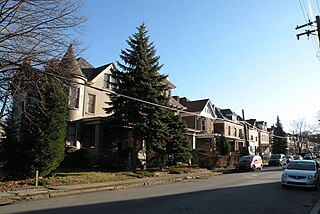
Large, early 20th-century housing in the southern portion of the neighborhood.
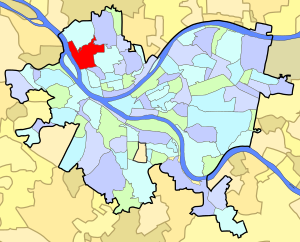
Pgh locator marshall shadeland.svg
Coordinates: 40°28′08″N80°01′55″W / 40.469°N 80.032°W / 40.469; -80.032
Country United States
State Pennsylvania
County Allegheny County
City Pittsburgh
Area
[1]
  Total1.254 sq mi (3.25 km2)
Population
 (2010) [1]
  Total6,043
  Density4,800/sq mi (1,900/km2)

Marshall-Shadeland is a neighborhood on Pittsburgh, Pennsylvania's North Side. It has a zip codes of both 15212 and 15214, and has representation on Pittsburgh City Council by the council member for District 1 (North Neighborhoods).

Contents

The neighborhood is a largely residential area that was annexed by Allegheny City in 1870. It is bordered by Woods Run Avenue on the north, Marshall Avenue on the south, and Riverview Park, Highwood Cemetery, and Uniondale Cemetery on the east. The neighborhood technically extends west to the Ohio River, but in practice the residential district ends at California Avenue. The area between California Avenue and the Ohio River is an industrial site and the home of the Woods Run Penitentiary, now known as State Correctional Institution – Pittsburgh.

The neighborhood has been home to a number of different ethnic groups and has been called a number of different names.

It was called "Woods Run" after early settler John Ross, and the neighborhood's library is still the Woods Run branch of the Carnegie Library of Pittsburgh. In an article about the library, reporter Patricia Lowry described the neighborhood by saying that "Woods Run isn't an official city neighborhood, but it has always seemed to me to be one of the most quintessentially Pittsburgh places—a valley village with some neatly kept gardens and frame houses stacked on the hillsides." [2]

It was called "Shadeland-Halls Grove" in a 1974 Neighborhood Profile by the City of Pittsburgh Department of Urban Planning, which drew a distinction between the residential neighborhood and the "Woods Run Industrial district." [3]

It was called "Marshall-Shadeland" in a 1977 Neighborhood Atlas that purported to be part of "a neighborhood information system that more closely reflects neighborhood boundaries as defined by residents instead of by public officials." [4] The Atlas stated that "Marshall-Shadeland was named for Archibald M. Marshall, Irish grocer, dry goods merchant, landscaper of West Park and a partner in the Marshall-Kennedy Milling Company. A residential area, Marshall-Shadeland is predominately Slovak, with Italians, Carpatho-Rusins, Russians, Irish and Germans also represented."

More recently, residents have been calling the area Brightwood. [5] The City of Pittsburgh's website now (2011) refers to the area as "Marshall-Shadeland (Brightwood)". [6] Area advocates have organized the Brightwood Civic Group. [7]

Surrounding and adjacent neighborhoods

Marshall-Shadeland has six land borders, including the Pittsburgh neighborhoods of Brighton Heights to the north, Perry North to the northeast, Perry South to the east, and California-Kirkbride, Manchester and Chateau to the south. Across the Ohio River to the west, Marshall-Shadeland runs adjacent with Stowe Township, McKees Rocks, and the Pittsburgh neighborhood of Esplen. The McKees Rocks Bridge westbound starts at PA Route 65 in Brighton Heights, then passes over Marshall-Shadeland, the Ohio River, Stowe Township and ends at PA Route 51 in McKees Rocks.

Transportation

Marshall-Shadeland is within the city of Pittsburgh, and is served by the Port Authority of Allegheny County, with a number of bus routes through the neighborhood.

City Steps

The Marshall-Shadeland neighborhood has 29 distinct flights of city steps - many of which are open and in a safe condition. In Marshall-Shadeland, the Steps of Pittsburgh quickly connect pedestrians to public transportation and provide an easy way to travel through this hilly, populated area. [8]

The Atmore Street city steps in Marshall Shadeland. Photo by Laura Zurowski. Atmore Street city steps Marshall Shadeland Pittsburgh.jpg
The Atmore Street city steps in Marshall Shadeland. Photo by Laura Zurowski.

See also

Related Research Articles

McKees Rocks, Pennsylvania Borough in Pennsylvania, United States

McKees Rocks, also known as "The Rocks", is a borough in Allegheny County, in western Pennsylvania, along the south bank of the Ohio River. The borough population was 6,104 at the 2010 census.

Stowe Township, Allegheny County, Pennsylvania Township in Pennsylvania, United States

Stowe Township is a township in Allegheny County, Pennsylvania, United States. The population was 6,362 at the 2010 census.

North Side (Pittsburgh) Region of Pittsburgh, Pennsylvania

North Side refers to the region of Pittsburgh, Pennsylvania, located to the north of the Allegheny River and the Ohio River. The term "North Side" does not refer to a specific neighborhood, but rather to a disparate collection of contiguous neighborhoods.

Greenfield (Pittsburgh) Neighborhood of Pittsburgh in Allegheny County, Pennsylvania, United States

Greenfield is a neighborhood in Pittsburgh, Pennsylvania, United States. It is represented on Pittsburgh City Council by Corey O'Connor.

Downtown Pittsburgh Neighborhood of Pittsburgh in Allegheny County, Pennsylvania, United States

Downtown Pittsburgh, colloquially referred to as the Golden Triangle, and officially the Central Business District, is the urban downtown center of Pittsburgh. It is located at the confluence of the Allegheny River and the Monongahela River whose joining forms the Ohio River. The "triangle" is bounded by the two rivers. The area features offices for major corporations such as PNC Bank, U.S. Steel, PPG, Bank of New York Mellon, Heinz, Federated Investors and Alcoa. It is where the fortunes of such industrial barons as Andrew Carnegie, Henry Clay Frick, Henry J. Heinz, Andrew Mellon and George Westinghouse were made. It contains the site where the French fort, Fort Duquesne, once stood.

Allegheny, Pennsylvania Former city in Pennsylvania, United States

Allegheny City was a municipality that existed in the U.S. state of Pennsylvania from 1788 until it was annexed by Pittsburgh in 1907. It was located north across the Allegheny River from downtown Pittsburgh, with its southwest border formed by the Ohio River, and is known today as the North Side. The city's waterfront district, along the Allegheny and Ohio rivers, became Pittsburgh's North Shore neighborhood.
Highland Park (Pittsburgh neighborhood) Neighborhood of Pittsburgh in Allegheny County, Pennsylvania, United States

Highland Park is a neighborhood in the northeastern part of Pittsburgh, Pennsylvania. Highland Park, the neighborhood, fully encompasses the park with the same name.

California-Kirkbride (Pittsburgh) Neighborhood of Pittsburgh in Allegheny County, Pennsylvania, United States

California-Kirkbride is a neighborhood on Pittsburgh, Pennsylvania's North Side.

Brighton Heights (Pittsburgh) Neighborhood of Pittsburgh in Allegheny County, Pennsylvania, United States

Brighton Heights is a neighborhood in Pittsburgh, Pennsylvania's northside area. It has a zip code of 15212, and has representation on Pittsburgh City Council by the council member for District 1. The Western gateway to the neighborhood, Brighton Heights Boulevard, is opposite the McKees Rocks Bridge and accessible via Route 65/Ohio River Boulevard. The Pittsburgh Bureau of Fire houses 35 Engine and 33 Truck in Brighton Heights.

Banksville (Pittsburgh) Neighborhood of Pittsburgh in Allegheny County, Pennsylvania, United States

Banksville is a neighborhood in Pittsburgh, Pennsylvania. The neighborhood of Banksville is located in the West End of the city and borders the South Hills region. Real estate agencies frequently refer to the Banksville area as Greentree City due to Banksville's shared border with the borough of Green Tree. It has two zip codes of both 15220 and 15216, and has representation in Pittsburgh City Council by the council member for District 2. Theresa Kail-Smith is the current Councilperson for district two. Banksville's primary corridor, Banksville Road, is frequently used as a gateway between the South Hills of Pittsburgh and downtown Pittsburgh via the Fort Pitt Tunnels. Banksville, formerly Union Township, joined the City of Pittsburgh around 1928.
Central Northside (Pittsburgh) Neighborhood of Pittsburgh in Allegheny County, Pennsylvania, United States

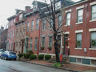
Central Northside is a neighborhood in the North Side of the city of Pittsburgh, Pennsylvania, USA. It has a zip code of 15212, and has representation on Pittsburgh City Council by the council member for District 6. Originally known as "The Buena Vista Tract", it is densely filled with restored row houses, community gardens and tree lined streets and alleyways.
East Allegheny (Pittsburgh) Neighborhood of Pittsburgh in Allegheny County, Pennsylvania, United States

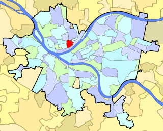
East Allegheny, also known as Deutschtown, is a neighborhood on Pittsburgh's North Side. It has a ZIP Code of 15212, and has representation on Pittsburgh City Council by the council member for District 1. The Pittsburgh Bureau of Fire houses 32 Engine and 32 Truck in Deutschtown.

Esplen (Pittsburgh) Neighborhood of Pittsburgh in Allegheny County, Pennsylvania, United States

Esplen is a neighborhood in Pittsburgh, Pennsylvania's West End. It has a zip code of 15204, and has representation on Pittsburgh City Council by the council member for District 2.
Manchester (Pittsburgh) Neighborhood in Pittsburgh, Pennsylvania, United States

Manchester is a neighborhood on Pittsburgh, Pennsylvania's North Side. It has a ZIP code of 15233, and has representation on Pittsburgh City Council by the council member for District 6. Manchester houses PBF Battalion 1 & 37 Engine, and is covered by PBP Zone 1 and the Bureau of EMS Medic 4. The neighborhood includes the Manchester Historic District, which protects, to some degree, 609 buildings over a 51.6-acre (20.9 ha) area. The district was listed on the National Register of Historic Places in 1975.

Morningside (Pittsburgh) Neighborhood of Pittsburgh in Allegheny County, Pennsylvania, United States

Morningside is a neighborhood on Pittsburgh, Pennsylvania's East End. It has two zip codes, 15201 and 15206, and has a representation on Pittsburgh City Council by Deb Gross for District 7.

Spring Garden (Pittsburgh) Neighborhood of Pittsburgh in Allegheny County, Pennsylvania, United States

Spring Garden is a small neighborhood on Pittsburgh, Pennsylvania's North Side. It takes its name from Spring Garden Avenue, which follows the floor of the valley that separates the two adjacent hilltop neighborhoods of Spring Hill and Troy Hill. Like those neighborhoods, Spring Garden was initially settled by the descendants of Germans and Austrians who had emigrated from Europe to East Allegheny in Allegheny City. These initial residents of Spring Garden worked in slaughterhouses, rendering factories, and tanneries located in this valley neighborhood.

West End (Pittsburgh) Neighborhood of Pittsburgh in Allegheny County, Pennsylvania, United States

West End Village is a neighborhood in Pittsburgh, Pennsylvania's west city area. It has a zip code of 15220, and has representation on Pittsburgh City Council by the council member for District 2.

Perry North (Pittsburgh) Neighborhood of Pittsburgh in Allegheny County, Pennsylvania, United States

Perry North is a neighborhood in Pittsburgh, Pennsylvania, USA's north city area. It lies within zip codes 15212 and 15214, and has representation on Pittsburgh City Council by the council member for District 1. The highest elevation in Pittsburgh is 1,370 feet at the Brashear Reservoir at the top of Observatory Hill. The Pittsburgh Bureau of fire houses 34 Engine in Perry North.

Perry South (Pittsburgh) Neighborhood of Pittsburgh in Allegheny County, Pennsylvania, United States

Perry South is a neighborhood on Pittsburgh, Pennsylvania's North Side.
References

  1. 1 2 "PGHSNAP 2010 Raw Census Data by Neighborhood". Pittsburgh Department of City Planning PGHSNAP Utility. 2012. Retrieved 24 June 2013.External link in |publisher= (help)
  2. Lowry, Patricia (August 9, 2006). "Places: Woods Run renovation brings light, neighborhood into library". Pittsburgh Post-Gazette. Retrieved 1 November 2011.
  3. "A Community Profile of Shadeland-Halls Grove" (PDF). Neighborhood Profiles. City of Pittsburgh Department of Urban Planning. Archived from the original (PDF) on April 15, 2012. Retrieved 1 November 2011.
  4. "An Atlas of the North Side" (PDF). Marshall-Shadeland Area of Pittsburgh. Pittsburgh Neighborhood Atlas. Archived from the original (PDF) on April 15, 2012. Retrieved 1 November 2011.
  5. "Brightwood hopes for brighter future". Pittsburgh Post-Gazette. April 30, 2007. Retrieved 1 November 2011.
  6. "Marshall-Shadeland (Brightwood)". Pittsburgh City Council District 1. City of Pittsburgh. Archived from the original on 7 July 2011. Retrieved 1 November 2011.
  7. "About Us". Brightwood Civic Group.
  8. Regan, Bob (2015). Pittsburgh Steps, The Story of the City's Public Stairways. Globe Pequot. ISBN   978-1-4930-1384-5.