
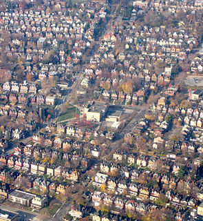
Squirrel Hill is a residential neighborhood in the East End of Pittsburgh, Pennsylvania, United States. The city officially divides it into two neighborhoods, Squirrel Hill North and Squirrel Hill South, but it is almost universally treated as a single neighborhood.

Hazelwood is a neighborhood of Pittsburgh, Pennsylvania in the United States. It is represented on Pittsburgh City Council by Corey O'Connor. It is bordered by Greenfield and Oakland on the north, Squirrel Hill and Glen Hazel on the east, and the Monongahela River on the south and west. The Pittsburgh Bureau of Fire houses 13 Engine and 13 Truck in Hazelwood.

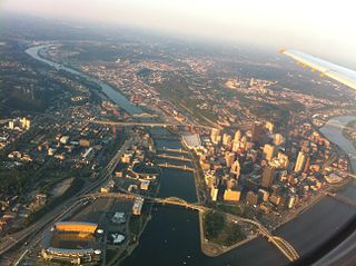
Downtown Pittsburgh, colloquially referred to as the Golden Triangle, and officially the Central Business District, is the urban downtown center of Pittsburgh. It is located at the confluence of the Allegheny River and the Monongahela River whose joining forms the Ohio River. The "triangle" is bounded by the two rivers. The area features offices for major corporations such as PNC Bank, U.S. Steel, PPG, Bank of New York Mellon, Heinz, Federated Investors and Alcoa. It is where the fortunes of such industrial barons as Andrew Carnegie, Henry Clay Frick, Henry J. Heinz, Andrew Mellon and George Westinghouse were made. It contains the site where the French fort, Fort Duquesne, once stood.
Friendship is a neighborhood of large Victorian houses in the East End of the City of Pittsburgh, Pennsylvania, United States, about four miles (6 km) east of Pittsburgh's Golden Triangle. Friendship is bordered on the north by Garfield, on the east by East Liberty, and on the south by Shadyside, and on the west by Bloomfield. It is divided into 3 Pittsburgh City Council districts.

Swisshelm Park is a neighborhood located in the southeast corner of Pittsburgh, Pennsylvania. It is represented on Pittsburgh City Council by Corey O'Connor. Swisshelm Park houses PBF 19 Engine, and is covered by PBP Zone 4 and the Bureau of EMS Medic 7.

Garfield is a neighborhood in the East End of the City of Pittsburgh, Pennsylvania, United States. Garfield is bordered on the South by Bloomfield and Friendship, on the West by the Allegheny Cemetery, on the North by Stanton Heights, and on the East by East Liberty. Like many parts of Pittsburgh, Garfield is a fairly steep neighborhood, with north-south residential streets running at about a 20% incline from Penn Avenue at the bottom to Mossfield Street at the top. Garfield is divided into “the valley” and “the hilltop.”

Uptown or The Bluff is a neighborhood in the city of Pittsburgh, Pennsylvania to the southeast of the city's Central Business District. It is bordered in the north by the Hill District and located across the Monongahela River from South Side. The predominant area zip code is 15219.

Arlington Heights is a neighborhood in the southern portion of Pittsburgh, Pennsylvania. The zip code used by residents is 15210, and this neighborhood is represented on the Pittsburgh City Council by the council member for District 3. This neighborhood is home to five government housing projects.
Spring Hill is a neighborhood on Pittsburgh, Pennsylvania's North Side. Spring Hill was named for the abundance of springs near the site. According to a 1977 Neighborhood Atlas, "Germans immigrated there from 1850 to 1920, giving the neighborhood a Bavarian atmosphere. Local street names include Rhine, Woessner, Haslage, Zoller and Goehring. In 1959 ACTION-Housing opened Spring Hill Gardens, a moderate rent, racially integrated, 209-unit apartment project at Buente and Rhine Streets. Spring Hill Gardens was Pittsburgh's first multi-family housing project backed by the Federal Housing Authority."

Brighton Heights is a neighborhood in Pittsburgh, Pennsylvania's northside area. It has a zip code of 15212, and has representation on Pittsburgh City Council by the council member for District 1. The Western gateway to the neighborhood, Brighton Heights Boulevard, is opposite the McKees Rocks Bridge and accessible via Route 65/Ohio River Boulevard. The Pittsburgh Bureau of Fire houses 35 Engine and 33 Truck in Brighton Heights.

Beechview is a neighborhood in Pittsburgh, Pennsylvania's southwestern side. It has a zip code of 15216, and has representation on Pittsburgh City Council by both the council member for District 4 and for District 2. Beechview was founded in 1905 after the introduction of a comprehensive light rail transit system. It is Pittsburgh Fire Bureau Zone 4-10 and houses Engine Company #28. It is located in Zone 6 for Pittsburgh Police. While Beechview took an economic downturn in the late 20th century, its proximity to downtown Pittsburgh, convenient access to trolley transit, sweeping vistas and new businesses have allowed Beechview to stabilize economically.

Hays is a neighborhood in the 31st Ward of the east side of Pittsburgh, Pennsylvania. It is represented on the Pittsburgh City Council by the representative of District 5. It occupies ZIP codes 15227, 15207, and 15236. It is named after James H. Hays, who opened a coal-mining operation called Hays and Haberman Mines in 1828.

Knoxville is a neighborhood in southern Pittsburgh, Pennsylvania. It is part of zip code 15210, and has representation on Pittsburgh City Council by the council member for District 3.
Lawrenceville is one of the largest neighborhood areas in Pittsburgh in the U.S. state of Pennsylvania. It is located northeast of downtown, and like many of the city's riverfront neighborhoods, it has an industrial past. The city considers Lawrenceville three neighborhoods, Upper Lawrenceville, Central Lawrenceville, and Lower Lawrenceville, but these distinctions have little practical effect. Accordingly, Lawrenceville is almost universally treated as being a single large neighborhood.
The North Shore is a neighborhood in Pittsburgh, Pennsylvania's North Side. It has a zip code of 15212, and has representation on Pittsburgh City Council by both the council members for District 1 and 6. The neighborhood is home to Heinz Field, PNC Park, and The Andy Warhol Museum.

Oakwood is a neighborhood in Pittsburgh, Pennsylvania's southwest city area. It has a zip code of 15205, and has representation on Pittsburgh City Council by the council member for District 2.

Northview Heights is a neighborhood in the North Side of the city of Pittsburgh, Pennsylvania, USA. It has a zip codes of both 15212 and 15214, and has representation on Pittsburgh City Council by the council member for District 1.

Stanton Heights is a neighborhood in Pittsburgh, Pennsylvania's east city area. It has zip codes of both 15201 and 15206, and has representation on Pittsburgh City Council by the council member for District 7. Stanton Heights is the home of PBF 7 Engine and the City's Arson Investigation Units, and is covered by PBP Zone 5 and the Bureau of EMS Medic 6.
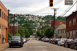
South Side Slopes is a neighborhood in Pittsburgh, Pennsylvania's South Side area. The neighborhood comprises the hills from the South Side Flats neighborhood along the Monongahela River from the Liberty Bridge (west) to beyond Josephine Street (east).
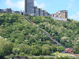
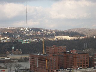
Mount Washington is a neighborhood in Pittsburgh, Pennsylvania's south city area. It has a zip code of 15211 and has representation on Pittsburgh City Council by both the council members for District 3 and District 2.
