Ben Nevis is the highest mountain in Scotland, the United Kingdom and the British Isles. The summit is 1,345 metres (4,413 ft) above sea level and is the highest land in any direction for 459 miles. Ben Nevis stands at the western end of the Grampian Mountains in the Highland region of Lochaber, close to the town of Fort William.

K2, at 8,611 metres (28,251 ft) above sea level, is the second-highest mountain on Earth, after Mount Everest. It lies in the Karakoram range, partially in the Gilgit-Baltistan region of Pakistan-administered Kashmir and partially in a China-administered territory of the Kashmir region included in the Taxkorgan Tajik Autonomous County of Xinjiang.

Mount Everest is Earth's highest mountain above sea level, located in the Mahalangur Himal sub-range of the Himalayas. The China–Nepal border runs across its summit point. Its elevation of 8,848.86 m (29,031.7 ft) was most recently established in 2020 by the Chinese and Nepali authorities.

Mount Kilimanjaro is a dormant volcano in Tanzania. It has three volcanic cones: Kibo, Mawenzi, and Shira. It is the highest mountain in Africa and the highest single free-standing mountain above sea level in the world: 5,895 metres (19,341 ft) above sea level and about 4,900 metres (16,100 ft) above its plateau base. It is the highest volcano in Africa and the Eastern Hemisphere.

Aconcagua is a mountain in the Principal Cordillera of the Andes mountain range, in Mendoza Province, Argentina. It is the highest mountain in the Americas, the highest outside Asia, and the highest in the Southern Hemisphere with a summit elevation of 6,961 metres (22,838 ft). It lies 112 kilometres northwest of the provincial capital, the city of Mendoza, about five kilometres from San Juan Province, and 15 km (9 mi) from Argentina's border with neighbouring Chile. The mountain is one of the so-called Seven Summits of the seven continents.

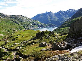
The Berwyn range is an isolated and sparsely populated area of moorland in the northeast of Wales, roughly bounded by Llangollen in the northeast, Corwen in the northwest, Bala in the southwest, and Oswestry in the southeast.

Mount Elbrus is the highest and most prominent peak in Russia and Europe. It is situated in the western part of the Caucasus and is the highest peak of the Caucasus Mountains. The dormant volcano rises 5,642 m (18,510 ft) above sea level; it is the highest stratovolcano in Eurasia, as well as the tenth-most prominent peak in the world. The mountain stands in Southern Russia, in the Russian republic of Kabardino-Balkaria.

The Zugspitze, at 2,962 m (9,718 ft) above sea level, is the highest peak of the Wetterstein Mountains as well as the highest mountain in Germany. It lies south of the town of Garmisch-Partenkirchen, and the Austria–Germany border runs over its western summit. South of the mountain is the Zugspitzplatt, a high karst plateau with numerous caves. On the flanks of the Zugspitze are three glaciers, including the two largest in Germany: the Northern Schneeferner with an area of 30.7 hectares and the Höllentalferner with an area of 24.7 hectares. The third is the Southern Schneeferner which covers 8.4 hectares.

Kebnekaise is the highest mountain in Sweden. The Kebnekaise massif, which is part of the Scandinavian mountain range, has two main peaks. The glaciated southern peak used to be the highest at 2,120 metres (6,960 ft) above sea level, but has shrunk by 24 meters during the last 50 years, making the northern icefree peak at 2,096.8 metres (6,879 ft) the highest. Kebnekaise lies in Swedish Lapland, about 150 kilometres (93 mi) north of the Arctic Circle and west of Kiruna near the Kungsleden hiking trail between Abisko and Hemavan.

A summit is a point on a surface that is higher in elevation than all points immediately adjacent to it. The topographic terms acme, apex, peak, and zenith are synonymous.
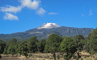
La Malinche, also known as Matlalcueye or Malintzin, is an active volcano located in the states of Tlaxcala and Puebla in Mexico. Officially, its summit reaches 4,461 metres (14,636 ft) above sea level, though it is generally considered to be closer to 4,440 metres (14,567 ft), using GPS measurements. It is the highest peak in Tlaxcala, the fifth-highest in Puebla, the sixth-highest in Mexico, the 23rd-highest in North America, and the 252nd-highest in the world. Its height above nearby cities varies from 1,908 metres (6,260 ft) above Huamantla, 2,461 metres (8,074 ft) above Villa Vicente Guerrero, 2,221 metres (7,287 ft) above Tlaxcala, to 2,299 metres (7,543 ft) above Puebla. The summit is 22.4 kilometres (13.9 mi) from Tlaxcala, 28.3 kilometres (17.6 mi) from Puebla, and 118 kilometres (73 mi) from Mexico City. The climate is cold near the summit and mild on the lower slopes.

The mountains and hills of the British Isles are categorised into various lists based on different combinations of elevation, prominence, and other criteria such as isolation. These lists are used for peak bagging, whereby hillwalkers attempt to reach all the summits on a given list, the oldest being the 282 Munros in Scotland, created in 1891.

Mullaghcleevaun at 849 metres (2,785 ft), is the 15th–highest peak in Ireland on the Arderin scale, and the 20th–highest peak on the Vandeleur-Lynam scale. Mullaghcleevaun is in the central sector of the Wicklow Mountains range, in Wicklow, Ireland; it is the 2nd highest peak in Wicklow after Lugnaquilla. Mullaghcleevaun lies on the main "central spine" of the whole range that runs from Kippure in the north, to Lugnaquillia in the south; and in particular, it lies on the continuous "central boggy ridge" that runs from the Sally Gap to Tonelagee.

Tonelagee at 817 metres (2,680 ft), is the 25th–highest peak in Ireland on the Arderin scale, and the 33rd–highest peak on the Vandeleur-Lynam scale. Tonelagee is situated in the central sector of the Wicklow Mountains range, and sits on the main "central spine" of the range that runs from Kippure in the north, to Lugnaquillia in the south; and in particular, the continuous "central boggy ridge" that runs from the Sally Gap in the north, via Mullaghcleevaun, to Tonelagee. Tonelagee is the third highest peak in Wicklow after Lugnaquilla and Mullaghcleevaun.
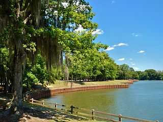
The Roods Landing Site or Roods Creek Mounds (9SW1) is an archaeological site located south of Omaha, Stewart County, Georgia, United States at the confluence of Rood Creek and the Chattahoochee River. It is a Middle Woodland / Mississippian period Pre-Columbian complex of earthen mounds. It was entered on the National Register of Historic Places on August 19, 1975.

An ultra-prominent peak, or Ultra for short, is a mountain summit with a topographic prominence of 1,500 metres (4,900 ft) or more; it is also called a P1500. The prominence of a peak is the minimum height of climb to the summit on any route from a higher peak, or from sea level if there is no higher peak. There are approximately 1,524 such peaks on Earth. Some well-known peaks, such as the Matterhorn and Eiger, are not Ultras because they are connected to higher mountains by high cols and therefore do not achieve enough topographic prominence.

The topographic isolation of a summit is the minimum distance to a point of equal elevation, representing a radius of dominance in which the peak is the highest point. It can be calculated for small hills and islands as well as for major mountain peaks and can even be calculated for submarine summits.

Baurtregaum at 851 metres (2,792 ft), is the 13th–highest peak in Ireland on the Arderin scale, and the 18th–highest peak on the Vandeleur-Lynam scale. Baurtregaum is situated at the centre of the massif of the Slieve Mish Mountains in the Dingle Peninsula in Kerry, Ireland, and is the tallest mountain of the Slieve Mish range, with a number of major subsidiary summits.