
The river Ticino is the most important perennial left-bank tributary of the Po. It has given its name to the Swiss canton through which its upper portion flows.

The Gotthard Pass or St. Gotthard Pass at 2,106 m (6,909 ft) is a mountain pass in the Alps traversing the Saint-Gotthard Massif and connecting northern with southern Switzerland. The pass lies between Airolo in the Italian-speaking canton of Ticino, and Andermatt in the German-speaking canton of Uri, and connects further Bellinzona to Lucerne, Basel, and Zurich. The Gotthard Pass lies at the heart of the Gotthard, a major transport axis of Europe, and it is crossed by three traffic tunnels, each being the world's longest at the time of their construction: the Gotthard Rail Tunnel (1882), the Gotthard Road Tunnel (1980) and the Gotthard Base Tunnel (2016). With the Lötschberg to the west, the Gotthard is one of the two main north-south routes through the Swiss Alps.

Monti della Laga is a mountain range in the central Apennines of Italy. Their ruggedness and inaccessibility makes them one of the lesser known areas of the Italian peninsula.

Pizzo di Cassimoi is a mountain of the Lepontine Alps, located on the border between the Swiss cantons of Ticino (west) and Graubünden (east). The mountain overlooks two lakes: Lago di Luzzone on its north-eastern side and Zervreilasee on its north-eastern side.

The Zapporthorn or Pizzo Zapport is a mountain of the Swiss Lepontine Alps, overlooking San Bernardino Pass in Graubünden. Its summit is the tripoint between the valleys of Hinterrhein, Calanca and Mesolcina. The summit is located approximately two kilometres east from the Ticino border.

Pizzo Barone is a mountain of the Lepontine Alps in Switzerland. It is located south of Pizzo Campo Tencia and is the highest summit of the Valle Verzasca in the canton of Ticino. From Sonogno a trail leads to the summit.

Pizzo di Claro is a 2,727 metres high mountain of the Lepontine Alps, located on the border between the Swiss cantons of Ticino and Graubünden. It overlooks Claro on its western side, although Cresciano is closer. On its eastern side it overlooks the valley of Calanca near Arvigo (Graubünden). A small lake lies west of the summit at 2,198 metres, Lago Canee.

The Cima della Bondasca or Pizzo del Ferro centrale is a mountain in the Bregaglia Range (Alps), located on the border between Italy and Switzerland. Its summit is the triple watershed between Valle del Ferro (Italy), Val Bondasca and Val d'Albigna (Switzerland).

Pizzo Peloso is a mountain in the Swiss Lepontine Alps, located west of Maggia in the canton of Ticino. It lies between the valleys of Vergeletto, Onsernone and Maggia. The closest higher summit is Pizzo Cramalina on the north-west side
The Corona di Redorta is a mountain of the Swiss Lepontine Alps, located between Lavizzara and Sonogno in the canton of Ticino. Culminating at a height of 2,804 metres above sea level, the Corona di Redorta is the second highest summit of the Valle Verzasca, after Pizzo Barone.

Pizzo Erra is a mountain of the Lepontine Alps, located in the Swiss canton of Ticino. It is located south of the pass of Basso di Nara, on the subrange that separates the main valley of Leventina from the valley of Blenio. At 2,416 metres (7,927 ft) above sea level, its summit can be accessed with trails from both western and eastern side.
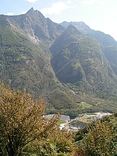
Pizzo Magn or Monte Crenone is a mountain of the Swiss Lepontine Alps, overlooking Biasca in the canton of Ticino. It is located west of the Mottone di Cava.

Lago di Ortiglieto is a reservoir in northwest Italy which straddles the Metropolitan City of Genoa in Liguria, and the Province of Alessandria in Piedmont.

Pizzo Camino is a mountain in the Bergamo Prealps, with a height of 2,492 metres (8,176 ft).
Pizzo Ferré is a mountain of the Lepontine Alps, located west of Isola in the Italian region of Lombardy. The Swiss border runs 140 metres west of the summit at approximately 3,040 m.

Pizzo Diei is a mountain of the Lepontine Alps in Piedmont, northern Italy. It is located in the Alpe Veglia Nature Park in the commune of Varzo, and has a slightly lower sister peak, the pyramidal shaped Monte Cistella. The mountain is a popular ski mountaineering peak and its summit offers fine views of the Monte Rosa Massif.

Bric del Dente is a 1107 metres high mountain of the Apennines located in the Italian region of Liguria.
The Viso Mozzo is a 3,019 metres high mountain on the Italian side of the Cottian Alps.
Alessandra Boarelli was an Italian mountaineer and, in 1864, became the first woman to summit Monviso in the Alps.

The Monte Fantino is a mountain of the Ligurian Alps located in Piedmont.

