Related Research Articles

Etna is a city in the Scott Valley area of Siskiyou County, California, United States. Its population is 678 as of the 2020 census, down from 737 from the 2010 census.

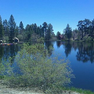
Fort Jones is a city in the Scott Valley area of Siskiyou County, California, United States. Like many of the communities that surround Mount Shasta, it lies in the southern tip of the Cascadia bioregion. Its population is 695 as of the 2020 census, down from 839 from the 2010 census.

Gazelle is a census-designated place (CDP) in Siskiyou County, California, United States. Its population is 95 as of the 2020 census, up from 70 from the 2010 census.

Macdoel is a census-designated place (CDP) in Siskiyou County, California, United States. Macdoel is located on U.S. Route 97 approximately halfway between Klamath Falls, Oregon and Weed. Its population is 86 as of the 2020 census, down from 133 from the 2010 census.

McCloud is a small town and census-designated place (CDP) in Siskiyou County, California, United States. Its population is 945 as of the 2020 census, down from 1,101 from the 2010 census.

Klamath County was a county of California from 1851 to 1874. During its existence, the county seat moved twice and ultimately portions of the territory it once had were carved up and added to nearby counties. It was formed from the northwestern portion of Trinity County, and originally included all of the northwestern part of the state, from the Mad River in the south to Oregon in the north, from the Pacific Ocean in the west to the middle of what is now Siskiyou County in the east. It is the only county in California to be disestablished.

The Shasta Cascade region of California is located in the northeastern and north-central sections of the state bordering Oregon and Nevada, including far northern parts of the Central Valley and the Sierra Nevada mountain range.
Portuguese Flat was a California mining camp of the early 1850s during the California Gold Rush, consisting largely of Portuguese miners. It was located about 35 miles north of Redding, California near what is currently now the unincorporated community of Pollard Flat. It is in the ZIP code area of 96051 and the area code 530.
The Quartz Valley Indian Community of the Quartz Valley Reservation of California is a federally recognized tribe of Klamath, Karuk, and Shasta Indians in Siskiyou County, California.

Castella is a small, unincorporated community in the upper Sacramento Canyon of Shasta County, California. It is located 46 miles north of Redding on Interstate 5, and is home to Castle Crags State Park. Its population is 214 as of the 2020 census, down from 240 from the 2010 census. It has a Chevron gas station/store and a post office. The ZIP Code is 96017. The community is inside area code 530.

Castle Lake is a glacial lake located in the Trinity Mountains, in Siskiyou County of northern California. It is west of Mount Shasta City and Mount Shasta peak.
Cedar Lake is an artificial lake in the San Bernardino Mountains of California that has appeared in dozens of Western films. It is the centerpiece of Cedar Lake Camp, a private retreat center owned and operated by Cedar Lake Camp, Inc., a non profit public benefit corporation.

Sawyers Bar is an unincorporated community located on the North Fork Salmon River in unincorporated Siskiyou County, California, not to be confused with a Sawyers or Lawyers Bar in Del Norte County.
Bestville is an unincorporated community in on the North Fork Salmon River in Siskiyou County, California, just downstream from Sawyers Bar. Bestville is located at 41.3007°N 123.1431°W.
Little Shasta is an unincorporated community in Siskiyou County, California.
Big Spring is an artesian spring in Siskiyou County, California.
Black Bear is a populated place, originally a gold mining town in Klamath County, now in unincorporated Siskiyou County, California.
Hooperville, a former gold mining camp, near Fort Jones in the 1850s in Siskiyou County, California. Its site lies at an elevation of 3054 feet,. The village site is on Indian Creek road, and Schoolhouse Gap fort jones ca. There are a few mines left (private) and the obvious remains of the stamp mill footings.

Oro Fino is a populated place, formerly a gold mining town near Fort Jones in the 1850s, in unincorporated Siskiyou County, California. Its site lies at an elevation of 2,871 ft (875 m). Oro Fino addresses are all within Fort Jones.
Beaughton Creek is a stream located in the U.S. state of California. A tributary of the Shasta River, it is located in Siskiyou County.
References
- ↑ U.S. Geological Survey Geographic Names Information System: Cheeseville, California
- ↑ "Cheeseville (Siskiyou County, California): Census Information". roadsidethoughts.com. Retrieved April 18, 2018.
Municipalities and communities of Siskiyou County, California, United States | ||
|---|---|---|
| Cities |  | |
| CDPs | ||
| Unincorporated communities | ||
| Indian reservation | ||
| Ghost towns | ||
| Footnotes | ‡This populated place also has portions in an adjacent county or counties | |
41°31′15″N122°53′59″W / 41.52083°N 122.89972°W
| | This Siskiyou County, California-related article is a stub. You can help Wikipedia by expanding it. |