
The Calapooya Mountains are a mountain range in Lane and Douglas counties of southwestern Oregon in the United States. The range runs for approximately 60 miles (97 km) west from the Cascade Range between Eugene on the north and Roseburg on the south.

The Tualatin Valley is a farming and suburban region southwest of Portland, Oregon. The valley is formed by the meandering Tualatin River, a tributary of the Willamette River at the northwest corner of the Willamette Valley, east of the Northern Oregon Coast Range. Most of the valley is located within Washington County, separated from Portland by the Tualatin Mountains. Communities in the Tualatin Valley include Banks, Forest Grove, Cornelius, Hillsboro, Aloha, Beaverton, Sherwood, Tigard, and Tualatin.

Springbrook is an unincorporated community within the city of Newberg, in Yamhill County, Oregon, United States. The community was originally named "Hoskins", after pioneer Cyrus E. Hoskins, who settled in the area. When a post office was established on June 30, 1893, the name was changed to Springbrook, since there was already a Hoskins, Oregon in Benton County. The post office closed in 1961.
The state of Oregon in the United States has established an international reputation for its production of wine, ranking fourth in the country behind California, Washington, and New York. Oregon has several different growing regions within the state's borders that are well-suited to the cultivation of grapes; additional regions straddle the border between Oregon and the states of Washington and Idaho. Wine making dates back to pioneer times in the 1840s, with commercial production beginning in the 1960s.
The history of Oregon wine production stretches back to before the state was incorporated. Settlers to the Oregon Territory planted grapes as early as the 1840s, however the production of wine has only been a significant industry in Oregon since the 1960s. Oregon wines first achieved significant critical notice in the late 1970s; in 2005, the industry sold 1.6 million cases of Oregon vintages with a retail value of US$184.7 million. In 2015, there were 702 wineries and 28,034 acres of vitis vinifera planted.

The Willamette Valley AVA is an American Viticultural Area which lies in the Willamette Valley of Oregon. The AVA is the wine growing region which encompasses the drainage basin of the Willamette River. It stretches from the Columbia River in the north to just south of Eugene in the south, where the Willamette Valley ends; and from the Oregon Coast Range in the west to the Cascade Mountains in the east. At 5,360 square miles (13,900 km2), it is the largest AVA in the state, and contains most of the state's wineries; approximately 908 as of 2021.

The Dundee Hills AVA is an American Viticultural Area located in Yamhill County, Oregon. It is entirely contained within the Willamette Valley AVA, and is approximately 28 miles (45 km) southwest of Portland, near the towns of Dundee and Dayton. The area is 6,940 acres (2,809 ha) in total size, with 1,300 acres (526 ha) planted with grapes. The Dundee Hills are a north-south oriented line of hills on the western side of the Willamette River valley. The soil is red in color, rich in iron, relatively infertile, making it suitable for grape cultivation. The region gets 30 inches (76 cm) to 45 inches (114 cm) of rainfall per year. The Chehalem Mountains to the north protect the region from the cool breezes that enter Willamette Valley from the Columbia Gorge. Over 25 wineries and independent vineyards in this region produce over 44,000 cases of wine.

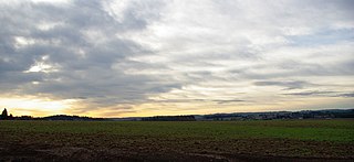
The Ribbon Ridge AVA is an American Viticultural Area in Yamhill County, Oregon. It is the smallest AVA in Oregon and is entirely contained within the Chehalem Mountains AVA, which in turn is entirely contained within the larger Willamette Valley AVA. Ribbon Ridge stretches between the towns of Newberg and Gaston. The ridge is defined by local geographic boundaries and an uplift of ocean sediment. It lies at 45° 21' N latitude and 123° 04' W longitude, at the northwest end of the Chehalem Mountains. Colby Carter, an early settler from Missouri, named Ribbon Ridge in 1865, and the ridge has been known by that name ever since. The first official use of the Ribbon Ridge name dates to 1888 with the creation of Ribbon Ridge School District No. 68. The ridge is approximately 0.25 miles (0.40 km) wide and 3.50 miles (5.63 km) long, and is 3,350 acres (1,356 ha) in area, with 500 acres (202 ha) planted on 20 vineyards. It is estimated that between 1,000 acres (405 ha) and 1,400 acres (567 ha) in the region is suitable for planting.

Bald Peak State Scenic Viewpoint is a state park located atop Bald Peak located in Yamhill County, in the United States. The day use only park offers picnic tables and a hiking trail for views of the Willamette Valley and the Cascade Range. The state of Oregon acquired the 26 acres (11 ha) in 1931 after Yamhill and Washington counties requested a park from the state.

The Chehalem Mountains AVA is an American Viticultural Area {AVA) located in the Yamhill and Washington counties of northwestern Oregon. It contains two sub-regions, Laurelwood District AVA and Ribbon Ridge AVA.

The Eola-Amity Hills AVA is an American Viticultural Area located in Polk County and Yamhill County, Oregon. It is entirely contained within the Willamette Valley AVA, and stretches from the city of Amity in the north to Salem in the south. The Eola and Amity hills cover an area west of the Willamette River approximately 15 miles (24 km) long by 6 miles (10 km) wide. The Eola-Amity Hills area benefits from steady winds off the Pacific Ocean that reach the Willamette Valley through the Van Duzer Corridor, a gap in the Oregon Coast Range, moderating the summer temperatures. The Eola Hills were named after the community of Eola, whose name was derived from Aeolus, the Greek god of the winds.
The Tualatin Plains are a prairie area in central Washington County, Oregon, United States. Located around the Hillsboro and Forest Grove areas, the plains were first inhabited by the Atfalati band of the Kalapuya group of Native Americans. Euro-American settlement began in the 1840s.

The Chehalem berry is a cross between the Himalayan blackberry and the Santiam berry, which is itself a cross between the California blackberry and the loganberry.

Bald Peak is a mountain top and highest point in the Chehalem Mountains in the Northwest area of the U.S. state of Oregon. Located in Yamhill County near the county line with Washington County, the summit at 1624+ feet is the highest point in the Willamette Valley. Bald Peak State Scenic Viewpoint is a 26-acre (11 ha) state park located on the peak.

Chehalem Creek is a tributary of the Willamette River in Yamhill County in the U.S. state of Oregon. It drains a watershed of 43,400 acres (176 km2), about 68 square miles. Its headwaters rise on the eastern slope of the Northern Oregon Coast Range above Larsen Reservoir 6 miles (10 km) southeast of Gaston and discharge into the Willamette near Newberg. The word "Chehalem" is a corruption of the Atfalati Indian word "'Chahelim'", a name given in 1877 to one of the bands of Atfalati.
Chehalem is an unincorporated community in Washington County, Oregon, United States, located southwest of Sherwood along Oregon Route 99W. The word "Chehalem" is a corruption of the Atfalati word "Chahelim," a name given in 1877 to one of the bands of Atfalati.
Laurelwood District is an American Viticultural Area (AVA) located west of the city of Portland and lies entirely within the northern end of Willamette Valley AVA with the Chehalem Mountains AVA covering its northern slopes including the towns of Cornelius, Scholls and Sherwood in Washington County. The district was established on May 13, 2020, by the Alcohol and Tobacco Tax and Trade Bureau (TTB). Its coverage is approximately 33,600 acres (13,597 ha) and contains 25 wineries and approximately 70 commercially-producing vineyards that plant approximately 975 acres (395 ha). The distinguishing feature of the Laurelwood District is the predominance of the Laurelwood soil that predominates in the area. The district contains the highest concentration of the namesake soil in Oregon.
Tualatin Hills is an American Viticultural Area (AVA) located due west of Portland and just east from the Oregon Coast Range in the upland hills of the Tualatin River watershed and encompasses elevations between 200 and 1,000 feet. It was established on May 13, 2020 by the Alcohol and Tobacco Tax and Trade Bureau (TTB). It lies entirely within the northern most location of the Willamette Valley AVA in and around towns like Gaston, Forest Grove, Sherwood and Cornelius. To the south and southeast are the Chehalem Mountains with elevations of over 1,000 feet (300 m) and considered to be a separate, distinct landform from the uplands within Tualatin Hills. The region stretches over approximately 144,000 acres (225 sq mi) and contains 21 wineries with 33 commercially-producing vineyards that covers approximately 860.5 acres (348 ha). The distinguishing features of Tualatin Hills are its soils, elevation, and climate.
