
Washington County is one of 36 counties in the U.S. state of Oregon and part of the Portland metropolitan area. The 2020 census recorded the population as 600,372, making it the second most populous county in the state and most populous "Washington County" in the United States. Hillsboro is the county seat and largest city, while other major cities include Beaverton, Tigard, Cornelius, Banks, Gaston, Sherwood, North Plains, and Forest Grove, the county's oldest city. Originally named Twality when created in 1843, the Oregon Territorial Legislature renamed it for the nation's first president in 1849 and included the entire northwest corner of Oregon before new counties were created in 1854. The Tualatin River and its drainage basin lie almost entirely within the county, which shares its boundaries with the Tualatin Valley. It is bordered on the west and north by the Northern Oregon Coast Range, on the south by the Chehalem Mountains, and on the north and east by the Tualatin Mountains, or West Hills.

Yamhill County is one of the 36 counties in the U.S. state of Oregon. As of the 2020 census, the population was 107,722. The county seat is McMinnville. Yamhill County was named after the Yamhelas, members of the Kalapuya Tribe.

The Yamhill River is an 11-mile (18 km) tributary of the Willamette River, in the U.S. state of Oregon. Formed by the confluence of the South Yamhill River and the North Yamhill River about 3 miles (5 km) east of McMinnville, it drains part of the Northern Oregon Coast Range. The river meanders east past Dayton to join the Willamette River at its river mile (RM) 55 or river kilometer (RK) 89, south of Newberg.

The North Yamhill River is a 31-mile (50 km) tributary of the Yamhill River in the U.S. state of Oregon. It drains an area of the Northern Oregon Coast Range, as well as part of the Willamette Valley west of the Willamette River.

The Tualatin Valley is a farming and suburban region southwest of Portland, Oregon. The valley is formed by the meandering Tualatin River, a tributary of the Willamette River at the northwest corner of the Willamette Valley, east of the Northern Oregon Coast Range. Most of the valley is located within Washington County, separated from Portland by the Tualatin Mountains. Communities in the Tualatin Valley include Banks, Forest Grove, Cornelius, Hillsboro, Aloha, Beaverton, Sherwood, Tigard, and Tualatin.
The Willamette National Forest is a National Forest located in the central portion of the Cascade Range of the U.S. state of Oregon. It comprises 1,678,031 acres (6,790.75 km2). Over 380,000 acres are designated wilderness which include seven major mountain peaks. There are also several National Wild and Scenic Rivers within the forest. The forest is named for the Willamette River, which has its headwaters in the forest. The forest's headquarters are located in the city of Springfield. There are local ranger district offices in McKenzie Bridge, Detroit, Sweet Home, and Westfir.

Springbrook is an unincorporated community within the city of Newberg, in Yamhill County, Oregon, United States. The community was originally named "Hoskins", after pioneer Cyrus E. Hoskins, who settled in the area. When a post office was established on June 30, 1893, the name was changed to Springbrook, since there was already a Hoskins, Oregon in Benton County. The post office closed in 1961.

Willamette Valley is an American Viticultural Area (AVA) which lies in the Willamette Valley of Oregon. The AVA is the wine growing region which encompasses the drainage basin of the Willamette River. It stretches from the Columbia River in the north to just south of Eugene in the south, where the Willamette Valley ends; and from the Oregon Coast Range in the west to the Cascade Mountains in the east. At 5,360 square miles, it is the largest AVA in the state, and contains most of the state's wineries; approximately 908 as of 2021.

Dundee Hills is an American Viticultural Area (AVA) located in Yamhill County, Oregon within the Willamette Valley AVA, and is located about approximately 28 miles (45 km) southwest of Portland, Oregon, and about 40 miles (64 km) inland from the Pacific Ocean near the town of Newberg. It was established on November 30, 2004 by the Alcohol and Tobacco Tax and Trade Bureau (TTB), Treasury after reviewing a petition submitted from Alex Sokol Blosser, secretary of the North Willamette Valley AVA Group, proposing the establishment of the 6,490-acre "Red Hills" viticultural area in Yamhill County. The petitioner subsequently amended the area’s name to "Dundee Hills." The area is 6,940 acres (2,810 ha) in total size, with {{convert|1300|acre} planted with grapes. The Dundee Hills are a north-south oriented line of hills on the western side of the Willamette River valley. The soil is Jory series reddish silt, clay and loam, moderately fertile and well-drained suitable for grape cultivation. The region gets 30 to 45 inches (760–1,140 mm) of rainfall per year. The Chehalem Mountains to the north protect the region from the cool breezes that enter Willamette Valley from the Columbia Gorge. Over 25 wineries and independent vineyards in this region produce over 44,000 cases of wine.

Laurelwood is an unincorporated community in Washington County, Oregon, United States. The community is located southwest of the Portland metropolitan area near Oregon Route 47 along Laurelwood Road, to the east of the city of Gaston and Wapato Lake. Laurelwood, a farming community, has a population of approximately 500 people. Settled in the 1860s, the community was home to Laurelwood Academy from 1904 until 2007. A large portion of the community is of the Seventh-day Adventist faith.

The Oregon Coast Range, often called simply the Coast Range and sometimes the Pacific Coast Range, is a mountain range, in the Pacific Coast Ranges physiographic region, in the U.S. state of Oregon along the Pacific Ocean. This north-south running range extends over 200 miles (320 km) from the Columbia River in the north on the border of Oregon and Washington, south to the middle fork of the Coquille River. It is 30 to 60 miles wide and averages around 1,500 feet (460 m) in elevation above sea level. The coast range has three main sections, a Northern, Central, and Southern.

Bald Peak State Scenic Viewpoint is a state park located atop Bald Peak located in Yamhill County, in the United States. The day use only park offers picnic tables and a hiking trail for views of the Willamette Valley and the Cascade Range. The state of Oregon acquired the 26 acres (11 ha) in 1931 after Yamhill and Washington counties requested a park from the state.

The Siuslaw National Forest is a national forest in western Oregon in the United States. Established in 1908, the Siuslaw is made up of a wide variety of ecosystems, ranging from coastal forests to sand dunes.

The Chehalem Mountains AVA is an American Viticultural Area (AVA) located in the Yamhill and Washington counties of northwestern Oregon. It contains two sub-regions, Laurelwood District AVA and Ribbon Ridge AVA.
The Chehalem Mountains are a mountain range located in the Willamette Valley in the U.S. state of Oregon. Forming the southern boundary of the Tualatin Valley, the Chehalems are the highest mountains in the Willamette Valley. The range extends from the Willamette River east of Newberg northwest to the foothills of the Oregon Coast Range south of Forest Grove.

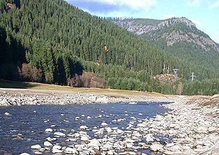
Chehalem Creek is a tributary of the Willamette River in Yamhill County in the U.S. state of Oregon. It drains a watershed of 43,400 acres (176 km2), about 68 square miles. Its headwaters rise on the eastern slope of the Northern Oregon Coast Range above Larsen Reservoir 6 miles (10 km) southeast of Gaston and discharge into the Willamette near Newberg. The word "Chehalem" is a corruption of the Atfalati Indian word "'Chahelim'", a name given in 1877 to one of the bands of Atfalati.

The Willamette Valley is a 150-mile (240 km) long valley in Oregon, in the Pacific Northwest region of the United States. The Willamette River flows the entire length of the valley and is surrounded by mountains on three sides: the Cascade Range to the east, the Oregon Coast Range to the west, and the Calapooya Mountains to the south.

The 2020 Oregon wildfire season was the most destructive on record in the state of Oregon. The season is a part of the 2020 Western United States wildfire season. The fires killed at least 11 people, burned more than 1,000,000 acres (400,000 ha) of land, and destroyed thousands of homes.

Chehalem Ridge Nature Park is a 1,260 acres (510 ha) nature park in the Portland metropolitan area in the U.S. state of Oregon. Opened in 2021, the park is owned and operated by Metro, the regional government in the Oregon portion of the metro area. This is despite that the park is located outside the regional government's boundary. The park is named after the Chehalem Mountains, where the park is located. The park is located off Dixon Mill Road, east of Gaston between Oregon Route 47 and Oregon Route 219.

