
Kottayam is one of 14 districts in the Indian state of Kerala. Kottayam district comprises six municipal towns: Kottayam, Changanassery, Pala, Erattupetta, Ettumanoor, and Vaikom. It is the only district in Kerala that does not border either the Arabian Sea or another Indian state.

Meenachil is the north-eastern region of Kottayam district in Kerala, south India. The name originates from Meenakshi, the Hindu Goddess. Pala is the main city in Meenachil. The arterial river of the district is also named Meenachil.
Malloossery is a small village in Kottayam district of Kerala state, south India. It is close to Kottayam. Private buses that travel to this small village from Kottayam city. It is mainly an agriculture based village, but the new generation is leaving this field and looking for professional jobs. Christians, Hindus and Muslims live together here. St. Thomas Catholic Church, St. Sebastian's Catholic Church, St. George Knanaya Jacobite Chappel, Thidamboor Temple, Malloorkulangara Mahadeva Temple and Malloossery Juma Masjid are the main worship centres. The Feast of St. Mary at St. Thomas Catholic Church is very famous here.

Manarcad is a small town in Kottayam district of Kerala state, South India. It is known for the Manarcad Perunnal, the annual feast at the St. Mary's Church, which is usually held from September 1–8. It is located about 9 km from the town of Kottayam and is on the way to tourist town of Thekkady.

Perumbavoor is a municipality in the Ernakulam district of Kerala, India. It is located 24 km (14.9 mi) north of the district collectorate in Thrikkakara and about 221 km (137.3 mi) north of the state capital Thiruvananthapuram. Perumbavoor is part of the Kochi metropolitan area and is located 32 km (19.9 mi) northeast of the Kochi city centre. As per the 2011 Indian census, Perumbavoor has a population of 28,110 people, and a population density of 2,065/km2 (5,350/sq mi).

Uzhavoor is an expanding town in Kottayam district, Kerala in India. It is just 32 km away from the administrative capital Kottayam District. Most of its residents are either wealthy farmers or businessmen. Many of the houses belong to NRIs. The tenth President of India, K. R. Narayanan, was born and brought up in this village. The newly expanded road which connects the city of Pala and other destinations such as Sabarimala to the city of Muvattupuzha passes through Uzhavoor. The town is 177 km from the state capital Thiruvananthapuram.
Pallom is a block situated 6.5 km south of Kottayam town and 12.4 km north of Changanassery, in the Kerala State. The nearest airport is the Cochin Nedumbassery International Airport which can be reached within 2 hours. Nearest local railway station is Chingavanam (3.6 km) and Major railway station is Kottayam (6 km).

Piravom is a municipality in the Ernakulam district of Kerala, India. It is located 22 km (13.7 mi) south of the district collectorate in Thrikkakara and about 162 km (100.7 mi) north of the state capital Thiruvananthapuram. As per the 2011 Indian census, Piravom has a population of 27,229 people, and a population density of 927/km2 (2,400/sq mi). The majority of people living in Piravom are Syrian Christians.

Kurichy is a village in Changanacherry Municipality in Kottayam district, in the southern Indian state of Kerala.

Neelamperoor is a village in Kuttanad, Alappuzha district, Kerala. It is famous for its backwaters, lakes and paddy fields. People comprises both Hindu and Christian denominations.
Karunagappally is a municipality in the Kollam district of Kerala, India. It is 24 km north of Kollam and 60 km (37 mi) south of Alappuzha. Karunagappally taluk consists of Alappad, Ochira, Adinad, Karunagappally, Thazhava, Pavumba, Thodiyoor, Kallalibhagom, Thevalakkara, Chavara, Neendakara, Clappana, Kulasekharapuram, Thekkumbhagam, Ayanivelikulangara, Panmana, Ponmana and Vadakumthala. The taluk is bound on the north by Kayamkulam, on the east by Kunnathur taluk, on the south by Kollam and on the west by the Arabian Sea. It is one of the fastest developing towns in Kerala and is part of Kollam metropolitan area.

Peroor is a village in Kottayam district of Kerala, India. It is located 3 km (1.8 mi) from the town Ettumanoor and contains more than five different settlement colonies.
Vakathanam is a Panchayat in Kottayam district of Kerala, India. It is 12 kilometres (7.5 mi) from Kottayam on the way to Changanassery via Puthupally. Vakathanam panchayat consists of two villages: Vakathanam and Thottakkad.
Perumpilly, also Perumpally, is a village in Kanayannur taluk of Ernakulam district in Kerala state, south India. It is 22 km (14 mi) south-east of Ernakulam city. Perumpilly is famous for historic Christian churches and Hindu temples. The village lies 14 km (8.7 mi) from Piravom. The nearest town is Mulanthuruthy.
Kavumbhagom, also spelled Kavumbhagam, is a ward and a census village in Thiruvalla municipality, in the Pathanamthitta district of Kerala, India. The village has a population of 6644 as of 2011. Kavumbhagom is an important junction serving as a major road route connecting Changanasserry, Thiruvalla, Chathenkary, and Mavelikkara. The Thiruvalla Sree Vallabha temple, after which the town of Thiruvalla has been named, is located in Kavumbhagom.

Vallicode-Kottayam is a village in Pathanamthitta district in the state of Kerala, India. Vallicode-Kottayam village is a part of Konni Taluk, District of Kerala State, India.
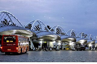
Vyttila, IPA:[ʋɐjt̺ːilɐ], is a ward in the city of Kochi, Kerala. It is a prominent area located in southern Kochi. The Vyttila junction is the busiest as well as the largest intersection in Kerala. This node intersects the main north–south artery of the state of Kerala, namely, the Kochi Bypass, with three city roads of Kochi viz, the S. A. Road, the Vyttila-Petta Road, and the Thammanam Road.
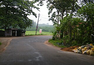
Chingavanam is a suburb of Kottayam city between Kottayam and Changanassery in Kottayam district of Kerala state, India.
Perumbavoor has many Hindu temples, Muslim mosques and Christian churches. As the area is dominated by expatriate north Indian workers, some places of worship cater to the taste of North Indian devotees.
Reflecting the religious constitution of the population, a large number of Hindu temples and Christian churches dot the townscape of Kottayam district. Some of them are the Thirunakkara Mahadeva temple, Kumaranalloor Devi temple, Thiruvarrpu Sri Krishna Temple, Thaliyil Mahadeva Temple, Pallippurathukavu Bhagavathi Temple, Elia Cathedral, Kottayam Valiya Pally, Manarcad Cathedral, Cheriya Palli, CSI Holy Trinity cathedral, Puthuppally St. George Church and Thazhathangadi Juma Masjid. All the temples of Kottayam were also built under royal patronage of Hinduism during the 2nd millennium.

