Chilamkur

Last updated

Chilamakur
చిలమకూరు
Chilamkur, Chilamakuru
India Andhra Pradesh location map (current).svg
Red pog.svg
Chilamakur
Location in Andhra Pradesh, India
India location map.svg
Red pog.svg
Chilamakur
Chilamakur (India)
Coordinates: 14°38′51″N78°28′08″E / 14.647626°N 78.469000°E / 14.647626; 78.469000
CountryFlag of India.svg  India
State Andhra Pradesh
District Kadapa
Mandal Yerraguntla
Government
  TypeAndhra Pradesh Government
Elevation
152 m (499 ft)
Population
 (Population (2011))
  Total11,239
Languages
  Official Telugu Urdu
Time zone UTC+5:30 (IST)
PIN

Chilamakur is a village located in the Kadapa district of Andhra Pradesh, India. It is located in the Yerraguntla mandal of the Kadapa revenue division. Chilamakur is one of the industrial areas located in Kadapa District. Sri Agasteswara Swamy temple is the oldest temple in Chilamakur which is noted by Archaeological Survey of India (ASI).

Contents

As of 2011, its population was 11,239, 5,601 of those being men, and 5,638 being women. The total number of homes was 2,743.

Education

Primary and secondary school education in Chilamkur is overseen by the Andhra Pradesh government, under the School Education Department of the state. The official languages of instruction in schools are English and Telugu.

Medical Facilities

Government medical facility There is one Primary Health Center maintained by the Government of Andhra Pradesh Medical Department. It is open 24h a day. It covers 10 villages around Chilamakur. One MBBS Doctor, Four ANM’s nurses, One Paramedical staff and one Medicine re-presentator

Veterinary clinic There is a veterinary clinic also available at Chilamakur.

Water Facility

Protected drinking water supply through the taps in the village is underway. The village receives water through hand pumps throughout the year. Drinking water to the village through the pond.

Power

The village has electricity supply system for household needs. Power supply for 7 hours a day for agriculture and 10 hours for commercial use.

Land use

Land use in Chilamakur is as follows:

Forest: 263 hectares

Non-agricultural land use: 197 hectares

Inaccurate and barren land: 127 hectares

Agricultural landless barren land: 1738 hectares

Non-cultivable land holdings are non-existent fields: 385 hectares

Barren land: 600 hectares

Filled ground: 500 hectares

Non-irrigated land: 1485 hectares

Industries

The India Cements Limited (previously Coromandal Cements) Industry is established in Chilamakur

Nearest Industries:

Rayalaseema Thermal Power Project (8Kms towards north)

The India Cements Limited, Yerraguntla (7Kms towards east)

Zuari cements, Yerraguntla (11Kms towards southern)

Bharathi Cements Limited, Nallalingayapalli, Kamalapuram (15Kms towards East)

Penna Cemnts, Tadipatri (65Kms towards west)

Banking

State Bank of India (IFSC: SBIN0007514)

Syndicate Bank (IFSC: SYNB0003210)

Andhra Pragathi Grameena Bank (IFSC: APGB002067)

State Bank of India Customer Service Point (1A830795)

Services

Mee Seva ("At your service") is a good-governance initiative that incorporates the vision of National eGov Plan "Public Services Closer to Home" and facilitates single entry portal for entire range of G2C (Government to Citizens) and G2B (Government to Business) services. It offers citizens a bouquet of 329 high volume services[1] from across 36 departments of Andhra Pradesh Government.

APSRTC Reservation Counter is a office to who requires to book a ticket in APSRTC buses from anywhere to anywhere.

IRCTC Authorized ticket booking agency office.

Digital Seva or Common Services Centers (CSC) scheme is one of the mission mode projects under the Digital India Programme. are physical facilities for delivering Government of India e-Services to rural and remote locations where availability of computers and Internet was negligible or mostly absent. They are multiple-services-single-point model for providing facilities for multiple transactions at a single geographical location.

Transportation

Chilamakur is located Ballary-Nellore Road or Ballary-Krishnapatnam Port Highway or Renigunta-Kadapa-Tadipatri-Gooty State Highway (SH31).

Roadways

More than 250 bus services passing or halting at Chilamakur which operated by APSRTC. Nearest bus depot is Proddatur.

From Chilamakur to Proddatur, Pulivendula, Kadapa, Tadipatri, Anantapuramu, Tirupathi, Kadiri, Dharmavaram and Puttaparthi towns and Vijayawada, Guntur, Rajahmundry and Bengaluru Citis Direct bus services are provided by APSRTC, Ballary and Bengaluru bus services provided by NEKRTC.

Railways

Nearest Railway station located at Yerraguntla Junction Railway Station.

Airways

Nearest Airport is Kadapa Airport.

Related Research Articles

<span class="mw-page-title-main">Kadapa district</span> District of Andhra Pradesh in India

Kadapa district is one of the twenty six districts in the Indian state of Andhra Pradesh. In 2022 reorganisation of Andhra Pradesh districts, the district boundary is largely restricted to Kadapa parliamentary constituency area. It is also one of the eight districts in the Rayalaseema region. Kadapa is the administrative headquarters for this district.

<span class="mw-page-title-main">Proddatur</span> City in Andhra Pradesh, India

Proddatur (1915) is a city in the YSR Kadapa District of Andhra Pradesh, located on the banks of the Penna River. The city is a municipality, and also the mandal headquarters of Proddatur mandal. It is the second-largest town in former Kadapa District. It is the oldest municipality which formed before Independence.

Punganur is a Municipality city in Chittoor district of the Indian state of Andhra Pradesh. It is the headquarters of Punganur Mandel of Palamaner Revenue Division.

<span class="mw-page-title-main">Tadipatri</span> City in Andhra Pradesh, India

Tadipatri or Tadpatri is a town in Anantapur district of the Indian state of Andhra Pradesh at the border of Nandyala district and Kadapa district. It is the mandal headquarters of Tadipatri mandal in Anantapur revenue division. The Chintala Venkataramana Temple is located on a five-acre site in Tadipatri. The Bugga Ramalingeswara Temple is located one kilometer from the town, overlooking the Penna River.

<span class="mw-page-title-main">Yerraguntla</span> Town in Andhra Pradesh, India

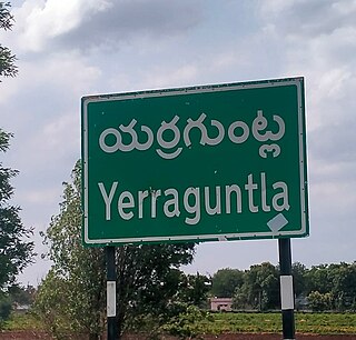
Yerraguntla is a town and Nagar Panchayat in YSR Kadapa District. It is an industrial area in YSR Kadapa district, Andhra Pradesh. It is located in Yerraguntla mandal of Kadapa revenue division.

Vuyyuru is a town in Krishna district of the Indian state of Andhra Pradesh. It is a Nagar panchayat and the headquarters of Vuyyuru Mandal. It is emerging as neighbourhood of Vijayawada, India situated 30 km away.

<span class="mw-page-title-main">Pakala, Tirupati district</span> Town in Andhra Pradesh, India

Pakala is a town in Tirupati district of the Indian state of Andhra Pradesh. It is the mandal headquarters of Pakala mandal. It comes under Tirupati revenue division.

Avanigadda is a town in Krishna district of the Indian state of Andhra Pradesh. It is the mandal headquarters of Avanigadda mandal in Machilipatnam revenue division.

<span class="mw-page-title-main">Andhra Pradesh State Road Transport Corporation</span> Indian state bus operator

Andhra Pradesh State Road Transport Corporation, officially Andhra Pradesh Raastra Roadu Ravaana Samstha, is the state-owned road transport corporation in the Indian state of Andhra Pradesh. Its headquarters is located at NTR Administrative Block of RTC House in Pandit Nehru bus station of Vijayawada. Many other Indian metro towns in Telangana, Tamil Nadu, Karnataka, Odisha, Yanam, Kerala, Maharashtra and Chhattisgarh are also linked with the APSRTC services.

<span class="mw-page-title-main">Tadepalle, Vijayawada</span> Municipal Corporation in Andhra Pradesh, India

Tadepalli is a major residential area of Vijayawada in Guntur district of Indian state of Andhra Pradesh. It is a major south suburb of Vijayawada and a part of Vijayawada metropolitan area and Andhra Pradesh Capital Region. It is situated on National Highway 16 between Vijayawada and Guntur.

<span class="mw-page-title-main">Koilakuntla</span> Town in Andhra Pradesh, India

Koilakuntla is a town in Nandyal district of the Indian state of Andhra Pradesh. It is Head quarter of Koilakuntla mandal. in Dhone revenue division

<span class="mw-page-title-main">Kamalapuram, Kadapa</span> Town in Andhra Pradesh, India

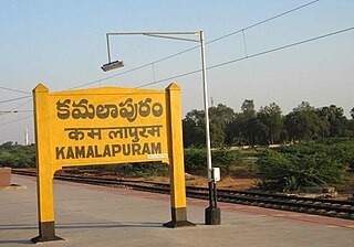
Kamalapuram is a Town in YSR Kadapa district of the Indian state of Andhra Pradesh. It is located in Kamalapuram mandal of Kadapa revenue division and is the Thaluka headquarter of Kamalapuram assembly constituency.

<span class="mw-page-title-main">Unguturu, Eluru district</span> Village in Andhra Pradesh, India

Unguturu is a village in Eluru district of the Indian state of Andhra Pradesh. It is located in Unguturu mandal of Eluru revenue division. Vasuki Sunkavalli of this village was elected Miss India Universe in 2011. It is located 12 km from the nearest town, Tadepalligudem. As per the 2011 census of India, the village is spread over 4405 hectares with 3912 houses and a population of 14280. The number of males in the village is 7143, the number of females is 7137. The number of Scheduled Castes is 3349 and the number of Scheduled Tribes is 130.

Penikeru is a village of in East Godavari district of the Indian state of Andhra Pradesh. It is located in Alamuru mandal of Rajahmundry revenue division.

<span class="mw-page-title-main">Tetagunta</span> Place in Andhra Pradesh, India

Tetagunta is one of the villages in Tuni mandal in Kakinada district in Andhra Pradesh State and is located 14.1 km from its Mandal main town Tuni. It is 44.3 km from its district main city Kakinada. It has a population of 11,967 and people mostly depend on farming. Tetagunta village of Tuni Mandal is having the largest area of 4,033 hectares in the East Godavari District.It is located at a distance of 120 km from the state main city Visakhapatnam. Pincode:533406

Chebrolu is a village in West Godavari district of the Indian state of Andhra Pradesh. It is located in Unguturu mandal of Eluru revenue division. The nearest town is Tadepalligudem.The AH45 which runs from NH16 in Kolkata to NH48 in Bangalore passes by the village with beautiful Godavari canal on the other side.

Velagalapalli is a village located in Chintalapudi Mandal of West Godavari District in the state of Andhra Pradesh, India.

<span class="mw-page-title-main">Nadimpalli, Chittoor</span> Village in Andhra Pradesh, India

Nadimpalli is a remote rural village in Puthalapattu mandal of Chittoor district in Andhra Pradesh in India.

Pottipadu is a village in the YSR Kadapa district of Andhra Pradesh State, India, lies 97 KM west of Kadapa, the district headquarters. The state’s capital, Vijayawada, is 436 KM away. The postal code of Pottipadu is 516464 and its post office is in Lavanur.

References