Rayalaseema is a geographic region in the Indian state of Andhra Pradesh. It comprises four southern districts of the State, from prior to the districts reorganisation in 2022, namely Kurnool, Anantapur, YSR, and Chittoor. Four new districts were created from these, namely Sri Sathya Sai, Nandyal, Annamayya, and Tirupati. As of 2011 census of India, the western four districts of the region had a population of 15,184,908 and cover an area of 77,424 km2 (29,894 sq mi).

Penna is a river of southern India. This is a unique river in world where after originating from Nandi hills, it flows as two different streams, one in North and South directions. The Penna rises in the Nandi Hills in Chikkaballapur District of Karnataka state, and runs north and east through the states of Karnataka and Andhra Pradesh to empty into bay of bengal in Andhra Pradesh. It is 597 kilometres (371 mi) long, with a drainage basin covering 55,213 km2: 6,937 km2 in Karnataka and 48,276 km2 in Andhra Pradesh. Along with this main stream there is another stream south towards Tamilnadu with the name Then Pennai or south Pennar which further moves towards the east to empty into the Bay of Bengal. The Penna river basin lies in the rain shadow region of Eastern Ghats and receives 500 mm average rainfall annually.

Anantapur district, officially Ananthapuramu district, is one of the eight districts in the Rayalaseema region of the Indian state of Andhra Pradesh. The district headquarters is located in Anantapur city. It is one of the driest places in South India. In the year 2022, as part of re-organisation of districts, Sri Sathya Sai district was carved out.

Kadapa district is one of the twenty six districts in the Indian state of Andhra Pradesh. In the 2022 reorganisation of Andhra Pradesh districts, the district boundary was largely restricted to the Kadapa parliamentary constituency area. It is one of the eight districts in the Rayalaseema region. Kadapa is the administrative headquarters for this district.

Kurnool district is one of the eight districts in the Rayalaseema region of the Indian state of Andhra Pradesh after the districts are reorganised in April 2022. It is located in the north western part of the state and is bounded by Nandyal district in the east, Anantapur district in the south, Raichur district of Karnataka in the northwest, Bellary district of Karnataka in the west, and Jogulamba Gadwal district of Telangana in the north. It has a population of 2,271,686 based on the 2011 census. The city of Kurnool is the headquarters of the district.

Nellore district, officially known as Sri Potti Sriramulu Nellore district in Coastal Andhra Region, is one of the 26 districts in the Indian state of Andhra Pradesh. According to the 2011 Census, the district's population was 2,963,557 of which 29.07% was urban. Its administrative headquarters are located in Nellore city. Located in the Coastal Andhra region, the district is bordered by the Bay of Bengal to the east, Kadapa district and Annamayya district to the west, Prakasam district to the north, and Tirupati district to the south.

Prakasamdistrict is one of the twelve districts in the coastal Andhra region of the Indian state of Andhra Pradesh. It was formed in 1970 and reorganised on 4 April 2022. The headquarters of the district is Ongole. It is located on the western shore of Bay of Bengal and is bounded by Bapatla district and Palnadu districts in the north, Nandyal district in the west, Kadapa and Nellore districts in the south. A part of north west region also borders with Nagarkurnool district of Telangana. It is the largest district in the state with an area of 14,322 km2 (5,530 sq mi) and had a population of 22,88,026 as per 2011 Census of India.
Rajampet is a town in Annamayya district of the Indian state of Andhra Pradesh, located in the Rayalaseema Region formed on the banks of Cheyyeru River. The town has an average elevation of 139 meters (456 ft).
Giddaluru is a town in the Prakasam district of the Indian state of Andhra Pradesh. It is the mandal headquarters of the Giddaluru mandal in Markapur revenue division. It was part of kurnool district till 1969 later it was merged into Prakasam district in 1970. Till 2008 it was under Nandyal parliament segment after delimitation it was moved to Ongole MP segment. Giddalur is also known as "3 zilla la muddu bidda " because during the Britishers rule it was in kadapa district later moved to kurnool then in 1970 merged in prakasam district. Giddalur is the only constituency in coastal districts which has Rayalseema culture,slang and traditions. Giddalur town has good transport connectivity to Nandyal, Markapur, Podili, Ongole, Kurnool, Kadapa.

Koilakuntla is a town in Nandyal district of the Indian state of Andhra Pradesh. It is Head quarter of Koilakuntla mandal. It is in Dhone revenue division.
Chilamakur is a village in the Kadapa district of Andhra Pradesh, India. It falls under the Yerraguntla mandal in the Kadapa revenue division. The village is an industrial hub in the Kadapa district and is home to the Sri Agasteswara Swamy temple, one of the oldest temples in the area, which has been recognized by the Archaeological Survey of India (ASI).

Andhra Pradesh lies between 12°41' and 19.07°N latitude and 77° and 84°40'E longitude, and is bordered by Telangana to the north and west, Chhattisgarh to the north-west, Orissa to the north, the Bay of Bengal to the east, Tamil Nadu to the south and Karnataka to the southwest and west. Andhra Pradesh has a coastline of around 974 km, which gives it the second longest coastline in the nation. Two major rivers, the Godavari and the Krishna run across the state. A small enclave 12 sq mi (30 km²), the Yanam district of Puducherry, lies in the Godavari Delta in the north east of the state. The state includes the eastern part of Deccan plateau as well as a considerable part of the Eastern Ghats.
The Kundu River also known as Kunderu, Kumudvathi is a tributary of the Penna River in the Rayalaseema region of Andhra Pradesh, India. Originating as a spring near the village of Uppalapadu in Orvakal Mandal of Kurnool District, it goes through many changes before merging with the Penna at kamalapuram of Kadapa District. It is known for frequent floods that bring heavy damage to the Nandyal and Koilkuntla areas, and hence it is popularly called the "Sorrow of Nandyal." But nowadays Nandyal town became a big town with huge population so that the drainage water is discharged to the Kundu river without prior treatment. Industrialists focused their vision at more and more profits and they polluted the river to the maximum extent. The villagers who are living at down flow of the river from Nandyala are suffering with different skin diseases. The pollution impacts even animals health too. In ancient times this river was known as the Kumudvathi. There is a saying in Rayalaseema that whoever drinks the water of the Kundu will gain enormous courage to face enemies. The valley of the Kundu is known as Renadu and is symbolic of the term "Renati Pourusham."

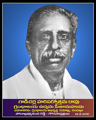
Gadicherla Harisarvottama Rao was a freedom fighter from Andhra during the Indian independence movement. He was inspired by the ideologies of Bal Gangadhar Tilak and Bipin Chandra Pal and joined the freedom movement at a very young age. He is the person who named the region as Rayalaseema when everybody taunted the region as Ceded because Nizam ceded the region to the British.
Government Maternity Hospital is a Maternity hospital in the pilgrim city of Tirupati, Andhra Pradesh, India. It is the largest maternity hospital in Andhra Pradesh. In 2013, it had 152 beds with minimum 50 deliveries being carried out per day. It serves majorly four districts of Rayalaseema, Nellore and Prakasam districts of Andhra Pradesh and few areas of Tamil Nadu. It was established in 1962.
National Highway 544D, commonly called NH 544D, and sometimes Anantapur-Guntur National highway 544D, is a national highway in India. It is a spur road of National Highway 44. NH-544D traverses the state of Andhra Pradesh in India.

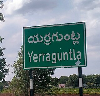
Yerragundla is a village midway between Kurnool and Kadapa on National Highway-40 in Sirivella mandal of Nandyal District of Andhra Pradesh, India.


