Cariboo was a federal electoral district in British Columbia, Canada, that was represented in the House of Commons of Canada from 1871 to 1892.

The Bridge River is an approximately 120 kilometres (75 mi) long river in southern British Columbia. It flows south-east from the Coast Mountains. Until 1961, it was a major tributary of the Fraser River, entering that stream about six miles upstream from the town of Lillooet; its flow, however, was near-completely diverted into Seton Lake with the completion of the Bridge River Power Project, with the water now entering the Fraser just south of Lillooet as a result.
The Chilcotin region of British Columbia is usually known simply as "the Chilcotin", and also in speech commonly as "the Chilcotin Country" or simply Chilcotin. It is a plateau and mountain region in British Columbia on the inland lee of the Coast Mountains on the west side of the Fraser River. Chilcotin is also the name of the river draining that region. In the language of the Tsilhqot'in people, their name and the name of the river means "those of the red ochre river". The proper name of the Chilcotin Country, or Tsilhqotʼin territory, in their language is Tŝilhqotʼin Nen.

The Chilcotin River /tʃɪlˈkoʊtɪn/ located in Southern British Columbia, Canada is a 241 km (150 mi) long tributary of the Fraser River. The name Chilcotin comes from Tŝilhqot’in, meaning "ochre river people," where ochre refers to the mineral used by Tŝilhqot’in Nation and other Indigenous communities as a base for paint or dye. The Chilcotin River, Chilko River and Lake, and Taseko River and Lake make up the Chilcotin River watershed. This 19,200 km2 (7,400 sq mi) watershed drains the Chilcotin Plateau which reaches north to south from the Nechako Plateau to Bridge River county and east to west from Fraser River to the Coast Mountains. It is also one of twelve watersheds that make up the Fraser River Basin. Made up of seven major tributaries, Chilcotin River starts northeast of Itcha Mountain, flowing southeast until it joins the Fraser River south of Williams Lake, 22 km (14 mi) upstream from Gang Ranch.

The Chilko River is a 75-kilometre-long (47 mi) river in the Chilcotin District of the Central Interior of British Columbia, Canada, flowing northeast from Chilko Lake to the Chilcotin River. Its main tributary is the Taseko River.

The Chilcotin Ranges are a subdivision of the Pacific Ranges of the Coast Mountains. They lie on the inland lea of the Pacific Ranges, abutting the Interior Plateau of British Columbia. Their northwestern end is near the head of the Klinaklini River and their southeast end is the Fraser River just north of Lillooet; their northern flank is the edge of the Plateau while their southern is the north bank of the Bridge River. In some reckonings they do not go all the way to the Fraser but end at the Yalakom River, which is the North Fork of the Bridge.

The Homathko River is one of the major rivers of the southern Coast Mountains of the Canadian province of British Columbia. It is one of the few rivers that penetrates the range from the interior Chilcotin Country to the coastal inlets of the Pacific Ocean. The Homathko River reaches the sea at the head of Bute Inlet, just west of the mouth of the Southgate River.
The Klinaklini River is one of the major rivers of the Pacific Ranges section of the Coast Mountains in the Canadian province of British Columbia. It originates in the Pantheon Range and empties into the head of Knight Inlet.
Cariboo was one of the twelve original electoral districts created when British Columbia became a Canadian province in 1871. Roughly corresponding to the old colonial electoral administrative district of the same name, it was a three-member riding until the 1894 election, when it was reduced through reapportionment and became a two-member riding until the 1916 election, after which it has been a single-member riding. It produced many notable Members of the Legislative Assembly (MLAs), including George Anthony Boomer Walkem, third and fifth holder of the office of Premier of British Columbia and who was one of the first representatives elected from the riding; John Robson, ninth Premier of British Columbia; and Robert Bonner, a powerful minister in the W.A.C. Bennett cabinet, and later CEO of MacMillan Bloedel and BC Hydro.
Junction Sheep Range Provincial Park is a provincial park in British Columbia, Canada, located near the confluence of the Chilcotin and Fraser Rivers on the west bank of the latter river.

The Spruce Lake Protected Area, formerly known variously as the Southern Chilcotin Mountains Provincial Park, Southern Chilcotins, and also as South Chilcotin Provincial Park, is a 71,347-hectare Protected Area in the British Columbia provincial parks system, approximately 200 km north of Vancouver. The area had been the subject of an ongoing preservationist controversy since the 1930s. In 2007, its status as a provincial park was downgraded to protected area.
Tyaughton Creek, formerly gazetted as the Tyaughton River, also historically known as Tyoax Creek, is a 50 kilometre tributary of British Columbia's Bridge River, flowing generally southeast to enter the main flow of that river about mid-way along the length of Carpenter Lake, a reservoir formed by Terzaghi Dam of the Bridge River Power Project.
Big Creek is a roughly 120-kilometre (75 mi) long tributary of British Columbia's Chilcotin River. Its surroundings are protected as the Big Creek Ecological Reserve.
The Taseko River or Dasiqox in the original Chilcotin, is a tributary of British Columbia's Chilko River, a tributary of the Chilcotin River which joins the Fraser near the city of Williams Lake.
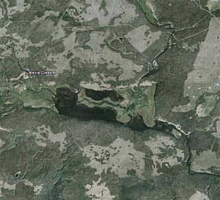
Alexis Creek is an unincorporated community in the Chilcotin District of the western Central Interior of the Canadian province of British Columbia, on Highway 20 between Williams Lake and Bella Coola. The creek is named, like the adjacent lake of the same name, for a colonial-era chief of the Tsilhqot'in people, Alexis, who figured in the story of the Chilcotin War of 1864.

The British Columbia Interior, popularly referred to as the BC Interior or simply the Interior, is a geographic region of the Canadian province of British Columbia. While the exact boundaries are variously defined, the British Columbia Interior is generally defined to include the 14 regional districts that do not have coastline along the Pacific Ocean or Salish Sea, and are not part of the Lower Mainland. Other boundaries may exclude parts of or even entire regional districts, or expand the definition to include the regional districts of Fraser Valley, Squamish–Lillooet, and Kitimat–Stikine.
Tatla Lake is a small unincorporated community in the west Chilcotin area of British Columbia, Canada, located at the west end of its eponymous lake. Situated 220 km west of Williams Lake along Highway 20, Tatla Lake's 123 people live approximately halfway between the two ends of the highway; Williams Lake to the east and the coastal community of Bella Coola to the west. The community is the service centre for three major mountain valleys of West Branch, Chilko and Tatlayoko. These valleys extend southward via secondary roads.
Cheẑichʼed Biny, known as Chilcotin Lake, is a lake in the Chilcotin District of the Central Interior of British Columbia, Canada. It is located on the Chilcotin River to the north of Puntzi Lake.
Chilanko Forks is an unincorporated settlement as well as a First Nations community of the Tsilhqot'in people, located on the north bank of the Chilanko River just northeast of Tatla Lake, and immediately south of Puntzi Lake, in the Chilcotin District of the Central Interior of British Columbia. Chilanko Forks is the location of the offices of the Alexis Creek First Nation.
Tŝideldel, also called Redstone, is an unincorporated settlement and First Nations community of the Tsilhqot'in people, located near Chilanko Forks in the Chilcotin District of the Central Interior of British Columbia, Canada. Located on the Chilanko River, it should not be confused with the locality also called Redstone, 16 km to the east, located at the confluence of the Chilanko and Chilcotin Rivers. It includes Redstone Flat Indian Reserve No. 1, Redstone Flat Indian Reserve No. 1A, and Redstone Cemetery Indian Reserve No. 1B, all under the administration of the Alexis Creek First Nation.
