
Kings Beach is a census-designated place (CDP) in Placer County, California, United States, on the north shore of Lake Tahoe. The population was 3,796 at the 2010 census, down from 4,037 at the 2000 census.
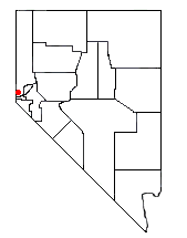
Incline Village is a census-designated place (CDP) on the north shore of Lake Tahoe in Washoe County, Nevada, United States. The population was 8,777 at the 2010 census. It is part of the Reno−Sparks Metropolitan Statistical Area. Until the 2010 census, the CDP Crystal Bay, Nevada was counted jointly with Incline Village.

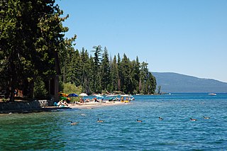
Lake Tahoe is a large freshwater lake in the Sierra Nevada of the United States. Lying at 6,225 ft (1,897 m), it straddles the state line between California and Nevada, west of Carson City. Lake Tahoe is the largest alpine lake in North America, and at 122,160,280 acre⋅ft (150.7 km3) it trails only the five Great Lakes as the largest by volume in the United States. Its depth is 1,645 ft (501 m), making it the second deepest in the United States after Crater Lake in Oregon.
The Carson Range is a spur of the Sierra Nevada in eastern California and western Nevada that starts at Carson Pass and stretches north to the Truckee River near Verdi, Nevada.

Ward Creek is a 6.1-mile (9.8 km) eastward-flowing stream in Placer County, California, United States. The creek flows into Lake Tahoe 2.7 miles (4.3 km) south of Tahoe City, California, and has undergone extensive restoration to reduce sediment and surface run-off to maintain the purity of Lake Tahoe.

Lake Tahoe–Nevada State Park is a state park comprising multiple management units and public recreation areas on the northeast shores of Lake Tahoe in the U.S. state of Nevada. The park covers approximately 14,301 acres (5,787 ha). The Marlette Lake Water System, which is listed on the National Register of Historic Places and as a National Historic Civil Engineering Landmark, lies within park boundaries.

Glenbrook is a census-designated place (CDP) on the east shore of Lake Tahoe in Douglas County, Nevada, United States. The population was 215 at the 2010 census. Beach and Bay are for residents and renters living in Glenbrook's gated community. There is no public access to the beach or bay.
The Marlette Lake Water System was created to provide water for the silver mining boom in Virginia City, Nevada. These structures are now listed as a National Historic Civil Engineering Landmark by the American Society of Civil Engineers, and are also listed on the National Register of Historic Places. The listed area included two contributing buildings and 12 contributing structures on 135.4 acres (54.8 ha). It has also been known historically as the Virginia and Gold Hill Water Company Water System.

The Tryon Creek State Natural Area is a state park located primarily in Portland, in the U.S. state of Oregon. It is the only Oregon state park within a major metropolitan area. The 645-acre (261 ha) park lies between Boones Ferry Road and Terwilliger Boulevard in southwest Portland in Multnomah County and northern Lake Oswego in Clackamas County and is bisected from north to south by Tryon Creek. To the north, the park abuts the Lewis & Clark Law School campus.

Snow Valley Peak is a mountain located in the Carson Range of the Sierra Nevada. The mountain lies within the city limits of Carson City, NV. At 9,214 feet in elevation it is also the city's highest point. From the peak Mound House, Carson City, Lake Tahoe, Reno and Carson Valley are all clearly visible. The peak is accessible along the Tahoe Rim Trail from the Spooner Lake Trailhead. The mountain is part of the Humboldt-Toiyabe National Forest although Lake Tahoe-Nevada State Park lies immediately to the west.
Whale Beach is a beach on the eastern shore of Lake Tahoe in Nevada, within the city limits of Carson City. It is known for being a nude beach. It derives its current name from the large rocks near the water's edge.
Ed Z'berg Sugar Pine Point State Park is a state park in California in the United States. It occupies nearly two miles of the western shore of Lake Tahoe and a total of about 1,000 hectares of forested mountains in El Dorado County. Originally called Sugar Pine Point State Park, its name was changed in 2003 to honor Edwin L. Z'berg, a California state assemblyman who specialized in environmental legislation and worked to develop state parks and other natural areas.
The Lower Sagehen Creek Hiking Trail follows Sagehen Creek, a tributary of the Truckee River on the east slope of the central Sierra Nevada in the western United States. The stream lies north of Lake Tahoe and the town of Truckee, California, and near the California/Nevada border.

Ophir Creek is a 7.7-mile (12.4 km) eastward-flowing stream originating in Tahoe Meadows just south of Tamarack Peak and southeast of Mount Rose Summit, a pass on Nevada State Highway 431. Ophir Creek flows to Washoe Lake in Washoe County in western Nevada, shortly after passing under U.S. Route 395.

Incline Creek is a 5.2-mile (8.4 km) southward-flowing stream originating in the Carson Range, Sierra Nevada in the northeast Lake Tahoe Basin in Washoe County in western Nevada. Incline Creek flows through the Diamond Peak Ski Area on the way to Incline Village where it empties into Lake Tahoe.
North Canyon Creek is a 6.8-mile-long (10.9 km) southwestward-flowing stream originating on Snow Valley Peak in the Carson Range of the Sierra Nevada. Most of the stream is in Carson City, Nevada, United States. It is a tributary stream of Lake Tahoe culminating at Glenbrook in Douglas County on Tahoe's Nevada shore.

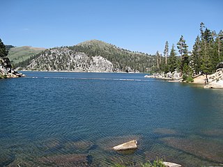
Spooner Lake is a man-made reservoir located just north of the intersection of Highway 50 and Highway 28 near Spooner Summit, a pass in the Carson Range of the Sierra Nevada leading to Carson City, Nevada from Lake Tahoe. It is located in Lake Tahoe – Nevada State Park.

Sand Dollar Beach is a .5 miles (0.80 km) long beach in Big Sur, California, one of the longest publicly accessible beaches on that coast. It is within the Los Padres National Forest and across Highway 1 from Plaskett Creek Campground. There is a picnic area, bathrooms, and barbeque pits at the parking area. There is a $10 access fee payable at the parking lot managed by a concession company. The park is open 10:00 a.m. to 6:00 p.m. daily. Dogs are permitted on leash while on the trail and off leash at the beach.
